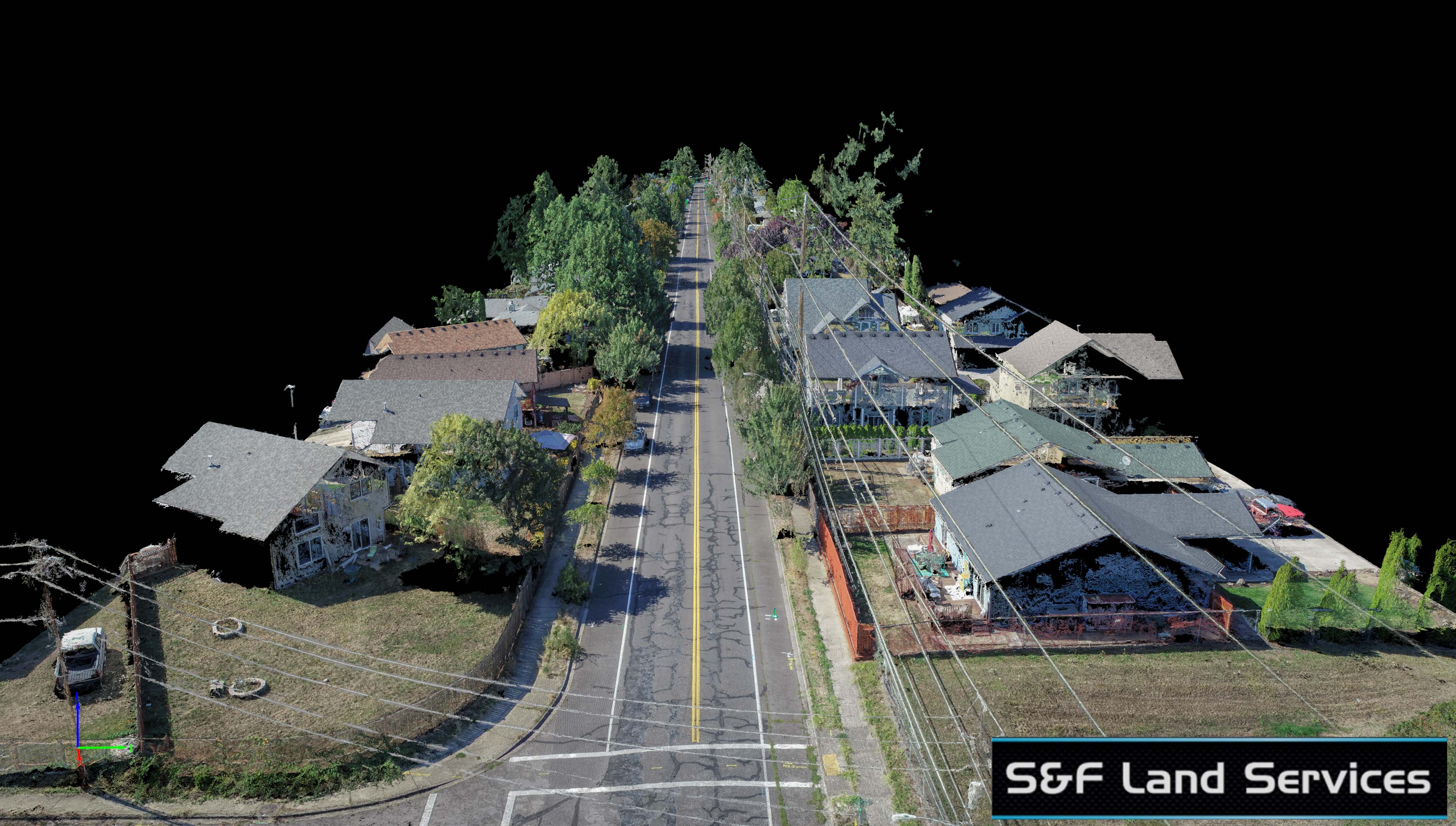
Yup, this is a different 39th Street in Vancouver than I completed last year. S&F Land Services again used TLT Photography’s aerial services to speed up their traditional survey work for this roadway. This particular street had some very tall Doug Fir trees in it forcing me to fly at 175ft vs my intended 150ft. Even so, I was able to produce a point cloud of over 60 million points with a ground sample distance (pixel width) of half an inch. Using air targets surveyed in by the S&F crew we were able to achieve sub-inch horizontal and vertical RMS accuracy values for this nearly mile long roadway. Sticking my standard of high quality work, I went the extra mile for S&F by taking the extra time of removing moving vehicles and pulling back overhanging tree canopy in the final mosaic to reveal as much of the painted utility lines on the roadway as possible. The ability to do this is only achievable through UAV acquisition as Satellite or traditional manned aircraft can’t get the angles necessary to capture underneath the tree canopy when capturing from such high altitudes (or space…). The ability to deliver a final othomosaic with all the moving objects removed is both unique to UAV capture and also unique to TLT Photography. This is a standard deliverable for my roadway work and sets the quality of my work for clients like S&F a bar above the competition.
Below is a screenshot of the final deliverable. Look on the lower left. If I hadn’t spent the extra time pulling back the tree canopy this underground utility gas line would never have been visible for digitizing the final deliverable.


