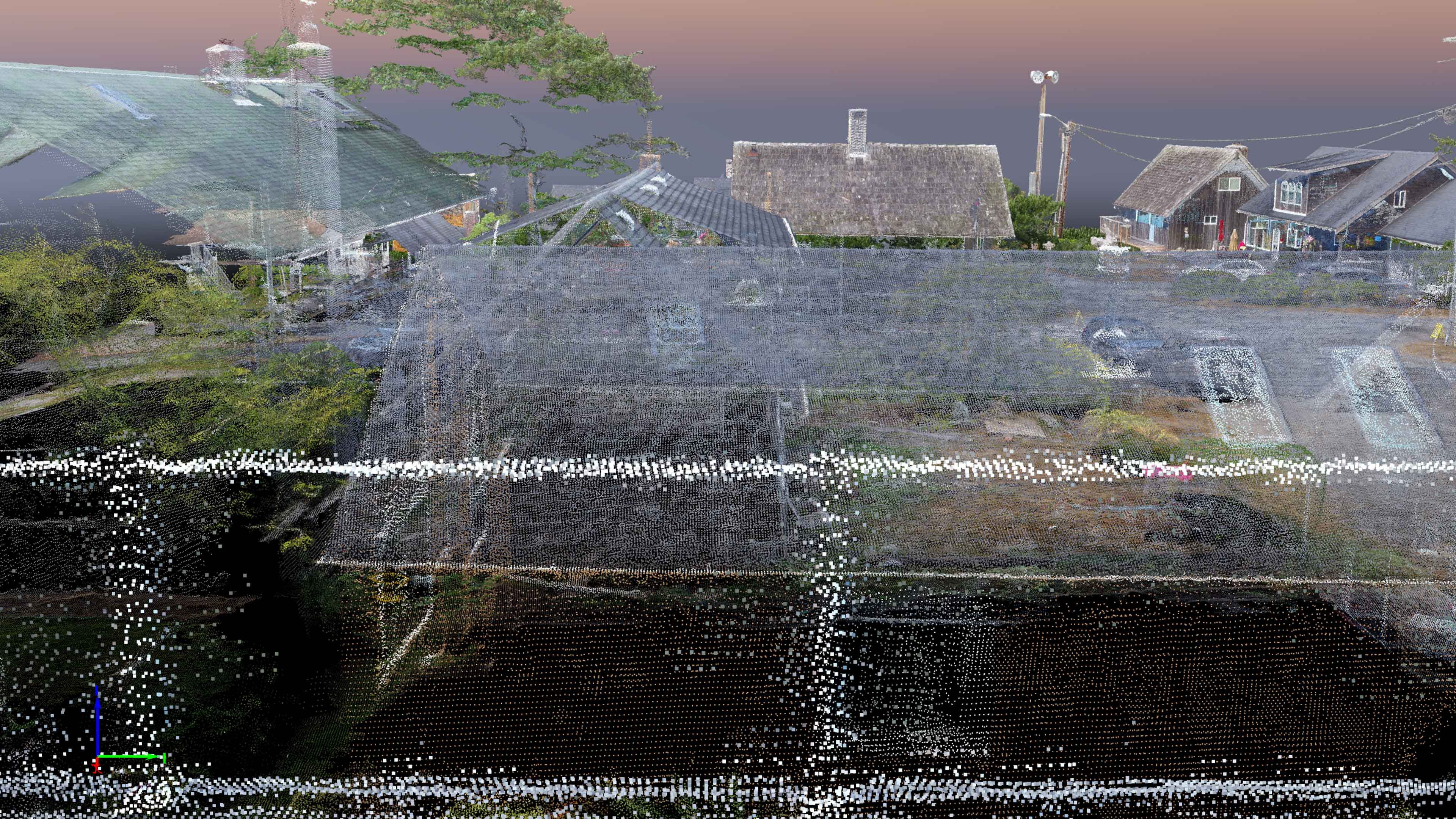
Pix4D Hall of Fame – Cannon Beach Viewshed Project

Posted Posted in 3D Modeling, Aerial Services, Data Solutions, GIS Solutions, Photogrammetry, Real Estate, Survey

Once again TLT Photography was selected for the Pix4D Hall of Fame blog.  This time it was for my Cannon Beach Viewshed Analysis Project from last fall.  This was a project that I had worked on with Mike Magyar of Magyar Land Surveying in Astoria.   Full Post Can Be Seen Here

Lucas Museum of Narrative Arts

Posted Posted in 3D Modeling, Data Solutions, Marketing, Photogrammetry

On Friday I had the pleasure of Mapping the site of the new Lucas Museum of Narrative Arts for BD Aerial.  I flew down to LA on Thurs night, arriving at midnight and was at the nearby site at 7am to lay ground control with Hathaway Dinwiddie, the construction company for the site.  The acquisition […]

BIM User Group Presentation

Posted Posted in 3D Modeling, Aerial Services, Data Solutions, GIS Solutions, Inspections, Marketing, Photogrammetry, Survey

Today I had the pleasure of presenting for the PDX BIM user group at the WeWork Custom House in downtown Portland.  I had contacted this group because of my interest in networking with BIM professionals in the area.  I am well versed in geospatial data processing software and GIS but I am still very new […]

Construction Site Mapping

Posted Posted in 3D Modeling, Data Solutions, Photogrammetry

Last night was a long night.  After returning from two mapping jobs in Astoria I arrived home to begin processing a half acre construction site for my partner BD Aerial.  This site was near the Hillsboro airport so Brian had to use some innovative techniques for capture that did not require flying… He came up […]

Columbia Pilots Pier 3D Modeling

Posted Posted in Aerial Services, Data Solutions, Real Estate, Survey

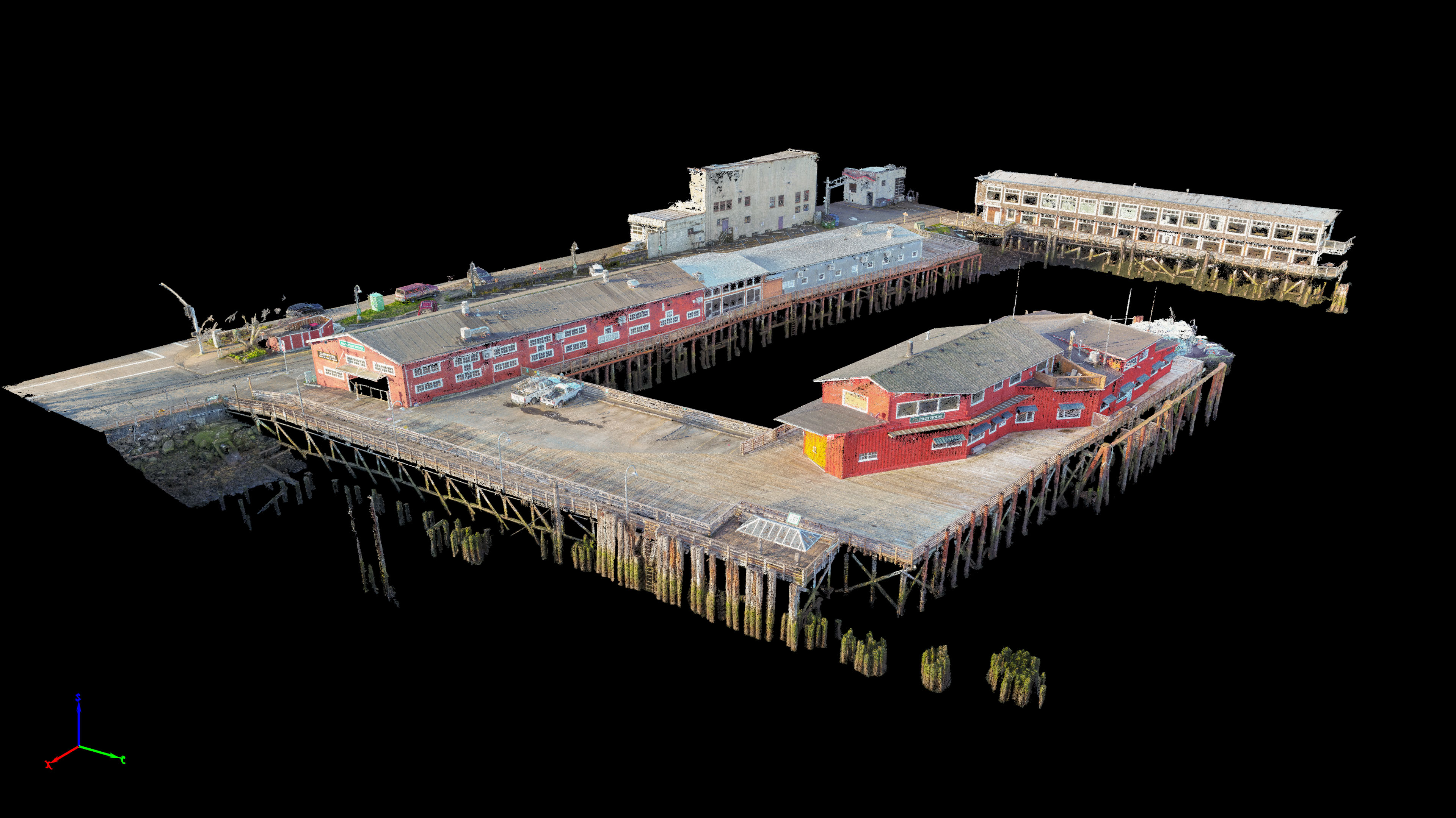
Working with Magyar Land Surveying we mapped the pier of the Columbia Pilots in Astoria.  This project was the first time I tried to map something that was not on solid ground.  Because the buildings were on a pier propped above water by wooden pilings I wasn’t 100% sure how everything would come out.   We […]

Best Western Mapping for Magyar Surveying

Posted Posted in 3D Modeling, Data Solutions, Photogrammetry, Survey

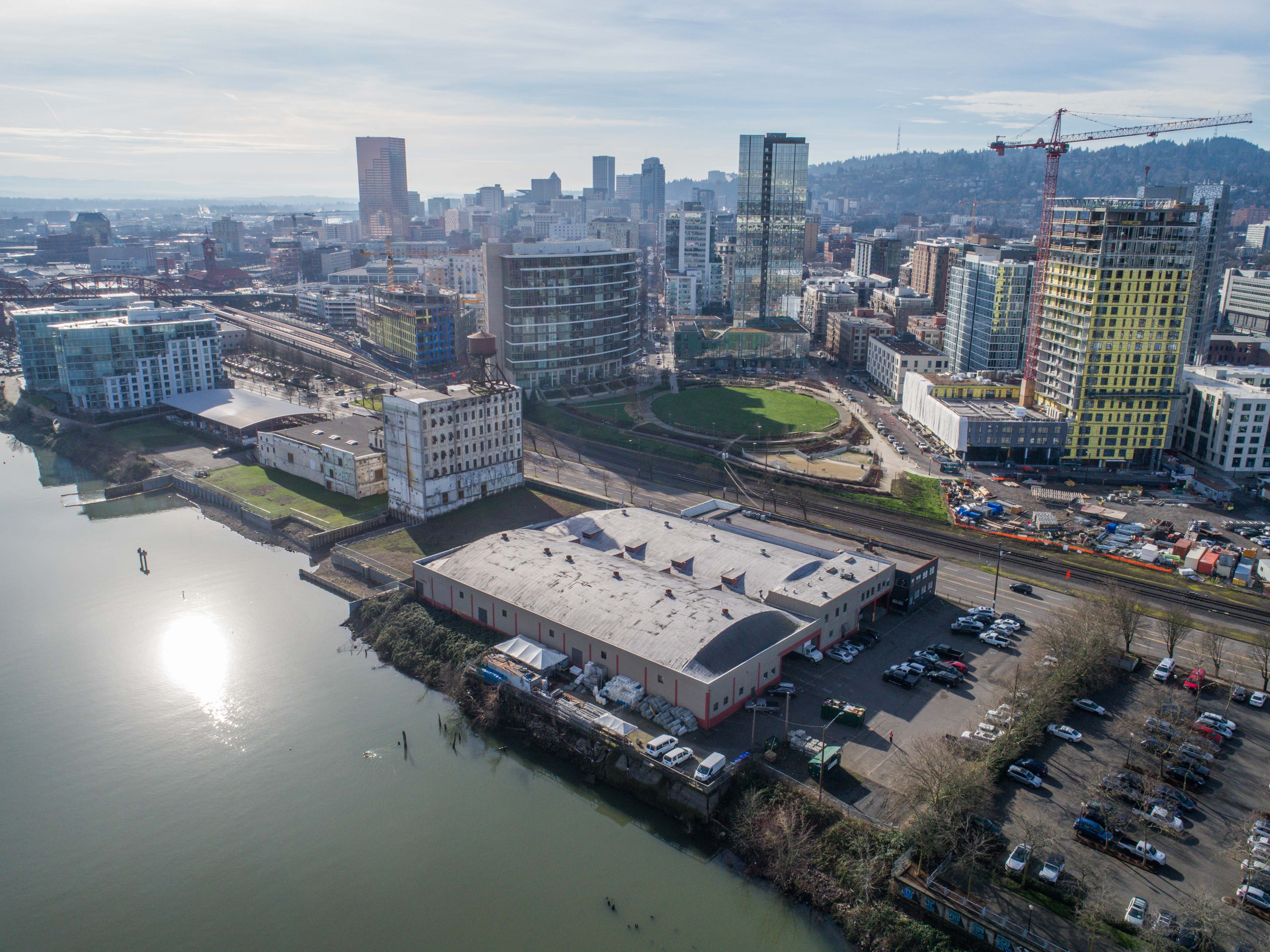
After spending all morning flying the Columbia Pilots Pier in Astoria Mike and I grabbed some lunch and headed over to the nearby Best Western to capture some quick aerials of the vegetation in front of the hotel. I of course would have been a little hesitant flying a drone around at roof level near […]

1462 NW Naito Parkway Aerial Imagery

Posted Posted in Aerial Services, Real Estate

Conducted a quick flight today for a Drone Base client who wanted aerial shots of a property on the west shore of the Willamette River just south of the Fremont bridge. There was a large construction crane nearby but I stayed well away from it and everything went smoothly. Gallery & Prints Here

720 NE Grand Ave

Posted Posted in Aerial Services, Real Estate

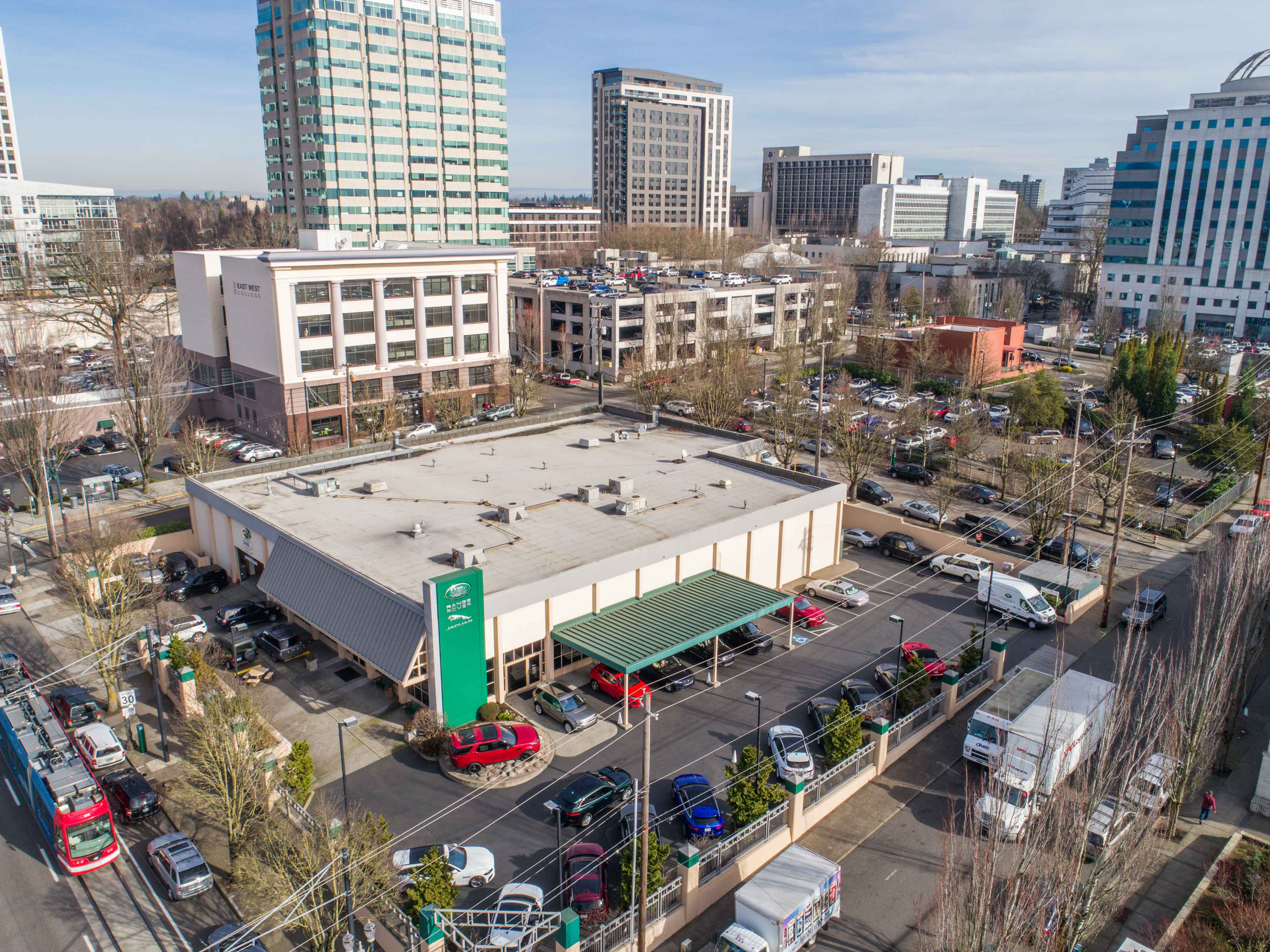
Conducted a quick flight over a Range Rover dealership today for the property owner. Lots of low utility wires and nearby tall buildings. Everything went smoothly and the client is extremely happy with the retouched imagery I delivered. Gallery & Prints Here

Eola Drive for Century West Engineering

Posted Posted in Aerial Services, Marketing

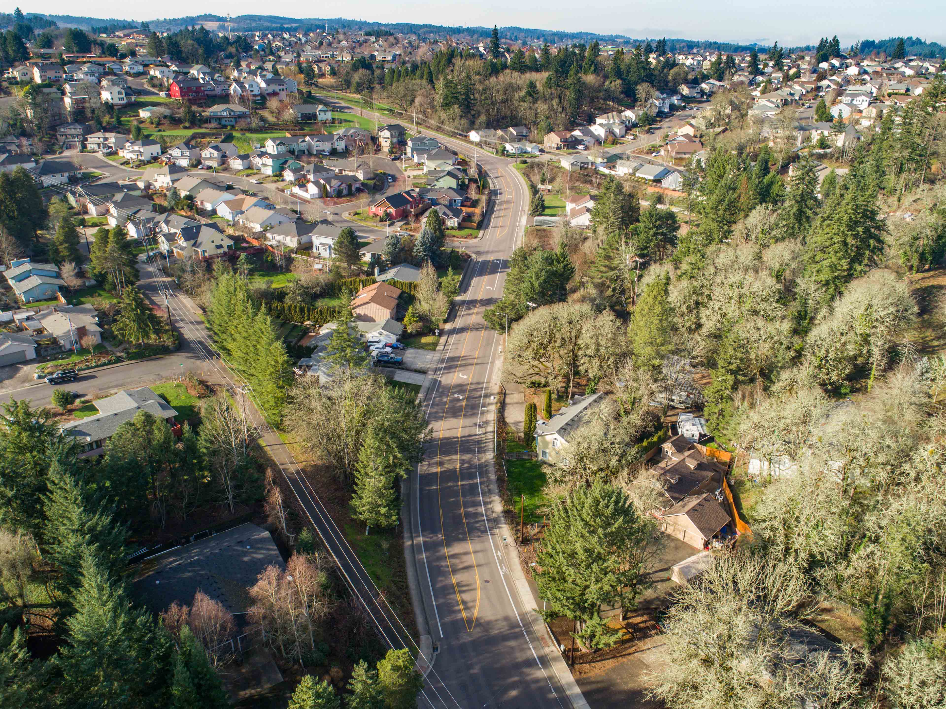
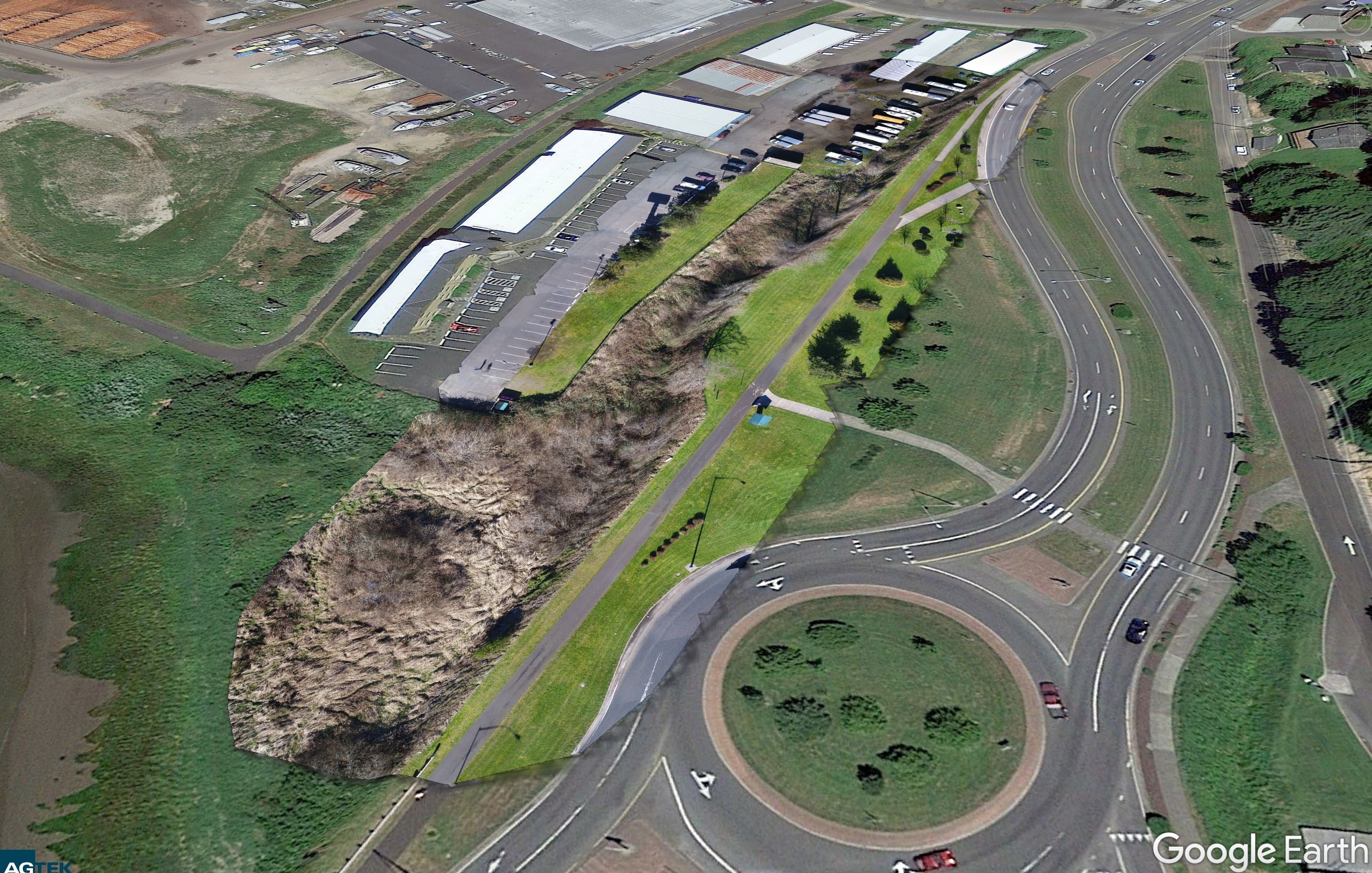
Today I flew a very long roadway for Century West Engineering. I took off, kept the drone at about 150 feet and followed it on foot as I walked down the side of the road keeping it to the side of the roadway. The roadway had a lot of elevation change so I had to […]

Adair Village Property

Posted Posted in Aerial Services, Real Estate

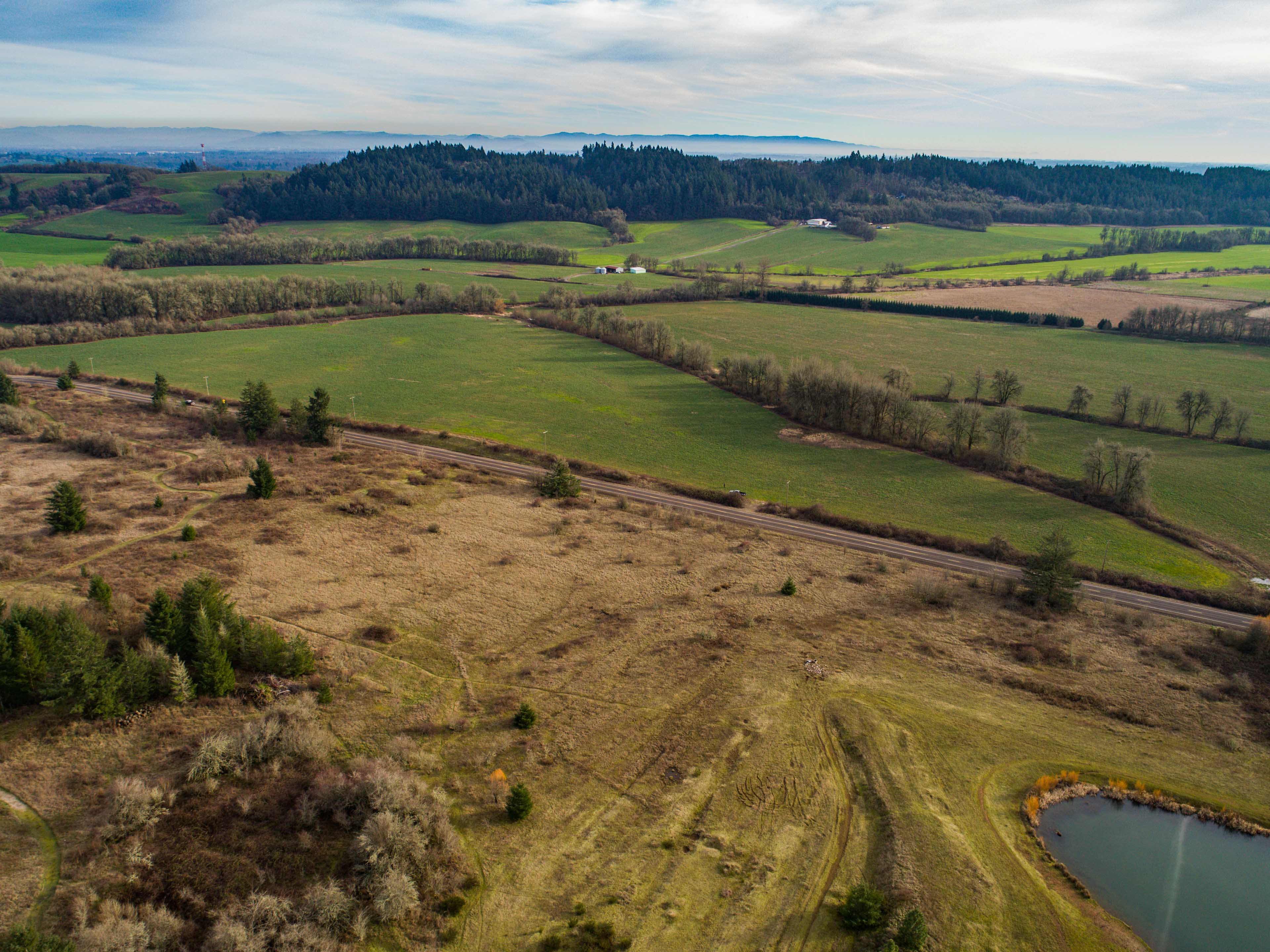
Today I flew a beautiful property for a new client. This property is owned by his family and he asked if he could get some aerial shots. It was totally clear airspace so I flew some really big orbits around it shooting video as well as 128 shots from all directions.   Gallery & Prints […]