Today I conducted my first manned-mission aerial mapping acquisition! I have been capturing my own data and processing through to completion for clients for over a year now but this always meant me standing on the ground and flying a drone. This time I was actually the one in the air capturing the data!
For this project we captured nearly 900 frames from 1300 feet AGL which produced a final orthomosaic for the client which had a pixel size of 2 inches. The client had asked for a detailed comparison of what their options were between hiring a larger aerial mapping firm with expensive sensors like an UltraCAM, using satellite data, or using existing Google Earth imagery. Having experience with all these options I explained that the best Google Earth imagery, even in urban areas is likely no better than 6in per pixel and provided some comparison examples showing road and car details for them to look at. UAV footage of course would be far clearer but this site was over 700 acres with airspace restrictions for flights which would be totally unreasonable to fly.
Having recently purchased my RedCatch Mono IMU/GNSS hotshoe attachment for my Nikon DSLR I thought this would be a perfect opportunity to test it out on a mapping job. There was some back and forth with Brian on who would actually go up in the helicopter but at the last moment it was decided that I would as I understood my camera gear better as well as the IMU unit. We agreed to a rental fee of my gear for this project as well as my time capturing the data.
I had never ridden in a helicopter before and was a little nervous about the type I wold fly in until I met the Pilot and saw the brand new Guimbal Cabri G2 helicopter from Precision, LLC. For this flight I would be strapped in with a harness with the door to the helicopter wide open. This would allow me to use my camera securely mounted to a monopod out the window. I was able to set the intervalometer to take a photo every 3 seconds as we passed over the AOI. I also instructed the pilot on the precise flight lines I needed to be flown to capture enough overlap of the site.


After a quick test run of the small airport we headed off to the site and quickly captured it all in about 40 minutes. The helicopter ride was amazing with the only downside of the acquisition being that it was one of the smokiest/haziest days of the year due to all the wildfires in the Northwest. Reports had it at 3x worse than Bejing the day we flew! If I could make this data come together and impress the client the next go around will blow their socks off!
It took me a few days to process the data simply because I put a lot of time in post trying to reduce the haze and increase the contrast and colors of the imagery. Even though we were flying at only 1300 feet there was still enough haze between my lens and the ground to really de-saturate the imagery. The client ultimately just wanted a super high resolution orthomosaic of the site and didn’t care about proper georeferencing of the data (next go around they will want this).
The helicopter only cost about $800 for a two hour rental. I just need to calculate that into my costs and how much my time is worth and I’m pretty comfortable saying that this methodology can definitely go head to head with the bigger acquisition companies like GeoTerra, David Evans and Associates, etc but for a fraction of the cost. Just budget in some time for a one of my survey partners to shoot in some ground control and it’s exactly like what I was doing at QSI back in the day but with less expensive software, and less expensive hardware to capture it, yet amazingly I was able to produce the same quality of results. Think of this. A survey from me for $5000 that would cost a minimum of $20,000 from any other major service provider and yet the quality and accuracy would be the same.
Roadway Mapping Possibilities

Closer
Residential Neighborhood Mapping Potential.
Closer
Parks Management
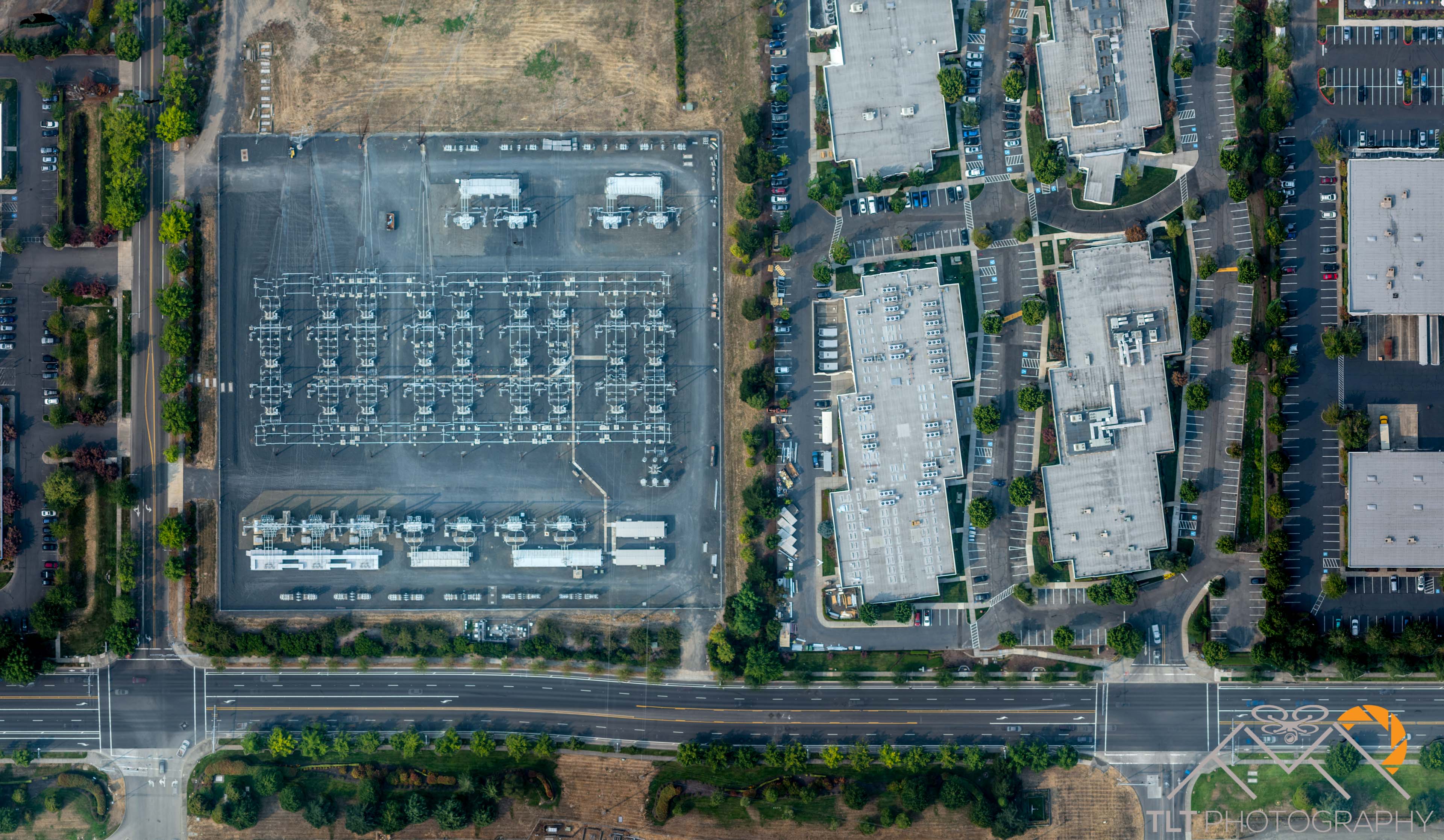
Utilities Mapping and Inspection
Closer

Commercial Real Estate Mapping
Closer
The above were all clipped from the final Orthomosaic. Below are some examples of the same area as the raw 3D point cloud.


2 thoughts on “Cost-Effective Aerial Mapping by Helicopter”
Comments are closed.