Continued Astoria Waterfront Detailed Mapping

Posted Posted in 3D Modeling, Aerial Services, Data Solutions, GIS Solutions, Photogrammetry, Real Estate, Survey

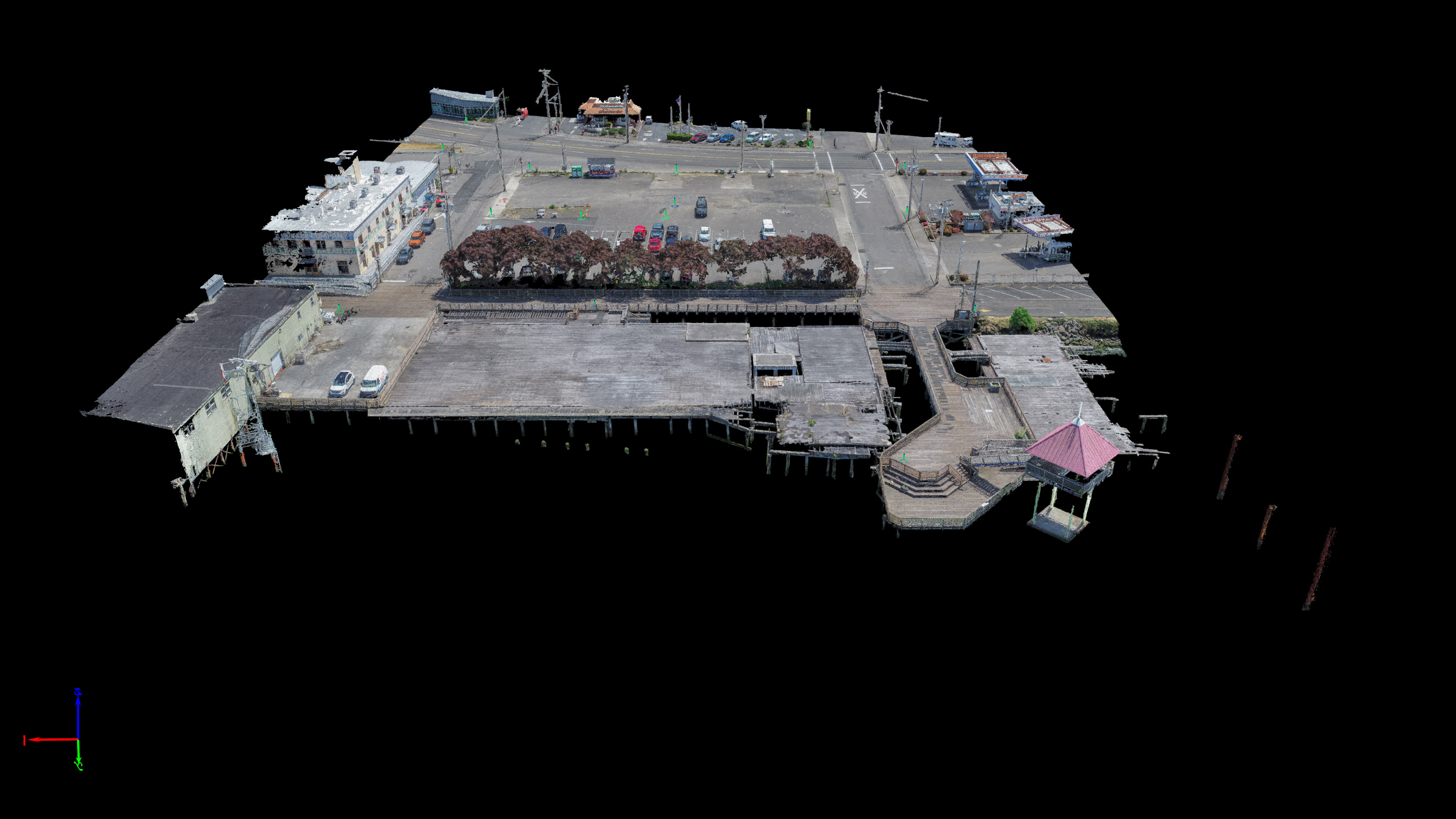
Mike Magyar of Magyar Land Surveying and I continue to inch along the waterfront in Astoria, mapping it with survey-grade accuracy.  This project was another small job that Mike invited me to come along and map with him.  I flew this one at 100ft to achieve a 0.35in pixel resolution and, like the Astoria Pilot […]

Roseburg 300 Acre Quarry Site

Posted Posted in 3D Modeling, Aerial Services, Data Solutions, GIS Solutions, Photogrammetry, Survey

I was pleasantly surprised to get a phone call from Brent at IE Engineering down in Roseburg.  I had worked with his boss Ron Quimby on the Stewart Parkway job I did for Century West Engineering earlier this year.  Apparently Ron had been impressed by my work!  Just another example of work I proudly find […]

TLT Photography Purchase RedCatch Mono

Posted Posted in 3D Modeling, Data Solutions, Photogrammetry

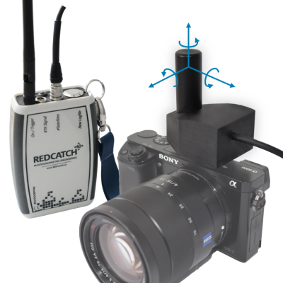
Today TLT Photography purchased the 3D Image Vector – Mono – by RedCatch GmbH out of Austria.  RedCatch is a world leader in Photogrammetry, both hardware and software.  I had been looking for a way to harness the power of my Nikon D850, purchased last fall, for photogrammetry use.  I have been dabbling with terrestrial […]

Natural Gas Facility UAV Survey

Posted Posted in 3D Modeling, Aerial Services, Data Solutions, GIS Solutions, Photogrammetry, Survey

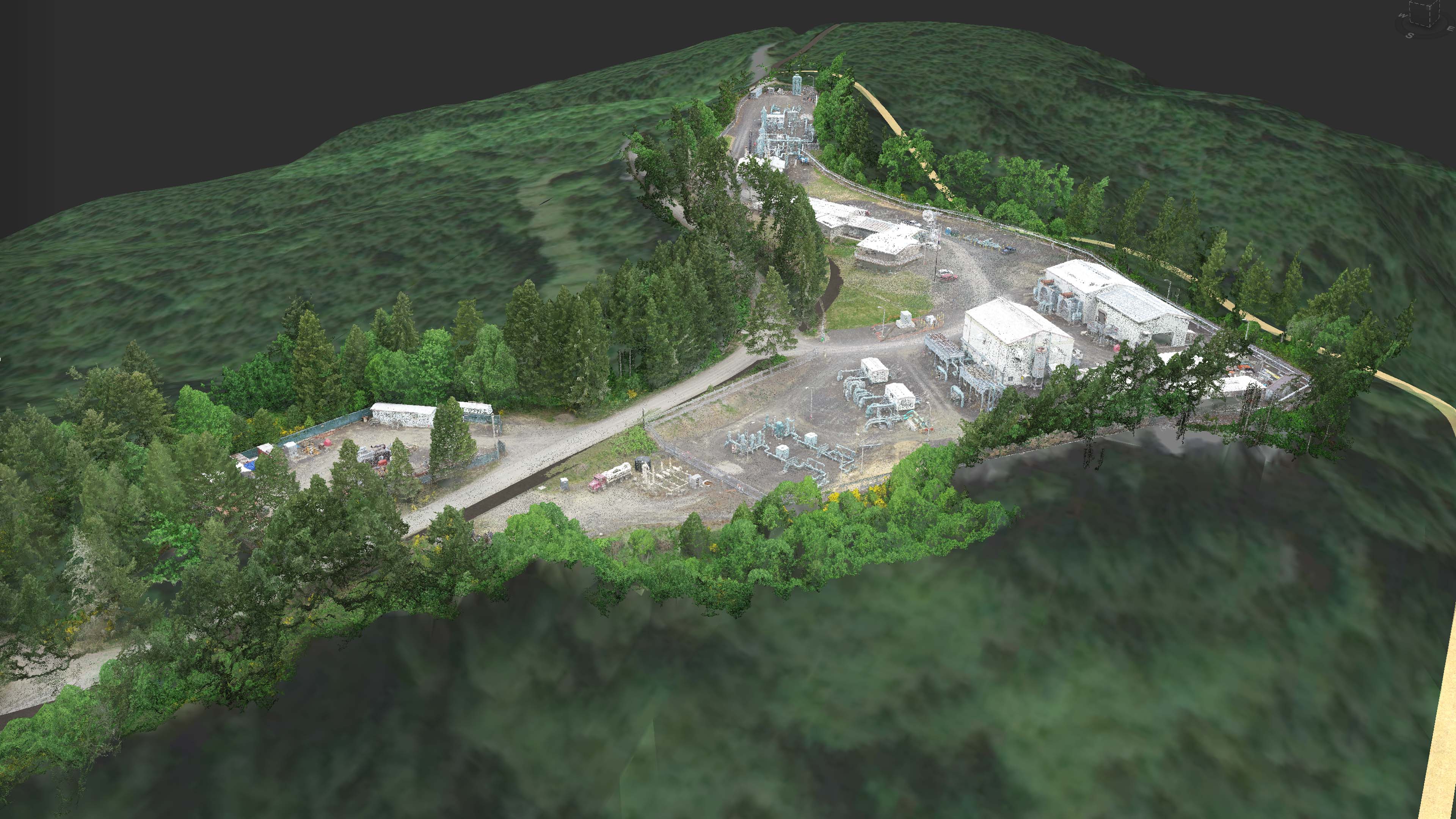
This week I flew a natural gas relay station for S&F Land Services.  To protect the interests of their client I can’t share where the facility is or any information that I captured of the facility.  I do feel comfortable sharing a few screen shots with name and geospatial data stripped out that are about […]

Umatilla Native American History in The Dalles

Posted Posted in 3D Modeling, Aerial Services, Data Solutions, GIS Solutions, Photogrammetry, Survey

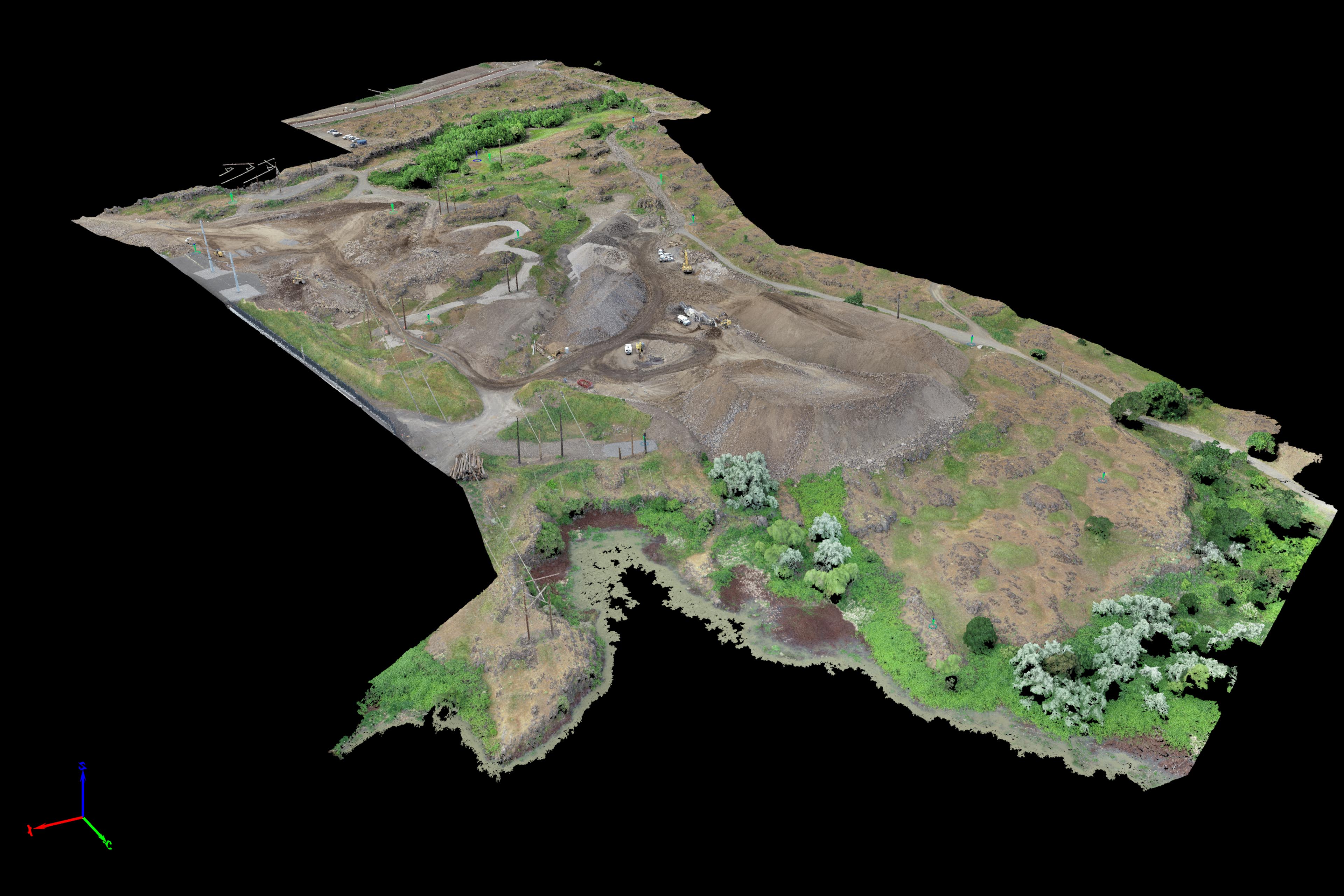
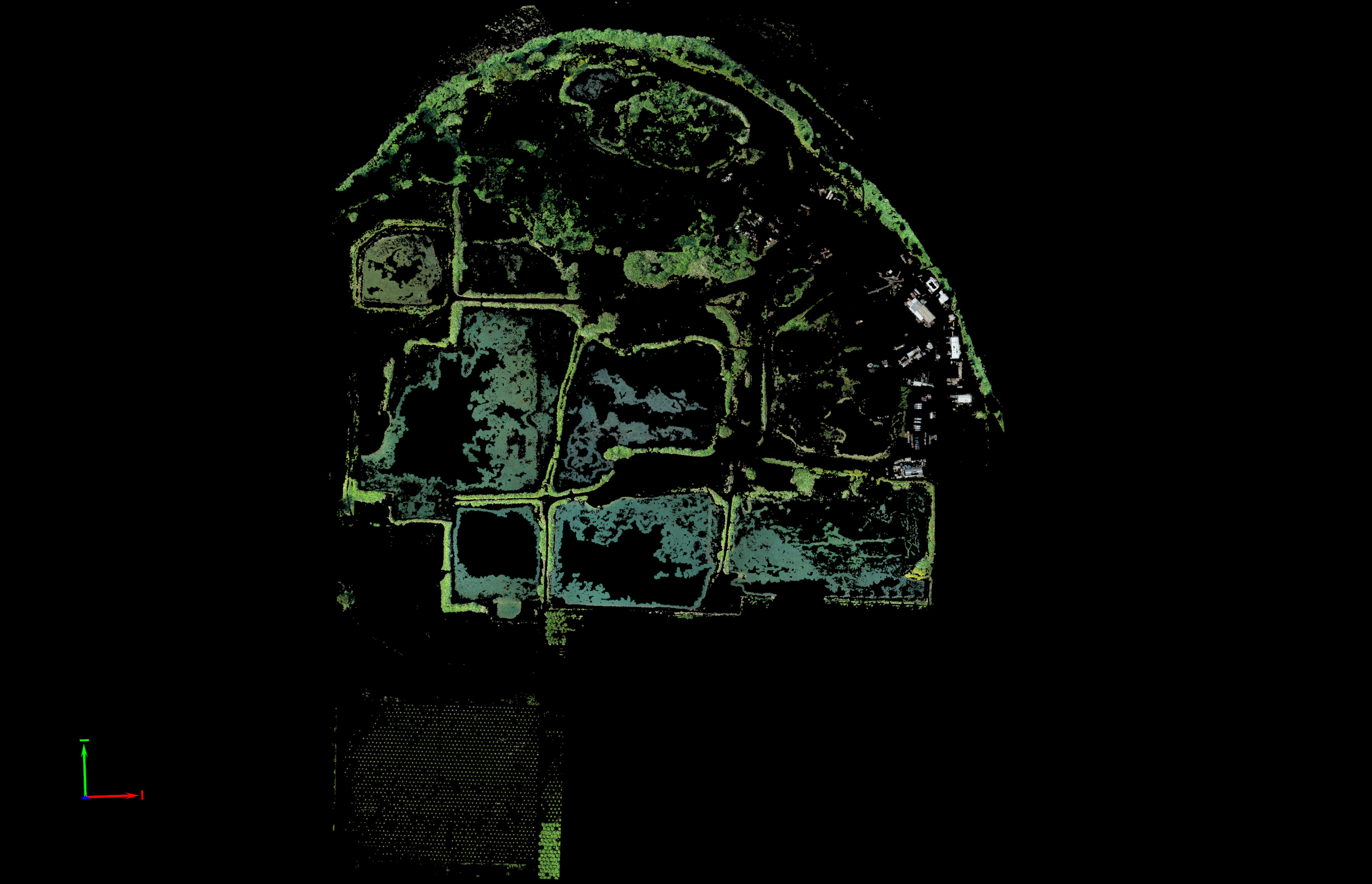
Greg from Statewide Land Surveying of Gresham gave me a call to inquire if I could fly a difficult site for them in The Dalles.  The site was surrounded by high power lines as it was next to a large Google Data Center along the Columbia River.  There will be new development going on at […]

The Aerial Photogrammetry Challenge

Posted Posted in 3D Modeling, Aerial Services, Data Solutions, GIS Solutions, Marketing, Photogrammetry, Real Estate, Survey

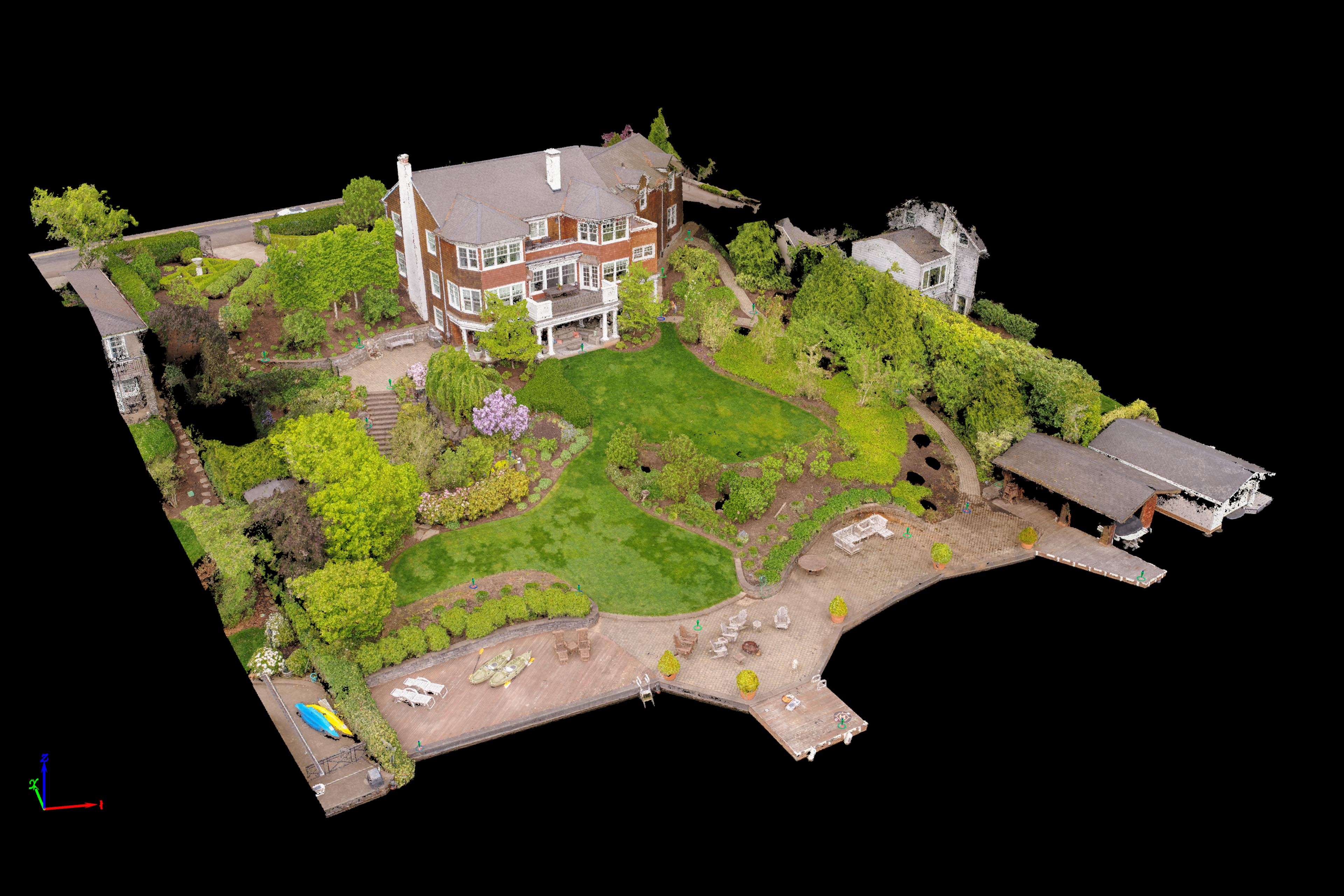
I’m labeling this project as such because it was the most difficult project site to capture thus far. My client, John from Riverland Homes of Lake Oswego asked me over the phone if I could fly a property for him that he was involved in designing a new property for.  He sent along an exquisite 3D Model […]

UAV Aerial Mapping for Landscape Architecture

Posted Posted in 3D Modeling, Aerial Services, Data Solutions, Marketing, Photogrammetry, Real Estate, Survey

Once again I’ve had the pleasure with working with Jason from MCM Construction on a project.  This time it was in combination with Lynn Wolfstone from Wolfstone Landscape Design.  This was another property on Lake Oswego but unlike the Cliff Face property before this site had even more canopy to capture as well as a […]