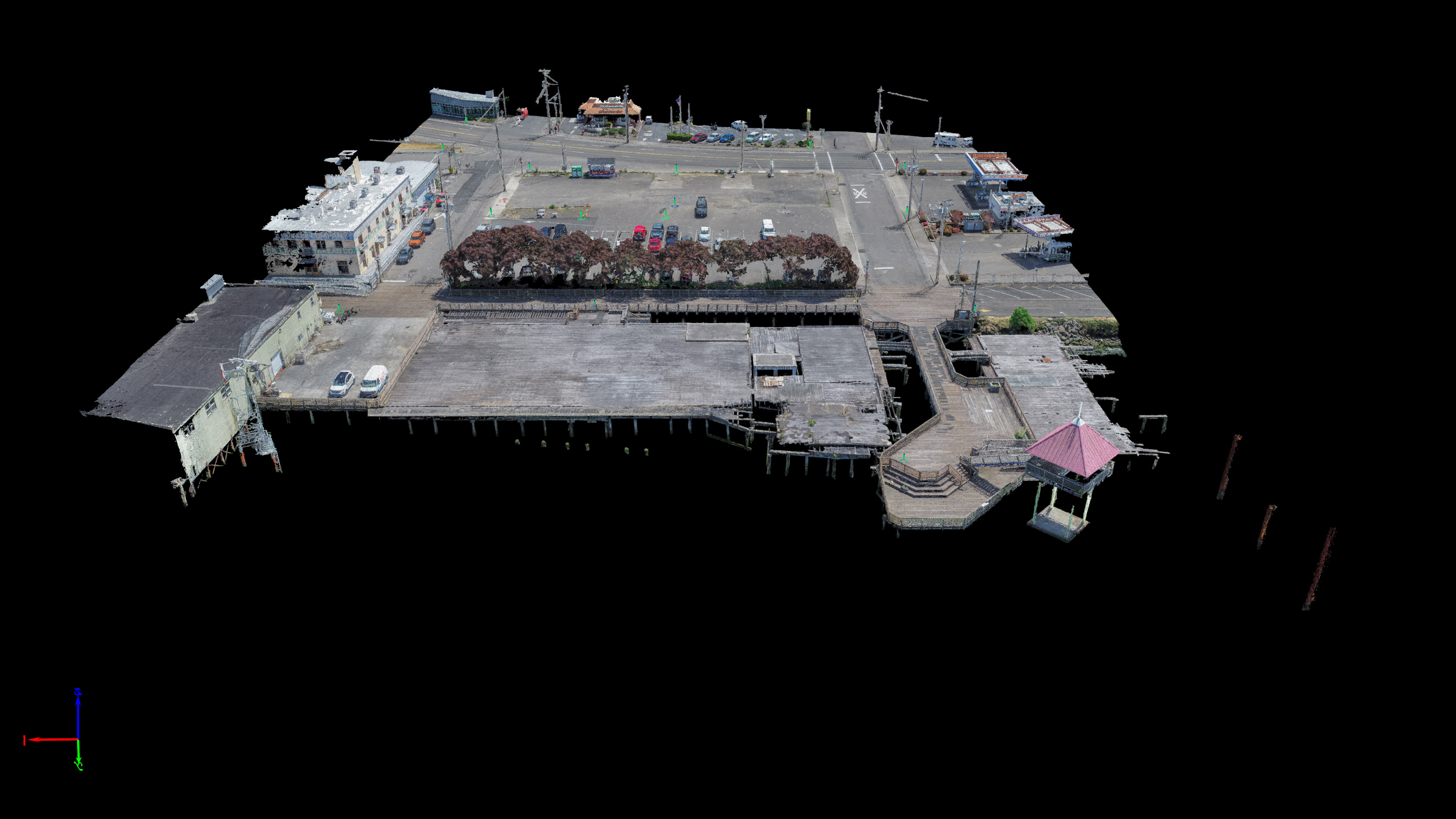
Mike Magyar of Magyar Land Surveying and I continue to inch along the waterfront in Astoria, mapping it with survey-grade accuracy. This project was another small job that Mike invited me to come along and map with him. I flew this one at 100ft to achieve a 0.35in pixel resolution and, like the Astoria Pilot Pier, I captured it at a ton of angles with over 1,000 frames to ensure I got all the building facades and the full decking and wooden struts of the shoreline. We laid out 17 aerial targets which mike surveyed while I flew giving us a final accuracy of about half a cm horizontally and just over a cm vertically. Of course you have to account for possible GPS error but this is pretty much the highest quality stuff that can come out of modern day photogrammetry software!

It took me a long time to edit the point cloud as usual because of the intricate nature of the wooden pilings and degrading wooden decks of the site. Moving water and shallow depth of field between the boards often creates a noisier photo-derived point cloud on sites like this so it takes a bit of extra work to clean out all the noise. Below are some screenshots of various angles of the site showing the finished product.


3D Interactive Model and Data Fly-Through Below