I was pleasantly surprised to get a phone call from Brent at IE Engineering down in Roseburg. I had worked with his boss Ron Quimby on the Stewart Parkway job I did for Century West Engineering earlier this year. Apparently Ron had been impressed by my work! Just another example of work I proudly find through word of mouth about the quality work I produce.

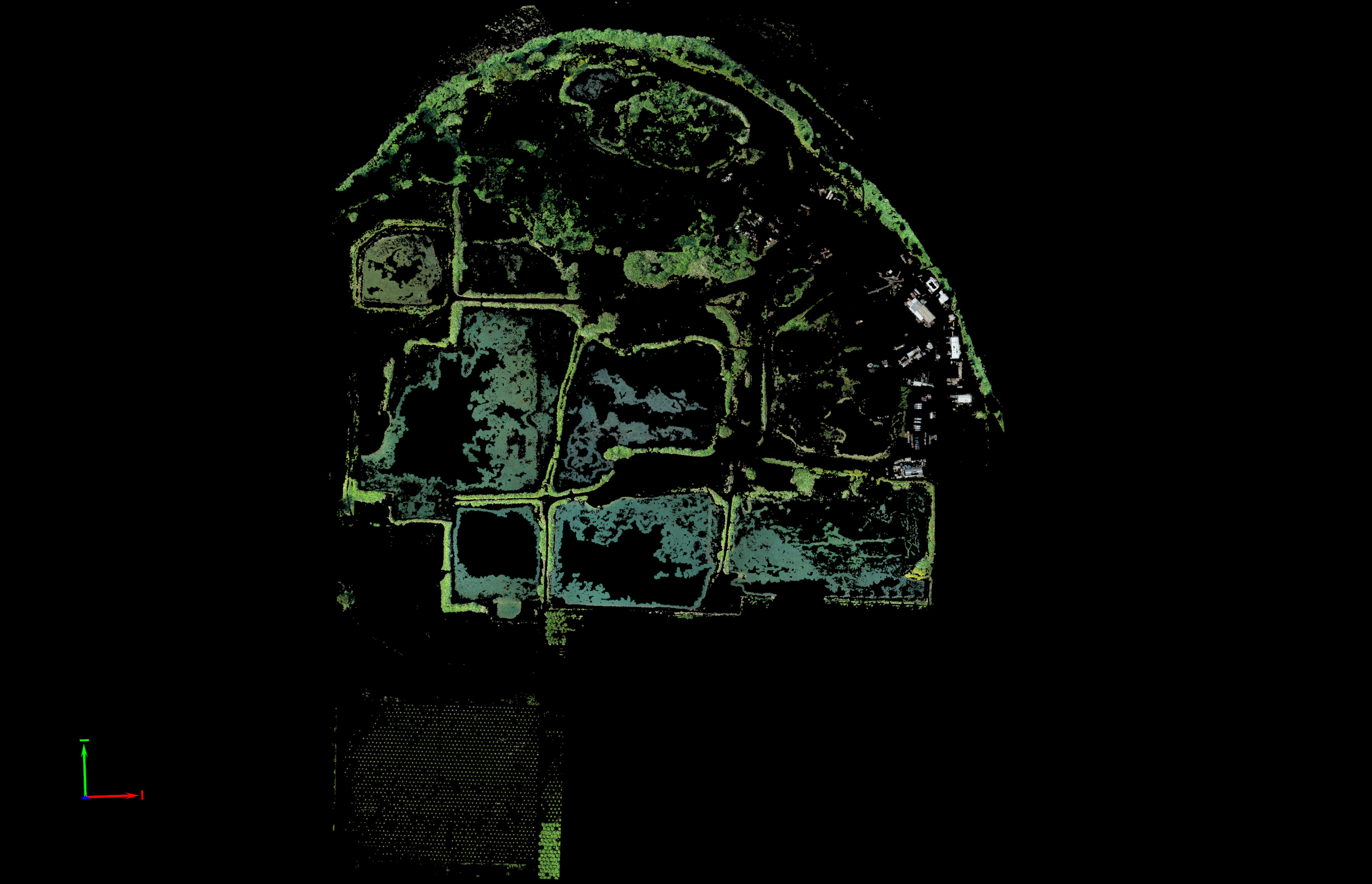
This site was challenging for a lot of reasons. It was huge, it was a long drive away, it was captured on a very hot day, and the subject matter of tall trees and very thick brush along the shores of the water features on site and nearby river made it a difficult job for sure. Brent’s client had agreed to a 400ft flying height (max I can fly) but also wanted a surface model for the site created. This presented a challenge as soon as I arrived on site and noticed that there was a ton of tall grass and very very thick brush everywhere except for the actual quarry which was just a small portion of the northeast corner of the AOI. Brent had been busy laying out the air targets with his crew the day before and that morning and were well aware trekking through the landscape that there was a lot of thick brush and grass. I explained that I would do my best to edit the point cloud to produce the best surface model possible for him and I’m glad that I only tacked on a small amount extra for that deliverable as I knew it would be a challenge. The photo below is of an area of the quarry where I have produced a super accurate surface model upon the hard gravel but the photo beneath that is of a typically thick brush area of the AOI where I simply could not capture the ground to make a reliable surface model. I believe LiDAR would even have trouble getting through the thick brush.


Flights took a long time and it was super hot out with me ducking into and out of my running truck as necessary to keep the iPad and RC unit cool as the drone raced back and forth above me. Because I don’t have an unlimited number of batteries I was forced to re-charge them in one of the building offices as I flew and thankfully I was able to finish up all the acquisition I needed by 6pm when the office closed and I had to leave the site as everyone was headed home! Phew, that was close!


I ended up collecting a massive 1,900 frames for the site which produced a huge 172 million point colorized point cloud for me to extract a surface from. Processing the orthomosaic didn’t take too long but it took me days of painstaking manual classification work to remove as much vegetation as I could for the surface model creation and then subsampling the point cloud over and over again to get it into a manageable size and format for AutoCad Civil3D to ingest and create a TIN from. Below you can use the slider to see just how much vegetation I meticulously removed from the model by hand.


I ended up flying at 300ft instead of 400ft to produce a higher resolution 2.5cm/1in pixel resolution data set for Brent’s client. This also helped with geospatial accuracy which was around +/- 1 inch horizontally and vertically. It was a super accurate data set but with the amount of vegetation I had to remove trying to create as accurate of a surface as possible I’m a little disappointed with the ground model results. I knew when I was there it would be a challenge and I did my best to communicate that throughout the project and I hope Brent is able to use the rough surface I provided him. As I always do I explained the other options such as traditional survey, terrestrial scanners, and even aerial lidar capture both from manned or unmanned sources but any of those options would have been triple the price I charged. Even though I have been able to produce some amazing and unique data sets from aerial photogrammetry all technology has its limitations and I was brushing right up against those limitations with this project.


Interactive 3D Model and Data Fly-Through Below