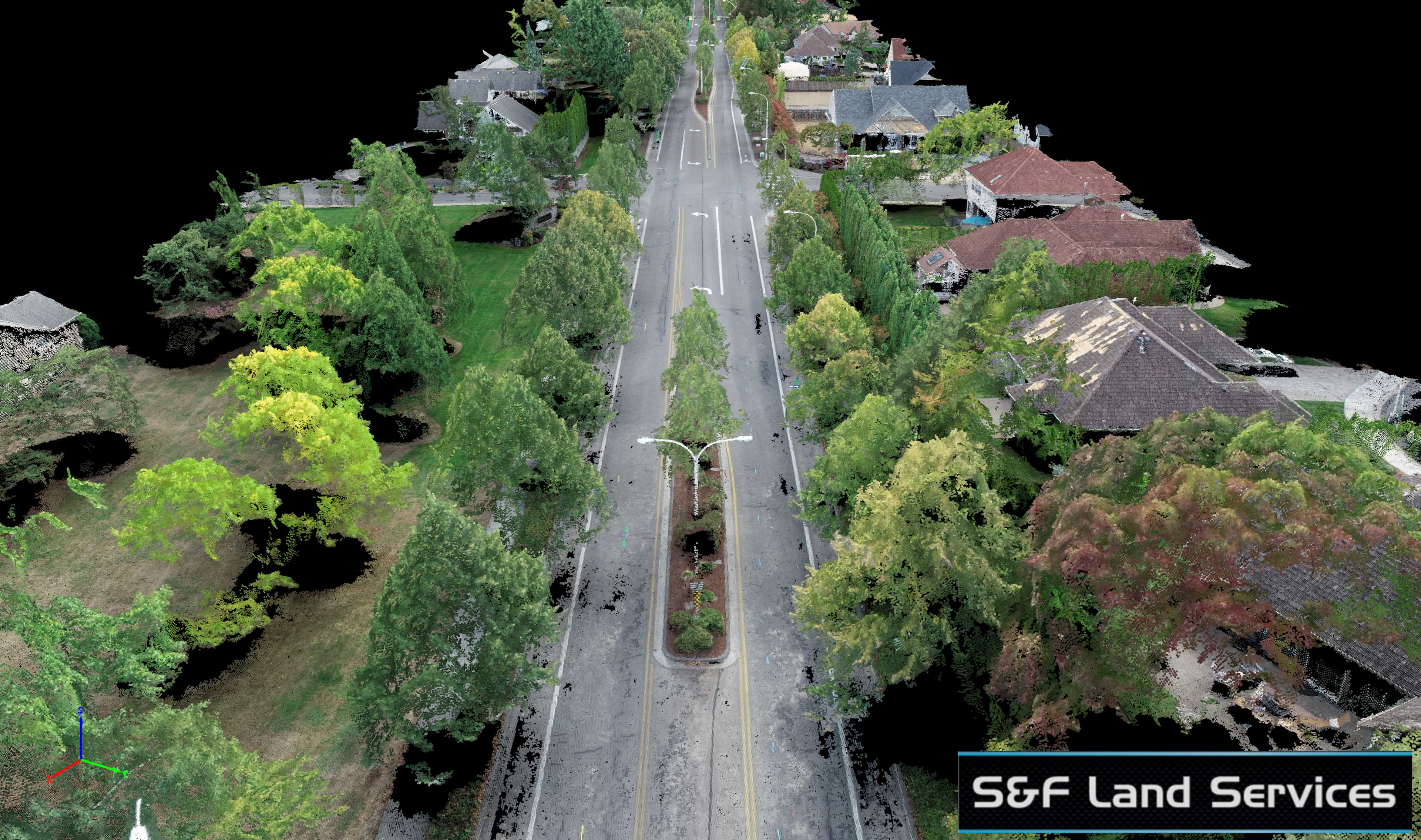
This project for S&F Land Services was a doozy. At 1.25 miles with the client asking for a surface model of the roadway heavily lined by tall trees I had to acquire an enormous amount of imagery to capture the road as much as possible under the canopy. This meant breaking the road up into 3 sections of acquisition and flying each section 4 times! It also meant flying on a cloudy day to minimize the noisy effects shadows have on photogrammetry derived point clouds.
I asked the S&F team to lay out more air targets than usual and waited until the afternoon skies to start clouding up which took longer than usual. This meant that I was flying in late afternoon under cloud cover with the light low in the sky meaning that I had to really open up the camera settings to capture quality imagery for processing. Basically, it was a very tough acquisition that required a couple days of prep work and planning to pull off without a hitch. Those who think they can just go out and purchase a drone and do aerial mapping for difficult projects like this are in for a rude awakening!
About three quarters of the way through the acquisition with the sun getting lower and lower in the sky I got a text from S&F saying that the client would prefer traditional surface modeling rather than one created through UAV Aerial Mapping. This technology is new territory for a lot of people so I totally understood the concern the client may have. Despite hearing that I decided to finish up what I had planned for acquisition to create an absolutely stunning 3D model to show the client as well as capture extra frames to help remove moving objects and pull back vegetation for the final Orthomosaic deliverable. This was some of the most intense post-processing work I have done in a while. When it was all done I had made over 500 edits to the final mosaic to pull back vegetation as well as remove cars without altering the geospatial accuracy of the data in any way. See below for some before and after comparisons.
In the end this data set produced a point cloud of over 80 million points with a ground pixel distance of just over half an inch. Despite the difficult acquisition conditions we also achieved a remarkable sub inch horizontal RMS accuracy as well as a 1.5 inch vertical one thanks to the stellar quality of the air target control S&F provided me.
Before and after sliders showing the level of effort I put in pulling back vegetation from over the roadway as well as removing cars. Without pulling back the vegetation the canopy of the trees as normally seen in traditional aerial imagery or satellite imagery would obstruct the underground utility paint lines that the client needs digitized for planning.


Below are some screenshots, a video fly through with many different angles (feel free to scroll) and a 3D model to interact with (3D model works best on a computer, or just follow the link to Sketchfab to check it out).


