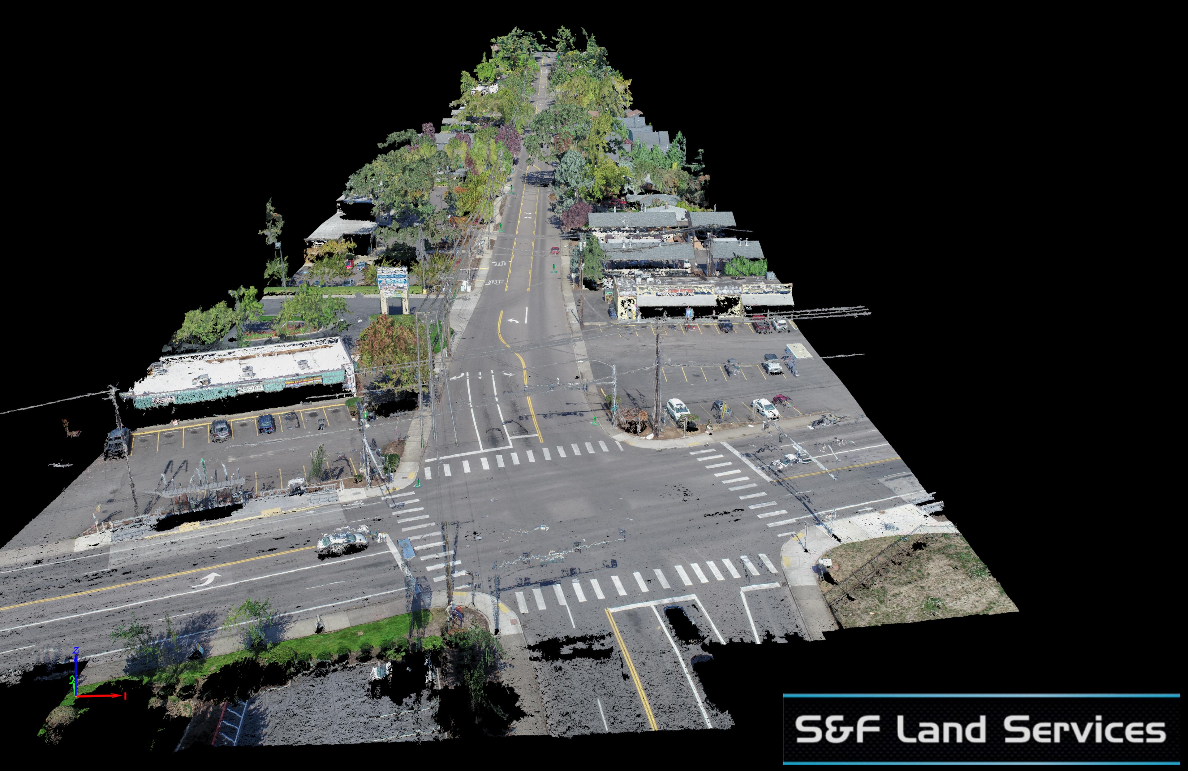
Another roadway project for my partner S&F Land Services. This road was a half mile long and with proper surveyed air targets we achieved a horizontal RMS accuracy value of half an inch and vertical of 1 inch. Like all the projects I produce for my clients I spent the extra time removing cars from the final deliverables as well as pulling back the tree canopy from over the roadway to reveal the painted underground utilities on the roadway below. This deliverable differentiates TLT Photography from other aerial providers. I take the time and effort to meet the strictest geospatial accuracy standards but also take the time to make the final deliverable as useful and aesthetically pleasing as possible. In the end it appears as if the entire road were shut down for this survey. This is why I call my deliverables “survey-grade”.
Below is a screenshot of the final deliverable. Look on the lower left. If I hadn’t spent the extra time pulling back the tree canopy this underground utility gas line would never have been visible for digitizing the final deliverable. 
Below are all the places where I pulled back vegetation and removed cars from the roadway for the final product. This is a low res version of the final deliverable for this blog post.


