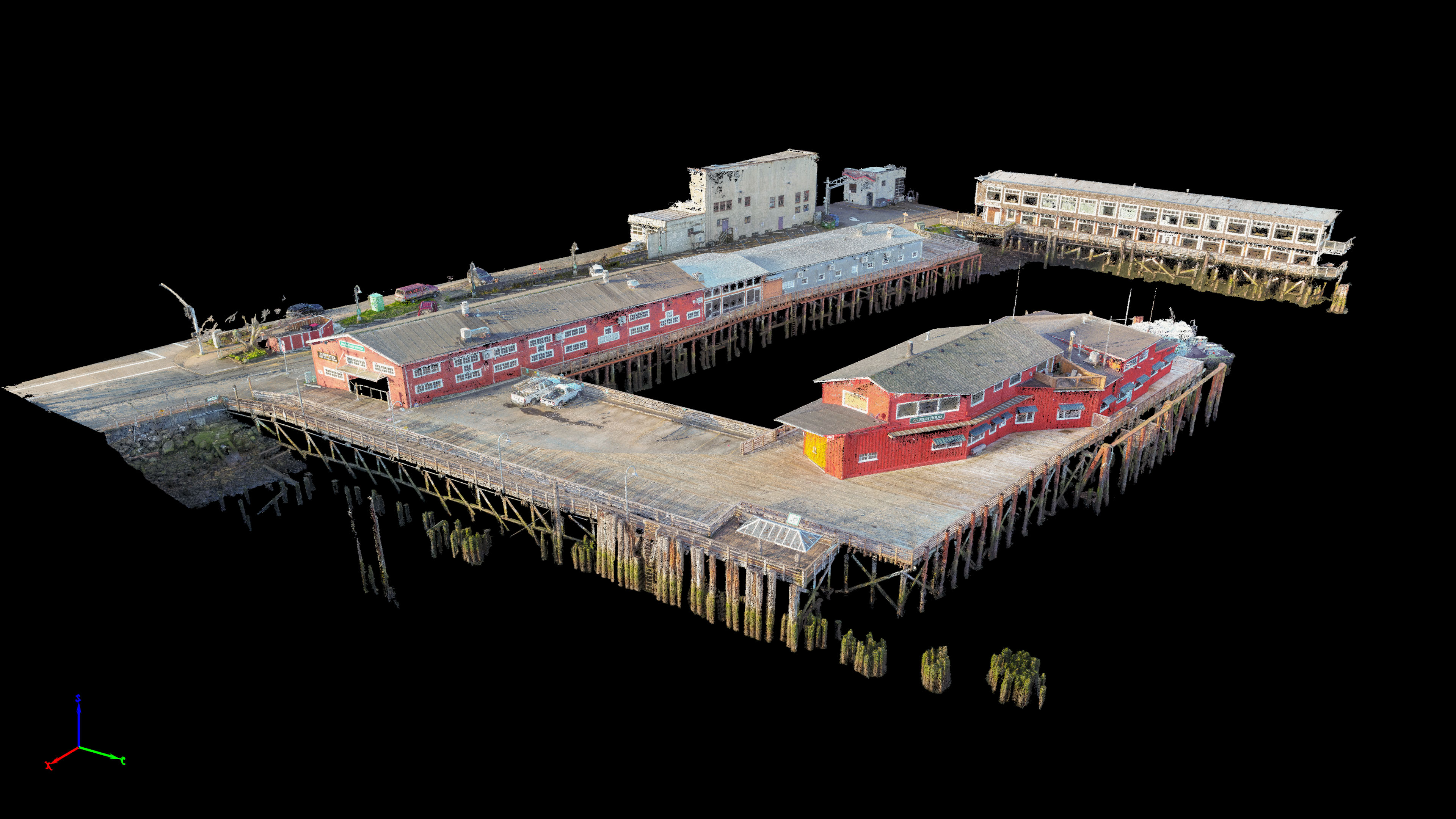
Working with Magyar Land Surveying we mapped the pier of the Columbia Pilots in Astoria. This project was the first time I tried to map something that was not on solid ground. Because the buildings were on a pier propped above water by wooden pilings I wasn’t 100% sure how everything would come out. We were also in a rush to fly in the best lighting which for photogrammetry happens to be with minimal shadows. The weather forecast had been for cloudy weather but on the 6am drive to the coast I realized it would be a bluebird day there which meant I had to fly the site before the morning sun came up.
I arrived at the site by 7am and began quickly laying out air targets with Mike that we would then survey after the flights were finished. By 7:30 we had everything laid out and I took off for my first NADIR mission for the site which was at about 80′ altitude and would take approximately 13 minutes. Once finished I quickly threw in another battery and had the Phantom 4 Pro in the air flying the 2nd perpendicular “double grid” mission. About 75% of the way through the 2nd mission the sun peaked out above the Goonies hillside and long shadows quickly began to appear. Phew… that was close.
After acquiring the 2nd NADIR mission Mike set about collecting coordinates for me of the air targets while I flew 4 more missions with the gimbal pointed at 60 degrees to capture the facades of the buildings and the pilings underneath. It was low tide so I was hoping to catch as much detail as possible and crossed my fingers that the deepening shadows from the rising sun would not be an issue.
Within a couple days I was able to provide Mike with an incredibly detailed and accurate orthomosaic of the pier for him to use for survey measurements and CAD design of the site. I have since then spent a lot of time editing out the inherent water noise in the model to make it more clean looking for presentation to Mike’s client. Despite the shadows I think it is one of the most detailed 3D models I have produced. We achieved quarter inch accuracy in the X and Y planes and half inch accuracy in the Z plane based off of 3 checkpoints I set aside for accuracy testing. These were fantastic results I am really proud of and I hope will be super useful for Mike with his site survey work. 3D models and animations below.