This spring I’ve been trying to develop a functional work flow for high quality terrestrial photogrammetry capture and processing using my new Nikon D850 and RedCatch Mono IMU/GNSS. This first started off with the possibility of using a drone for trail mapping. Brian from BD Aerial had successfully used this method to capture a PT slab where he was unable to take off because of flight restrictions. This got me to thinking so I took his setup out to Forest Park in Portland to give it a go on a trail. This being a narrow, long corridor it is also one of the toughest for photogrammetry to handle. Try not to laugh at the following photos. Just try. Definitely don’t laugh at the deep see fishing rod holder that I have strapped around my waist with velcro directly above my crotch.


Ok – Done laughing… Now look at the results. Pretty freaking amazing. I lost GPS connection part of the way through but the area I did capture came together beautifully with incredible detail in both the surface as well as the surrounding vegetation.


This being a huge success I thought that I would definitely be successful with the much wider lens and many more megapixels of my full frame Nikon D850 combined with my IMU/GNSS. So, I told my buddy Mike that I had high hopes for success on our trip down to Oregon Caves in June to map an old waterline through the woods. When my RedCatch mono arrived I even mounted to a rod and walked up and down my street with it to see how it would work. See below. Looking pretty good.

With everything looking promising Mike and I both separately drove south 4 hours to Oregon Caves to give the project a go. What the forest service had described to Mike as “open” was anything but. On both sides of the trail there was thick overgrown brush. Even over the trail there were constant low hanging branches and there was no way that I was going to be able to walk with my rig comfortably on either side of the trail to get the side lap I would need to construct a model. In the road above I was able to walk on either side of the road to create the great model you see. In Oregon Caves I only had a 2 foot wide (at best) trail to walk down. I wasn’t too confident at that point but I decided to give it a try and walked about a half mile down the trail and back with the camera set to take a photo every second. I actually made 3 passes over the trail capturing just under a 1,000 frames before my memory card filled up.
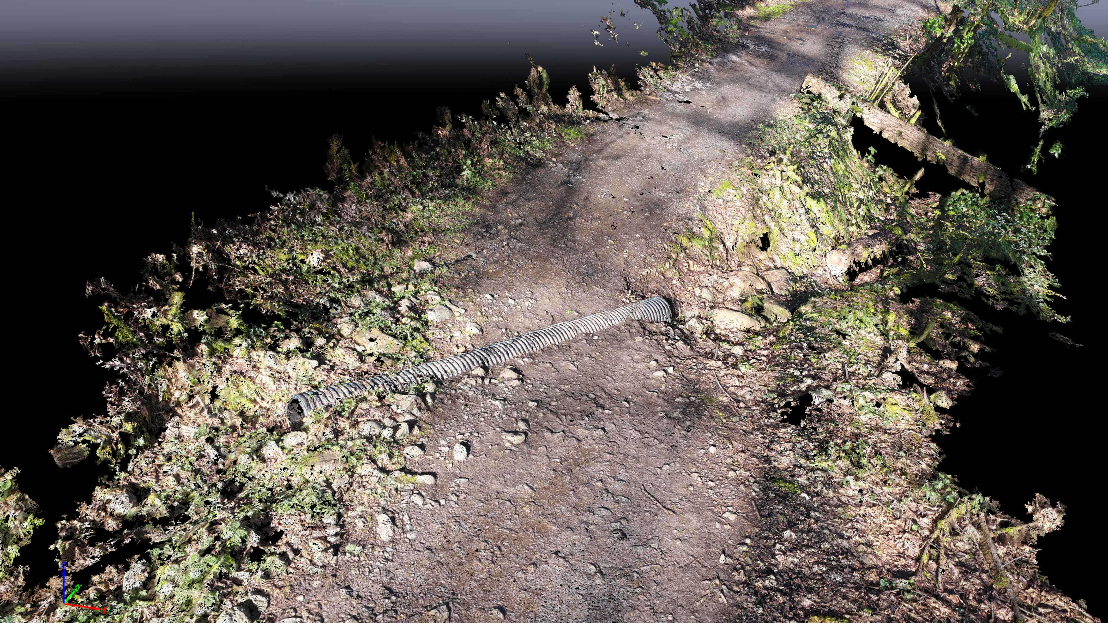
After we left and had dinner I started to process the data which took overnight. In the morning all I could do was laugh. It was a complete failure. There were occasional sections that looked partially ok but for the vast majority of the trail it was all garbage. Mike had been placing markers along the trail where he would shoot in points to help me georeference the model but looking at these results it wasn’t worth the effort. In the end the trail was too narrow, the brush was too thick and on top of it all I had a massive outbreak of poison oak going on all over my body. It was time to head home!
This one below looks almost useful but the one below is just garbage. I think that with a wider trail or at least less brush allowing me to walk on either side, I would have had much better results akin to my street successfully modeled above. 
