This week I enjoyed two full days of fairly easy aerial mapping for S&F Land Services. S&F had 6 fairly large sites where their client was planning on building solar farms. This work was to provide high resolution preliminary aerial imagery for each site. These sites ranged from 35 to a massive 117 acres. Most were located in Class G airspace but one was within a few miles of an airport requiring me fly beneath the FAA UAS Facility Map height and thereby requiring a heck of a lot more frames. It is very exciting that the LAANC system is being integrated throughout airports in Oregon as it is now super easy to use software like AirMap and quickly receive an FAA authorization for flight. Just don’t try getting approved for anything higher than the UAS Facility Map height because you’ll definitely get denied!
The S&F crew stayed ahead of me the first day laying out air targets as I had suggested based off the geometry of each site to best aid the data in triangulation and processing. Several factors proved to make the processing difficult on the sites captured the first day. Wind & Clouds. I found myself continually pausing the missions to avoid cloud cover over the fields which of course would make the final orthomosaic look pretty bad. This gave the crew enough time to stay ahead of me surveying in all the air targets before I flew which worked perfectly.


The first day I captured over 2,000 frames over 5 sites and the entire afternoon. The 2nd day I captured nearly the same amount just at the final site because of it’s size as well as the flying height restrictions. I also took our dog Leo along for the sunny afternoon to hang out with me while I flew. Leo and the hot sun provided a great excuse for me to deploy my “acquisition mobile”… ha! I have rigged my truck with a ARB Canopy so that on hot acquisition days I can pull it out for some much needed shade. If you have ever flown a drone using an iPhone or iPad on a sunny hot day you know how easily it is for the device to overheat in the sun which is of course a disaster when trying to watch the screen during a mapping mission!
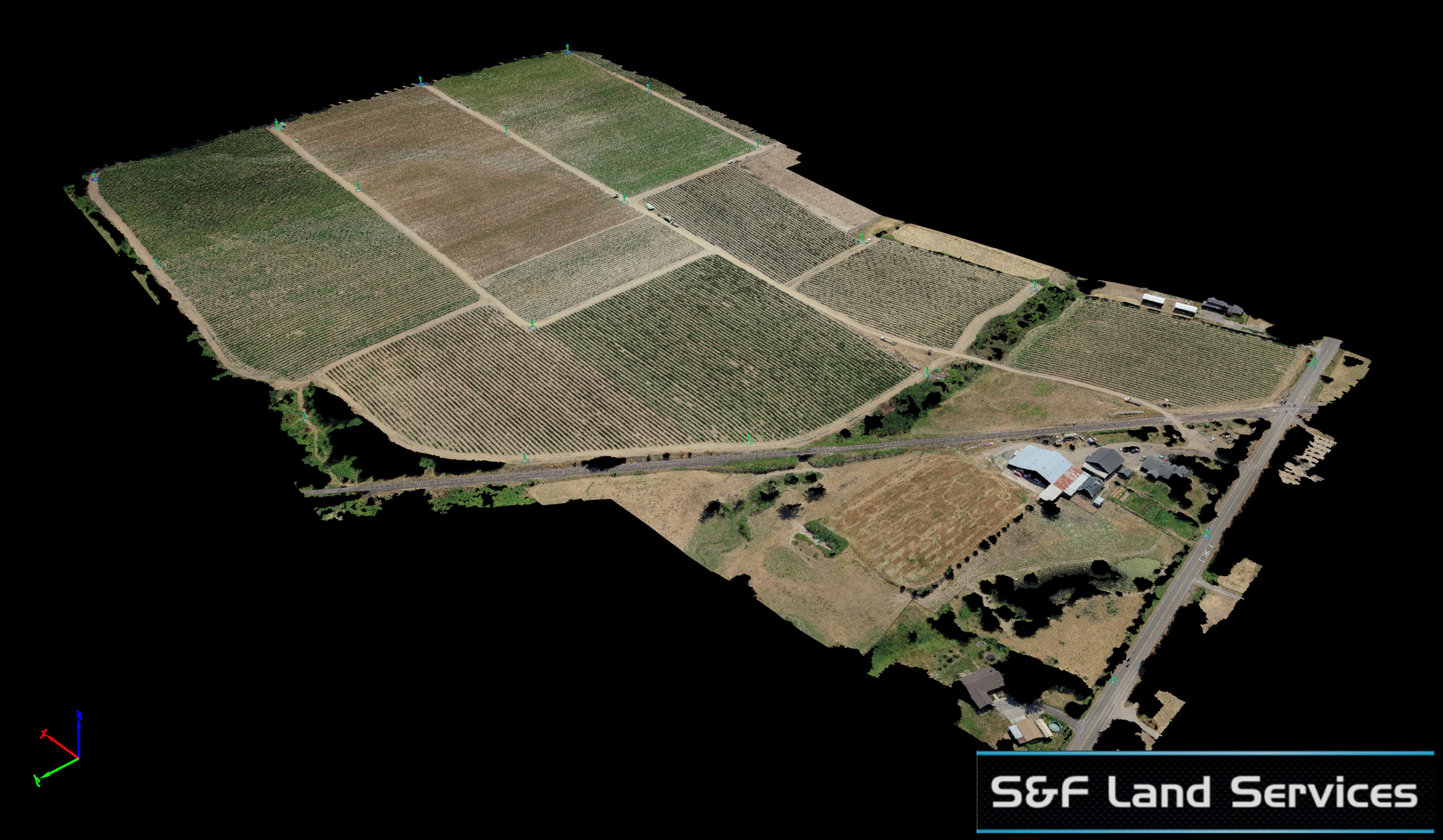
All of the sites were flown to create an orthomosaic with 1 inch pixel resolution and thanks to the incredible survey work of the S&F crew we achieved sub-in horizontal accuracy for all of them as well.
Below are some images of the data, a very long youtube video fly-thru of the data (feel free to use the scroll bar) and one 3D model of the data to play with. Feel free to visit my 3D model gallery to find the rest of the sites.


