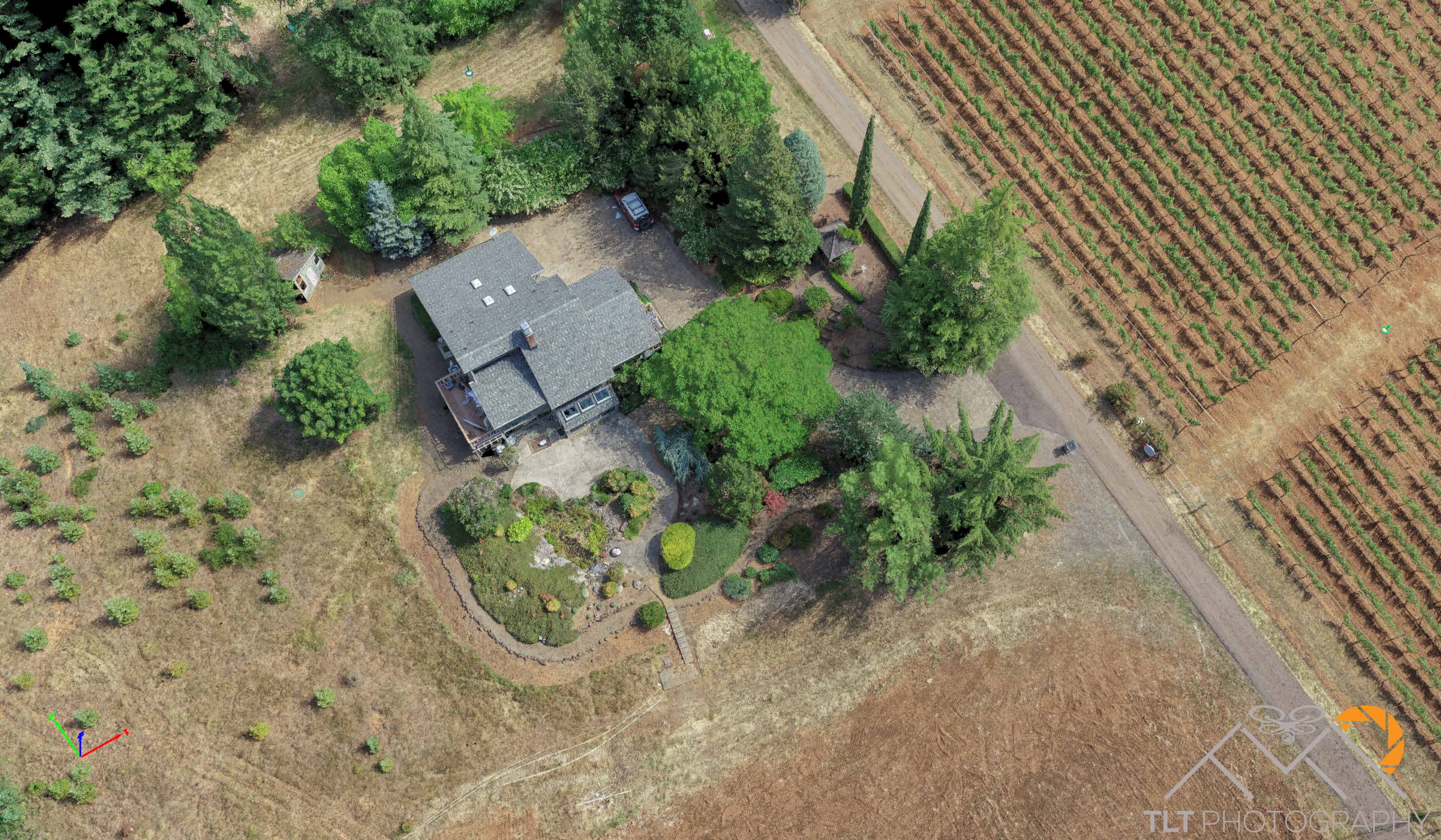
At the end of this week I rushed out to meet my buddy Mike Magyar at an absolutely beautiful vineyard just outside of Sheridan, OR. Mike had asked me to help him map the site. Part of the property was heavily vegetated with no chance of a reliable ground model from a photogrammetry derived point cloud but the other half was bare ground between grape vines and bare earth to the south of the home on site. When I got there Mike and I quickly laid out 8 air targets throughout the property and then I go to flying quickly, capturing just over 1,500 frames from all angles possible to get as much surface under the tree canopy and vines as I could. Leo had a fantastic time playing with Louie while I was flying and mike was off shooting in the points. After I completed my last mission I had to say a quick goodbye to Mike and race home in traffic to get ready for our 5 day backpacking trip along the Olympic Coast!

After our amazing backpacking trip I processed the data for Mike creating a point cloud of over 75 million points. With Mike’s targets I was able to achieve about sub-in horizontal accuracy and roughly 1.5 inch vertical accuracy (on hard surfaces). The orthomosaic produced had a GSD of roughly 0.5in so these accuracy results were great. To help Mike as much as I could I spent nearly a full day hand classifying the point cloud to create the best surface model I possibly could for him of just the ground points. This of course left holes in the data set underneath thick grass and impenetrable tree canopy but Mike just filled those spots in with traditional survey or if small enough just let the data set interpolate the area.

I felt bad that in my rush to beat traffic back to Portland I forgot to grab some oblique shots of the horizon from the property so I did my best to build an Infraworks project showing that viewpoint. I also took some time to show Mike some of the software tools in Infraworks that I used to create the surface model from the ground points as well as how to grab coordinates and digitize objects within the software. The hope is that we can collaborate on projects like this in the cloud in the future.


Below is all the vegetation that I carefully hand classified out of the model to leave only grounds.
Just Grounds

