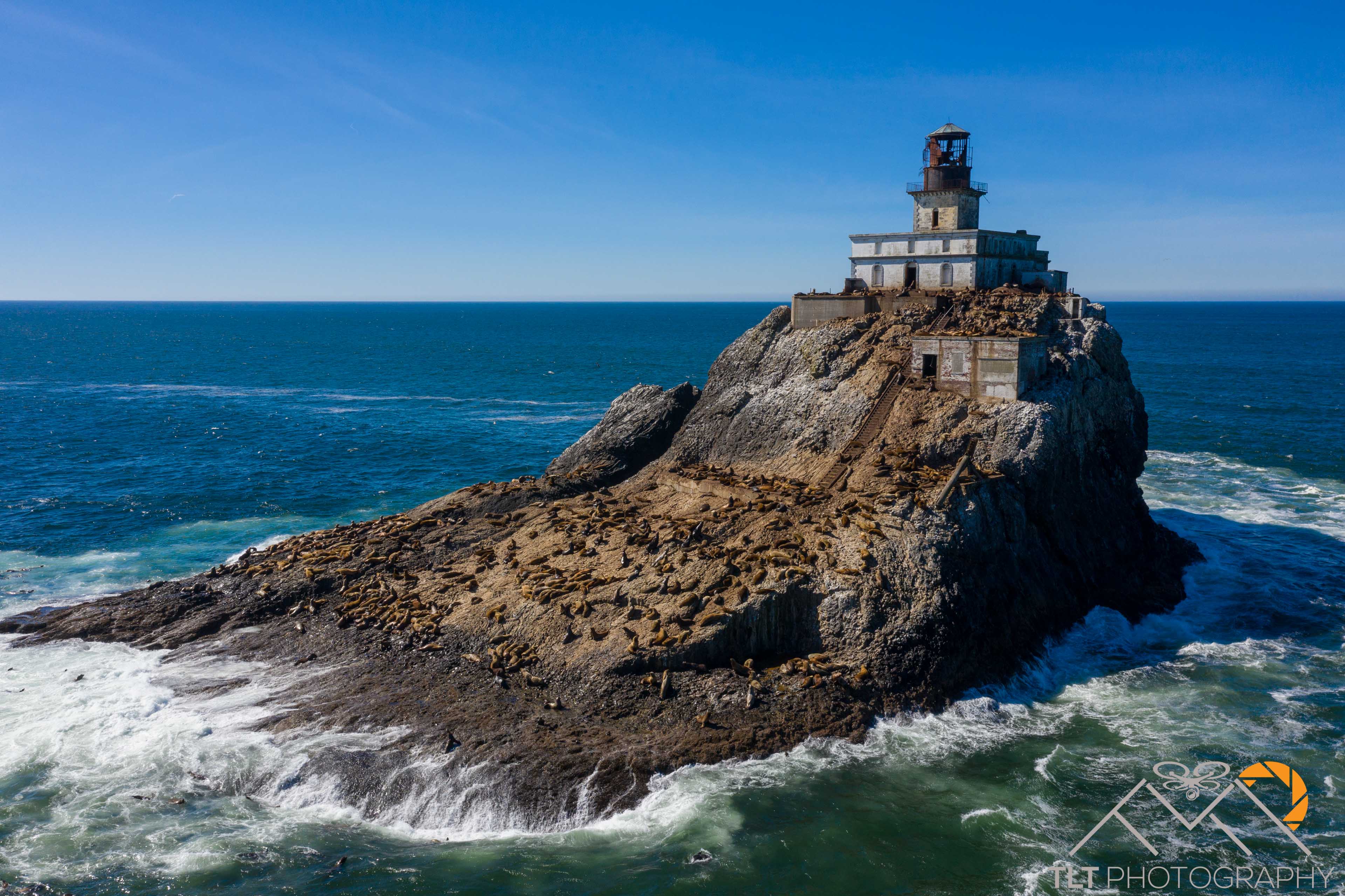
Tillamook Head Lighthouse
Emily and I have been really enjoying our time on the coast. It’s closer for her to get to work and it’s […]
Emily and I have been really enjoying our time on the coast. It’s closer for her to get to work and it’s […]
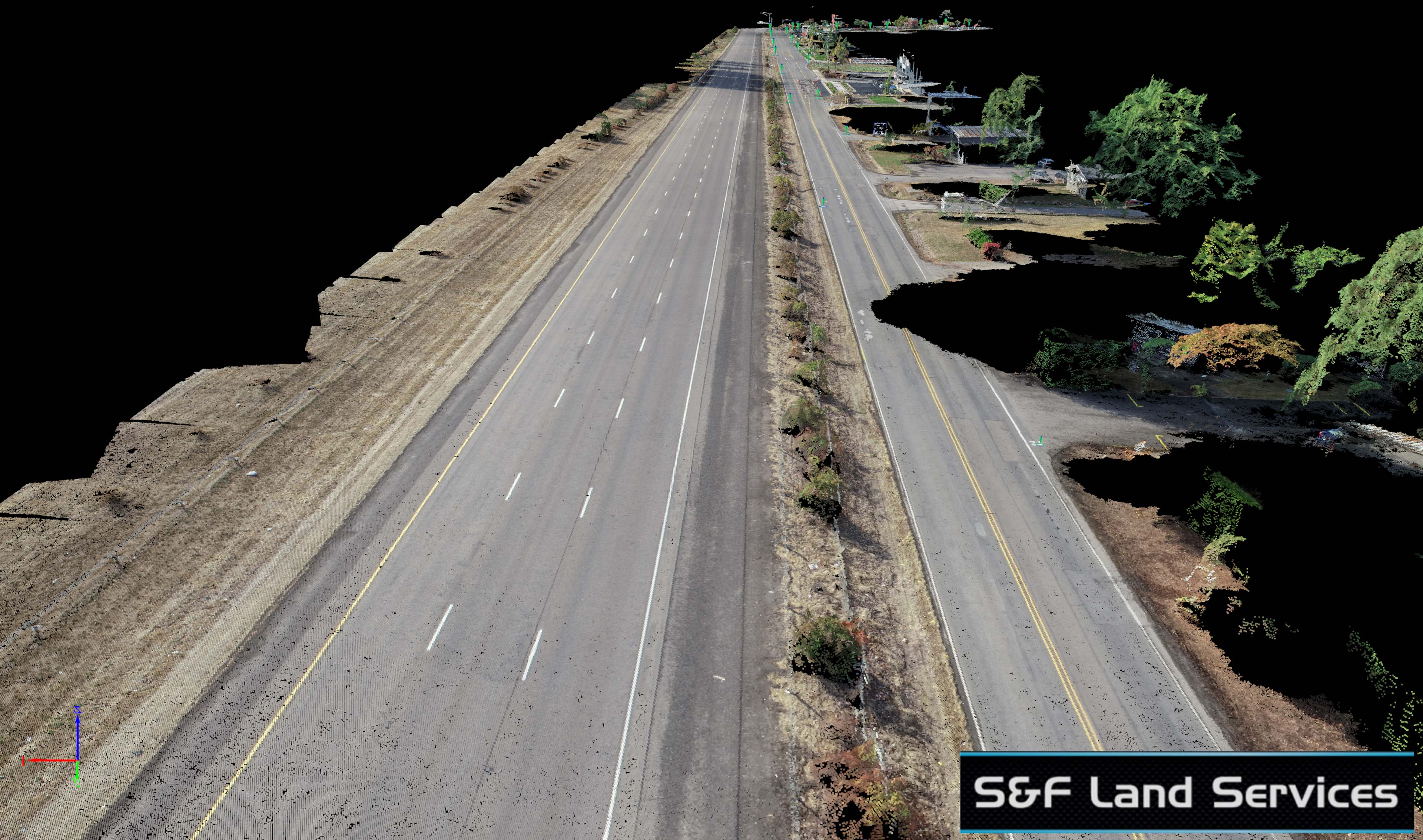
Another successful aerial mapping project for S&F Land Services. This roadway project was particularly challenging due to the road’s location next to […]
This project for S&F Land Services was a doozy. At 1.25 miles with the client asking for a surface model of the […]
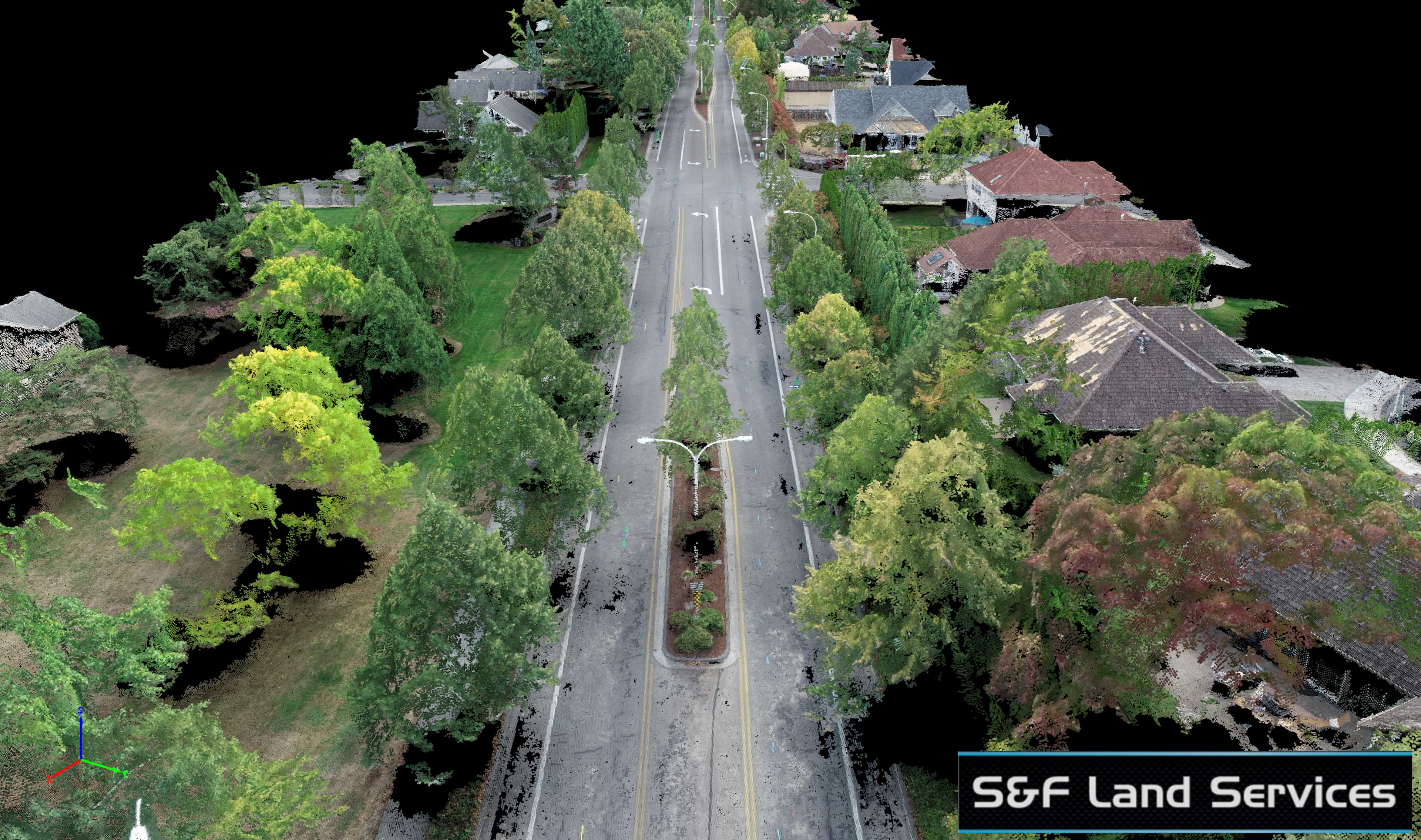
Another roadway project for my partner S&F Land Services. This road was a half mile long and with proper surveyed air targets […]
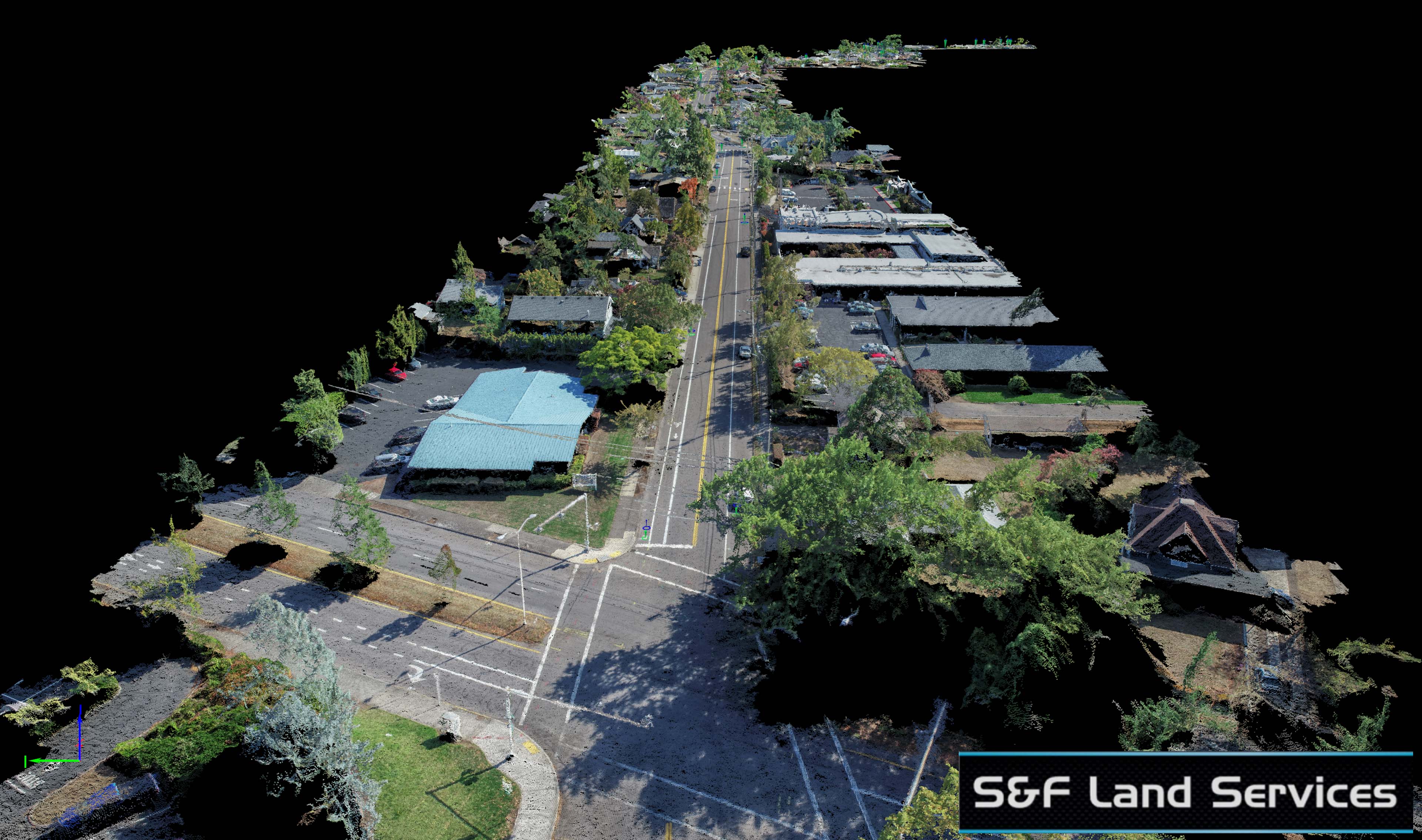
Another day, another roadway aerial acquisition for S&F Land Services. This one was a bit more challenging than I expected. At a […]
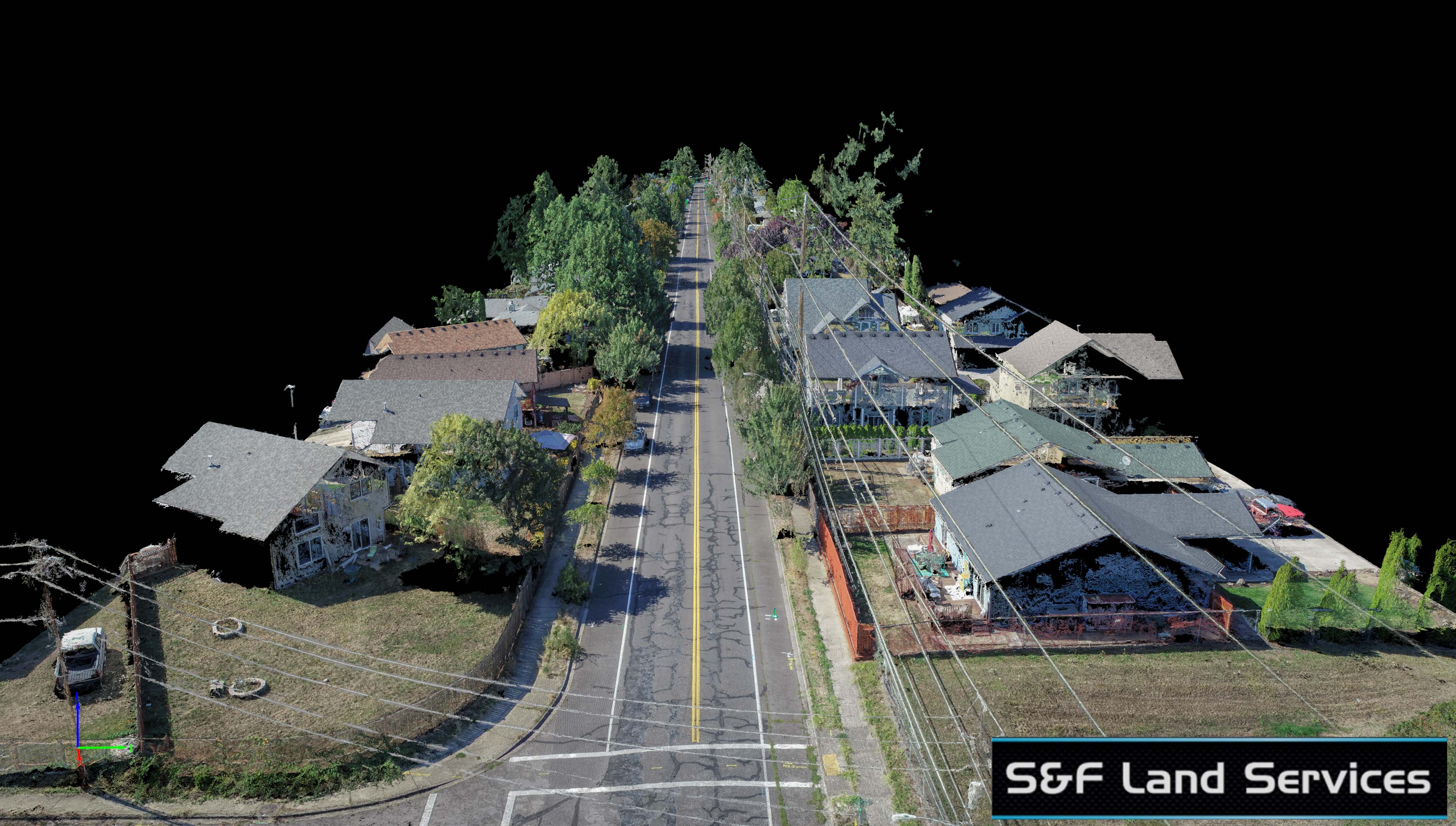
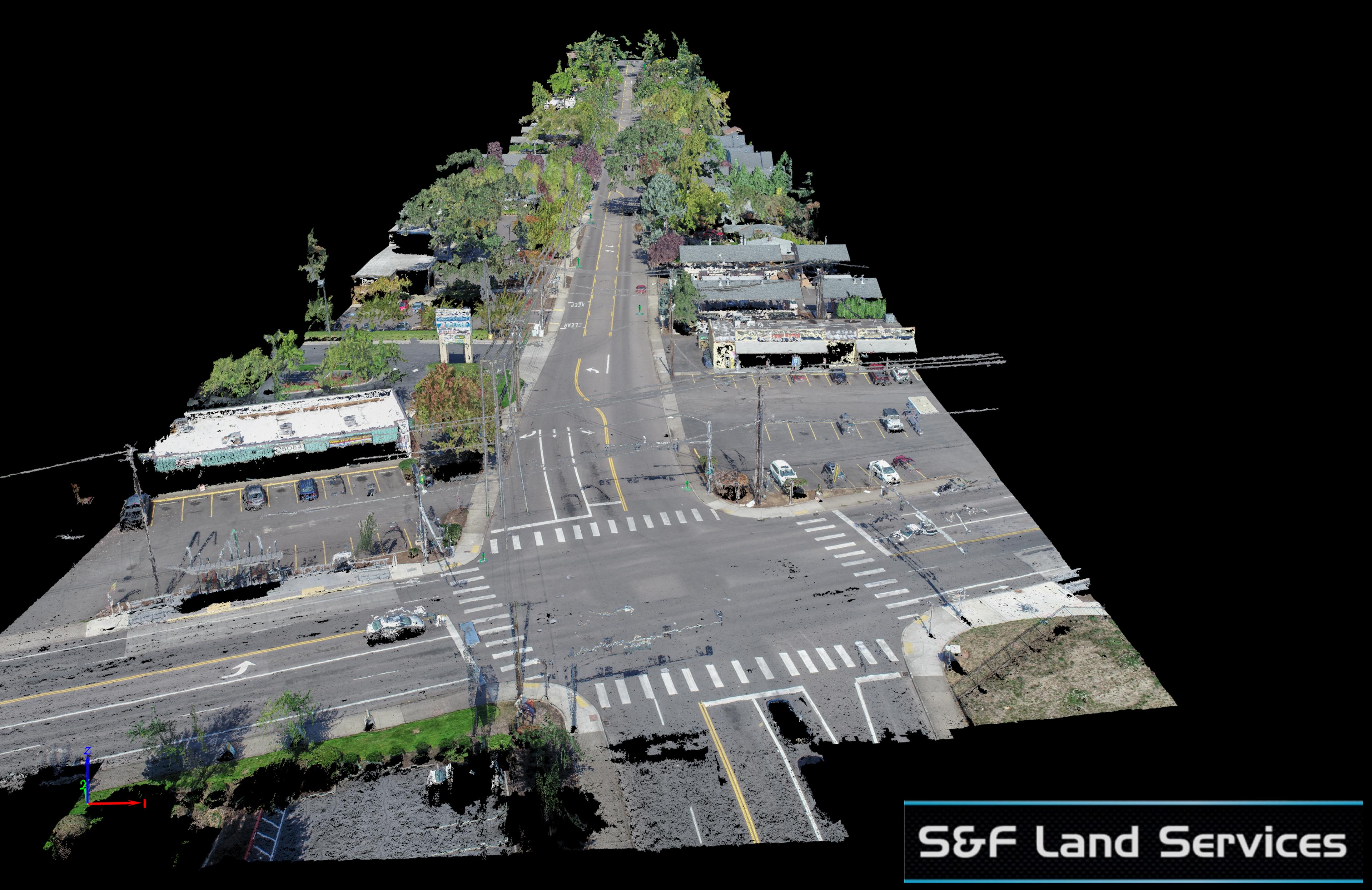
Yup, this is a different 39th Street in Vancouver than I completed last year. S&F Land Services again used TLT Photography’s aerial services […]