Skip to content
TLT Photography
Toggle menu
  • Photography
    • Landscape & Wildlife
    • Client Work
    • 3D Model Gallery
    • Family Archive
  • Adventures
  • Photo Blog
  • Contact

Month: March 2018

March 30, 2018November 7, 20183D Modeling, Data Solutions, GIS Solutions, Photogrammetry, Survey

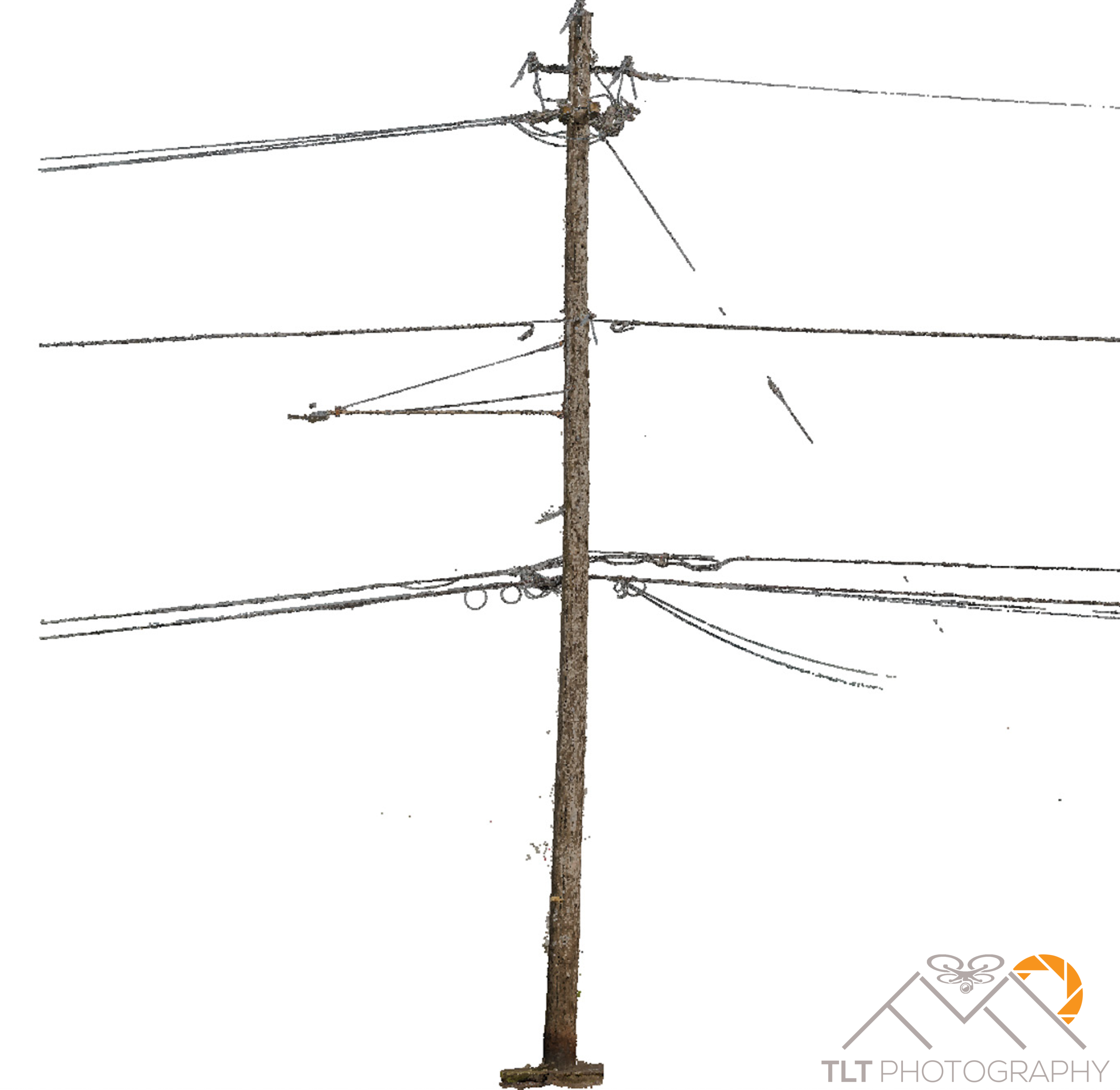
Fully Automated 3D Modeling of Lattice Structures

Today I had a bit of a breakthrough.  On a whim I decided that I wanted to see what I could model […]

Share this:

  • Click to email a link to a friend (Opens in new window)
  • Click to share on LinkedIn (Opens in new window)
  • Click to share on Facebook (Opens in new window)
  • Click to share on Twitter (Opens in new window)
  • Click to share on Pinterest (Opens in new window)
  • Click to share on Pocket (Opens in new window)
  • Click to share on Reddit (Opens in new window)
March 28, 20183D Modeling, Data Solutions, Photogrammetry, Survey

AutoCAD 2018 Training

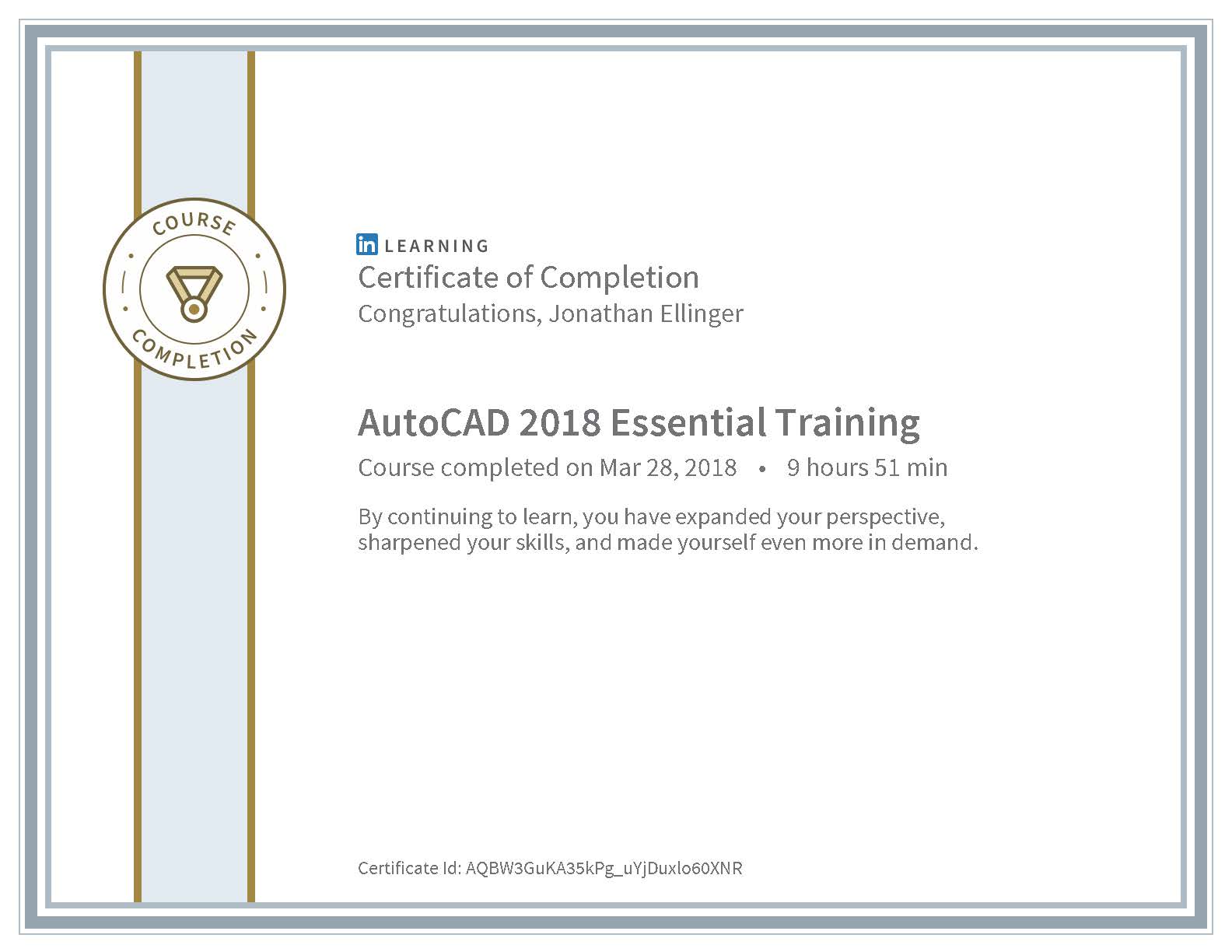
Just completed a 10 hour AutoDesk AutoCAD 2018 Essentials course on LinkedIn Learning.  My goal is to provide custom tailored photogrammetry mapping […]

Share this:

  • Click to email a link to a friend (Opens in new window)
  • Click to share on LinkedIn (Opens in new window)
  • Click to share on Facebook (Opens in new window)
  • Click to share on Twitter (Opens in new window)
  • Click to share on Pinterest (Opens in new window)
  • Click to share on Pocket (Opens in new window)
  • Click to share on Reddit (Opens in new window)
March 20, 2018June 26, 20183D Modeling, Aerial Services, Data Solutions, Photogrammetry, Real Estate, Survey

Mapping Reed College for ZGF Architects

This week I flew two acquisitions of Reed College in Portland, Oregon as a demonstration for ZGF Architects.  My goal was to […]

Share this:

  • Click to email a link to a friend (Opens in new window)
  • Click to share on LinkedIn (Opens in new window)
  • Click to share on Facebook (Opens in new window)
  • Click to share on Twitter (Opens in new window)
  • Click to share on Pinterest (Opens in new window)
  • Click to share on Pocket (Opens in new window)
  • Click to share on Reddit (Opens in new window)
March 20, 2018March 23, 20183D Modeling, Data Solutions, Photogrammetry, Survey

UAV Photogrammetry Derived Surface Models for Subdivision Grading in Warrenton

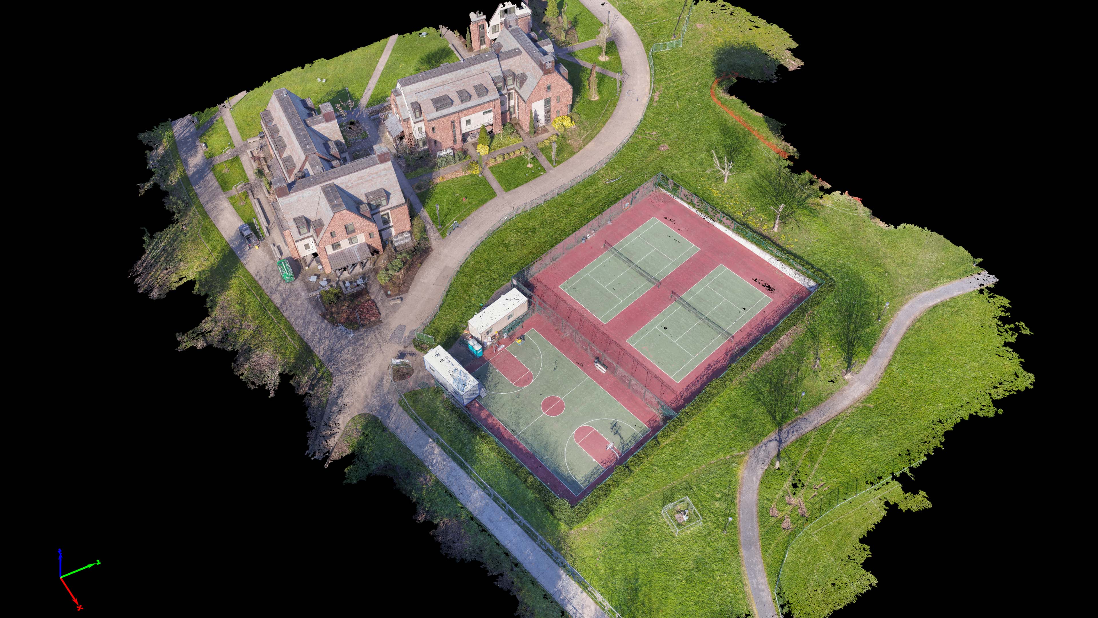
I just completed two surface models for Magyar Land Surveying of Astoria of a subdivision being built near Clear Lake in Warrenton, […]

Share this:

  • Click to email a link to a friend (Opens in new window)
  • Click to share on LinkedIn (Opens in new window)
  • Click to share on Facebook (Opens in new window)
  • Click to share on Twitter (Opens in new window)
  • Click to share on Pinterest (Opens in new window)
  • Click to share on Pocket (Opens in new window)
  • Click to share on Reddit (Opens in new window)
March 16, 20183D Modeling, Aerial Services, Data Solutions, Photogrammetry

Another Day, Another Deck, with BD Aerial

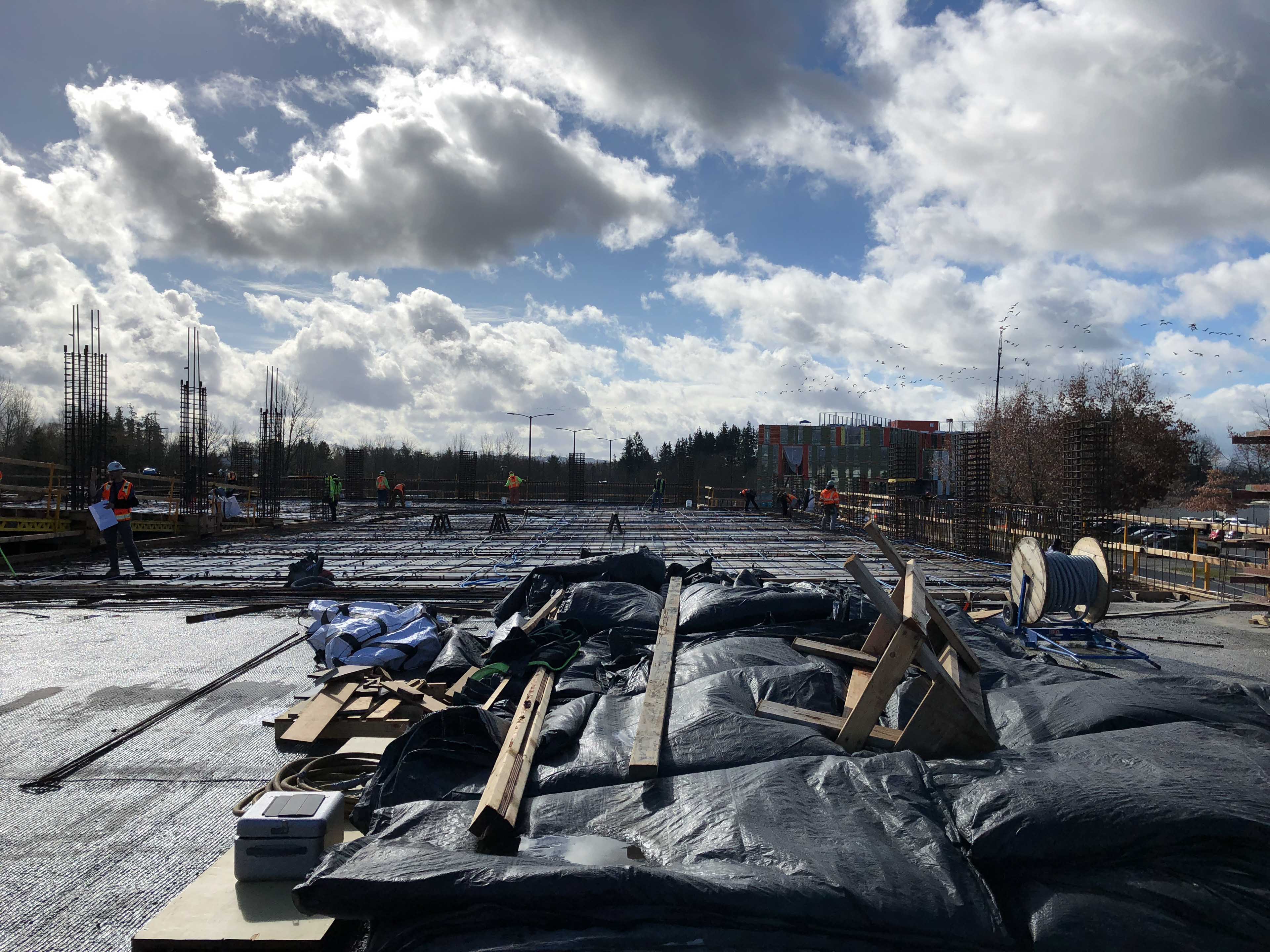
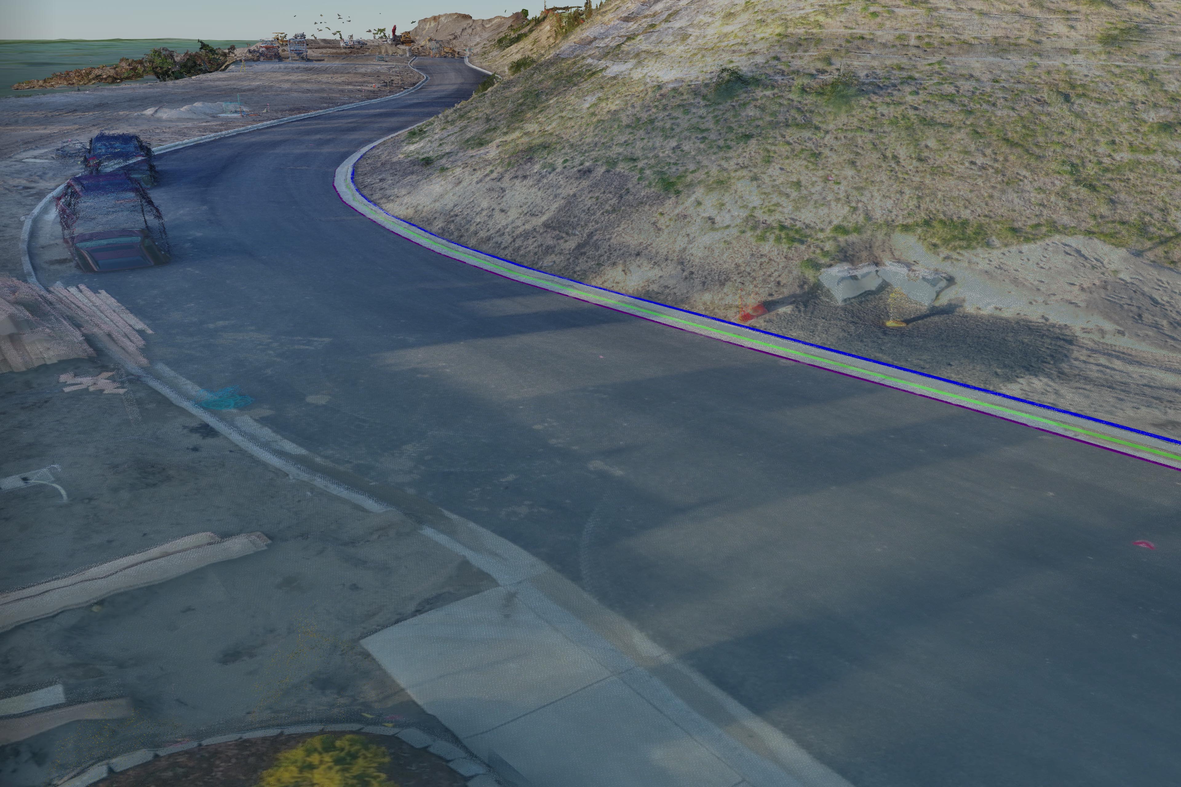
On Wednesday I successfully flew another construction deck for BD Aerial.  All went well and even got to see a few flocks […]

Share this:

  • Click to email a link to a friend (Opens in new window)
  • Click to share on LinkedIn (Opens in new window)
  • Click to share on Facebook (Opens in new window)
  • Click to share on Twitter (Opens in new window)
  • Click to share on Pinterest (Opens in new window)
  • Click to share on Pocket (Opens in new window)
  • Click to share on Reddit (Opens in new window)
March 6, 2018March 23, 20183D Modeling, Aerial Services, Data Solutions, Photogrammetry, Survey

New Data Product Development

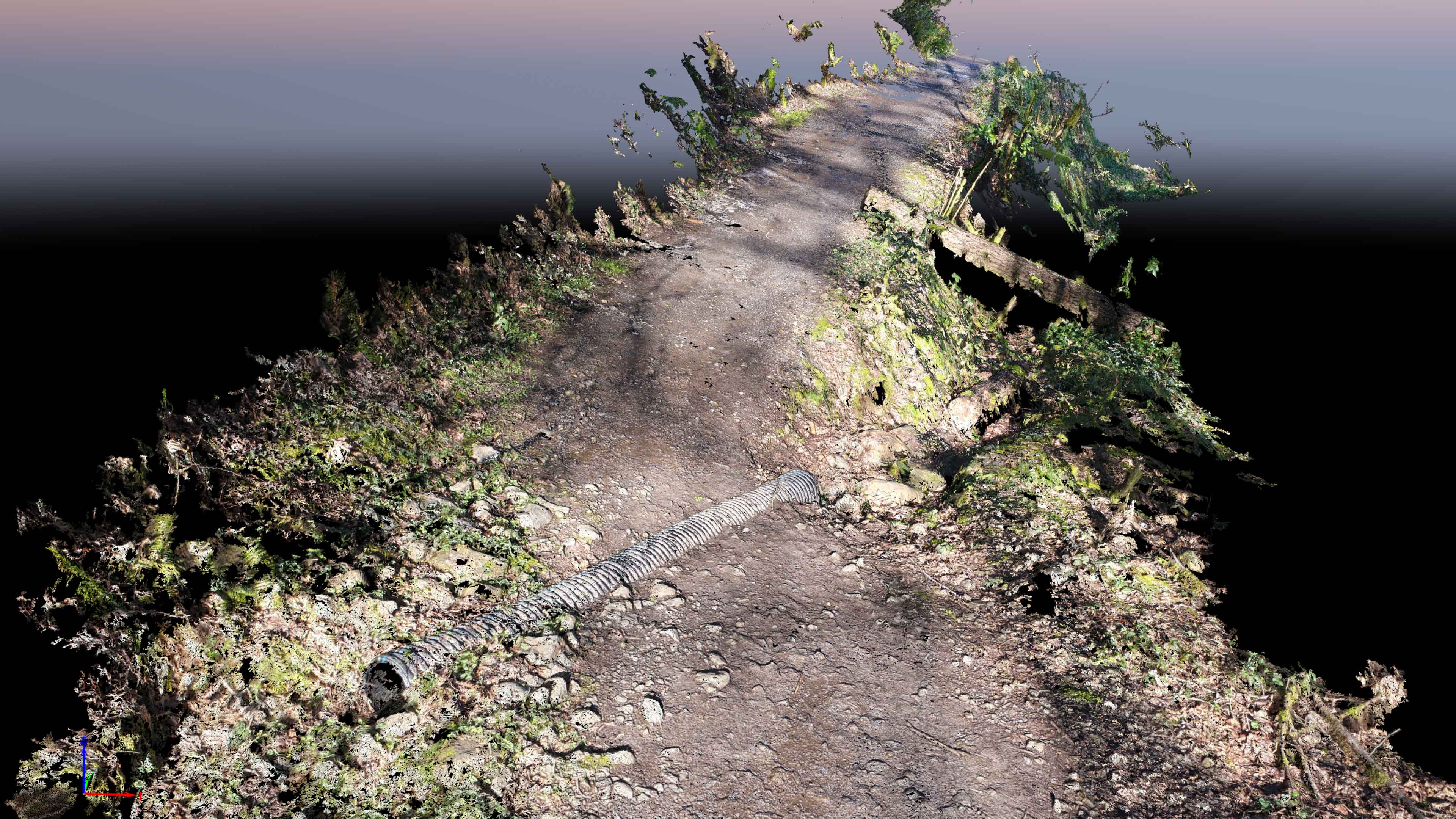
TLT Photography in collaboration with Magyar Surveying are in development of a new very cost-effective data product for mapping underneath dense tree […]

Share this:

  • Click to email a link to a friend (Opens in new window)
  • Click to share on LinkedIn (Opens in new window)
  • Click to share on Facebook (Opens in new window)
  • Click to share on Twitter (Opens in new window)
  • Click to share on Pinterest (Opens in new window)
  • Click to share on Pocket (Opens in new window)
  • Click to share on Reddit (Opens in new window)

Recent Posts

  • Baja Mexico Film
  • North Bethany Ridge Aerials
  • Tillamook Head Lighthouse
  • Boones Ferry Road
  • Wilsonville Road

Recent Comments

  • Homepage on Data Solutions
  • Anonymous on Tillamook Head Lighthouse
  • Holden Greene on Protected: Large Traditional Aerial Mapping Project in Southwest
  • Anonymous on Protected: Large Traditional Aerial Mapping Project in Southwest
  • Cost Effective Photography Salt Lake City Utah Area Payment Option | Salt Lake City Photography Guy on Cost-Effective Aerial Mapping by Helicopter

Archives

  • January 2020
  • October 2018
  • September 2018
  • August 2018
  • July 2018
  • June 2018
  • May 2018
  • April 2018
  • March 2018
  • February 2018
  • January 2018
  • December 2017
  • November 2017
  • October 2017
  • September 2017
  • August 2017
  • July 2017
  • June 2017
  • May 2017
  • April 2017
  • March 2017
  • January 2017
  • November 2016
  • December 2011

Categories

  • 3D Modeling
  • Action Sports
  • Adventure
  • Aerial Services
  • Data Solutions
  • Digital Archiving
  • GIS Solutions
  • Guide Services
  • Inspections
  • Itineraries & Planning
  • Marketing
  • Nature Photography
  • Personal Photographer
  • Photogrammetry
  • Photography
  • Real Estate
  • Review
  • Special Events
  • Survey

Meta

  • Log in
  • Entries feed
  • Comments feed
  • WordPress.org
© 2025 TLT Photography. Proudly powered by Sydney
 

Loading Comments...