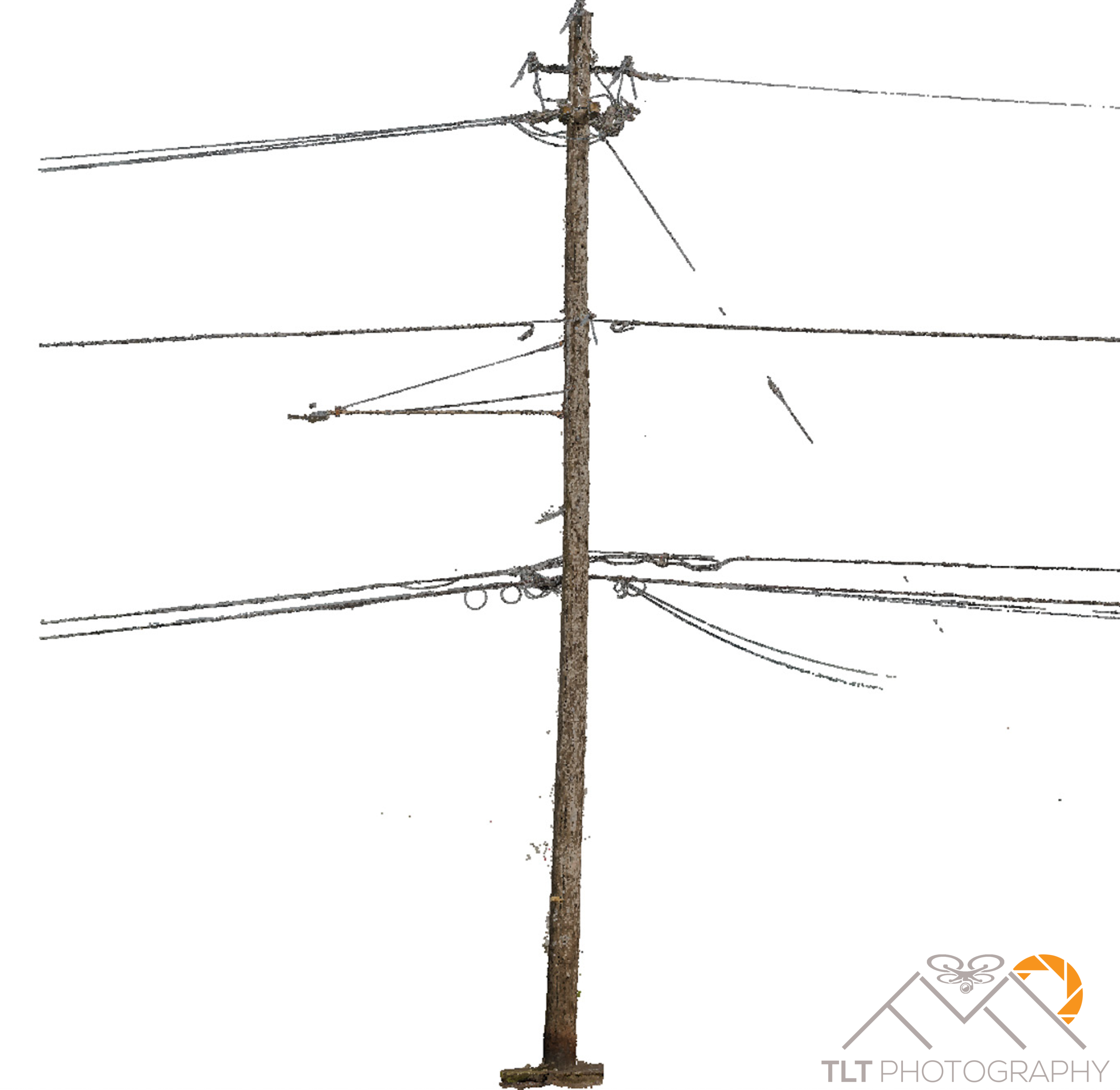
Today I had a bit of a breakthrough. On a whim I decided that I wanted to see what I could model with Pix4D. Really push the software to the limits…. So, I grabbed my DSLR and headed out the door to the end of the street with a 24mm lens on it. I own a Nikon D850 which shoots at 46 megapixels so I was hoping that if I walked slowly around the telephone at the end of the street snapping photos along the way that there would be enough detail in the wood of the pole to tie the imagery together, much like I did with my father’s carving in the backyard. I was expecting there to be a ton of noise from the sky in the background and I had learned my lesson about sky noise from my cliff modeling a year before. Then I thought of some of the techniques that I used when I worked with Mike Magyar on the viewshed analysis project in Cannon Beach. Using these experiences it dawned on me that I may have a process of running the raw imagery through several software programs before processing it in Pix4D. Then I realized that I might be able to use some open source software to auto classify out the sky from the point cloud, leaving only the structure of the telephone poles and wires. 2 hours later and I was staring at my computer with my jaw on the ground.
I then started from the beginning and took notes on all my steps. Then I stopped again and started from scratch a final time following all my notes. 30 minutes later I had a final result with absolutely no hand classification of the points. This was fully automated. This was ground breaking. I had to immediately share it on LinkedIn and to colleagues and friends of mine who understand the technology. All were amazed. Some wanted me to tell them how I did it. Ha! Yes, this was a small sample, and yes I do need to do a lot more R&D and test this out on bigger structures and perhaps ones with less texture as the wooden example here. But I see a lot of promise in this technique!
The final step was to ask my partner Greg Engelgau, the owner of Statewide Land Services if he could send a guy over to shoot in a few points on the pole for me to test the accuracy of the 3D model. This is where I ran into my first missteps. It seems Pix4D does an amazing job when the GCPs are distributed on the horizontal access but has trouble rectifying a model when they are stacked one on top of each other vertically as in the case of this pole. What I ended up with was a model of a telephone pole with a slight banana-esque curve in the bottom. This actually became more pronounced when I used the GCPs than it was initially without them. More testing will need to be done of course. Enjoy some data shots of my processing steps below.
The Subject

Initial Pix4D Output
After running the imagery through multiple software programs.

Re-colorizing it to it’s natural color

Tying it together with control points shot in by SWLS
Modeling the telephone pole in a 3D world in Infraworks
Investigating options on how to deliver this to clients in a CAD environment so they can glean useful information from the reality model.