Skip to content
TLT Photography
Toggle menu
  • Photography
    • Landscape & Wildlife
    • Client Work
    • 3D Model Gallery
    • Family Archive
  • Adventures
  • Photo Blog
  • Contact

Category: Aerial Services

February 19, 2018March 16, 2018Aerial Services, Data Solutions, Real Estate, Survey

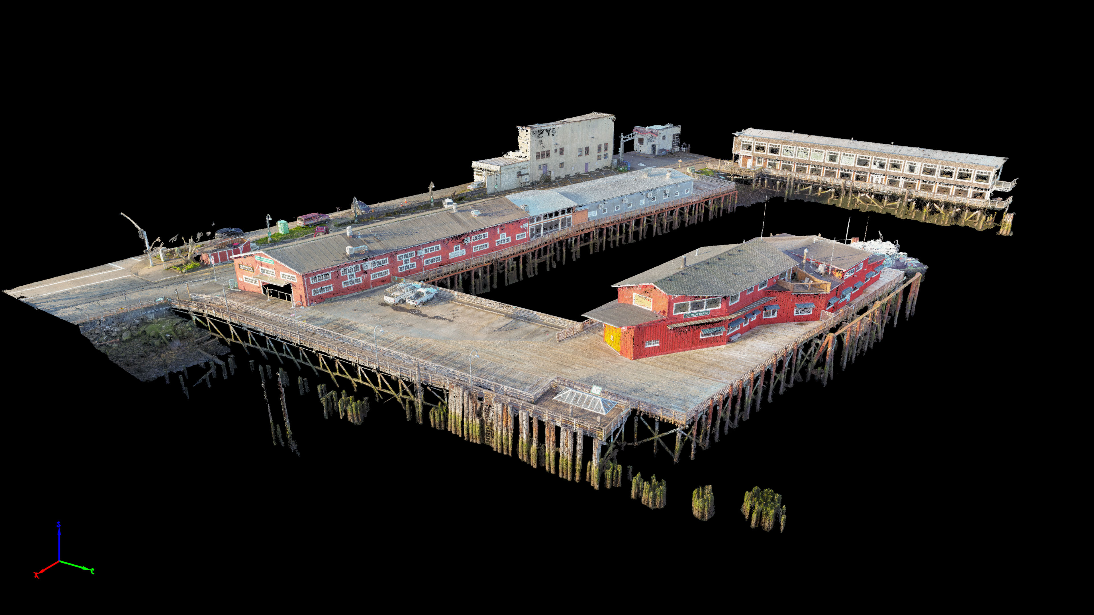
Columbia Pilots Pier 3D Modeling

Working with Magyar Land Surveying we mapped the pier of the Columbia Pilots in Astoria.  This project was the first time I […]

Share this:

  • Click to email a link to a friend (Opens in new window)
  • Click to share on LinkedIn (Opens in new window)
  • Click to share on Facebook (Opens in new window)
  • Click to share on Twitter (Opens in new window)
  • Click to share on Pinterest (Opens in new window)
  • Click to share on Pocket (Opens in new window)
  • Click to share on Reddit (Opens in new window)
February 19, 2018March 5, 20183D Modeling, Data Solutions, Photogrammetry, Survey

Best Western Mapping for Magyar Surveying

After spending all morning flying the Columbia Pilots Pier in Astoria Mike and I grabbed some lunch and headed over to the […]

Share this:

  • Click to email a link to a friend (Opens in new window)
  • Click to share on LinkedIn (Opens in new window)
  • Click to share on Facebook (Opens in new window)
  • Click to share on Twitter (Opens in new window)
  • Click to share on Pinterest (Opens in new window)
  • Click to share on Pocket (Opens in new window)
  • Click to share on Reddit (Opens in new window)
February 7, 2018February 9, 2018Aerial Services, Real Estate

1462 NW Naito Parkway Aerial Imagery

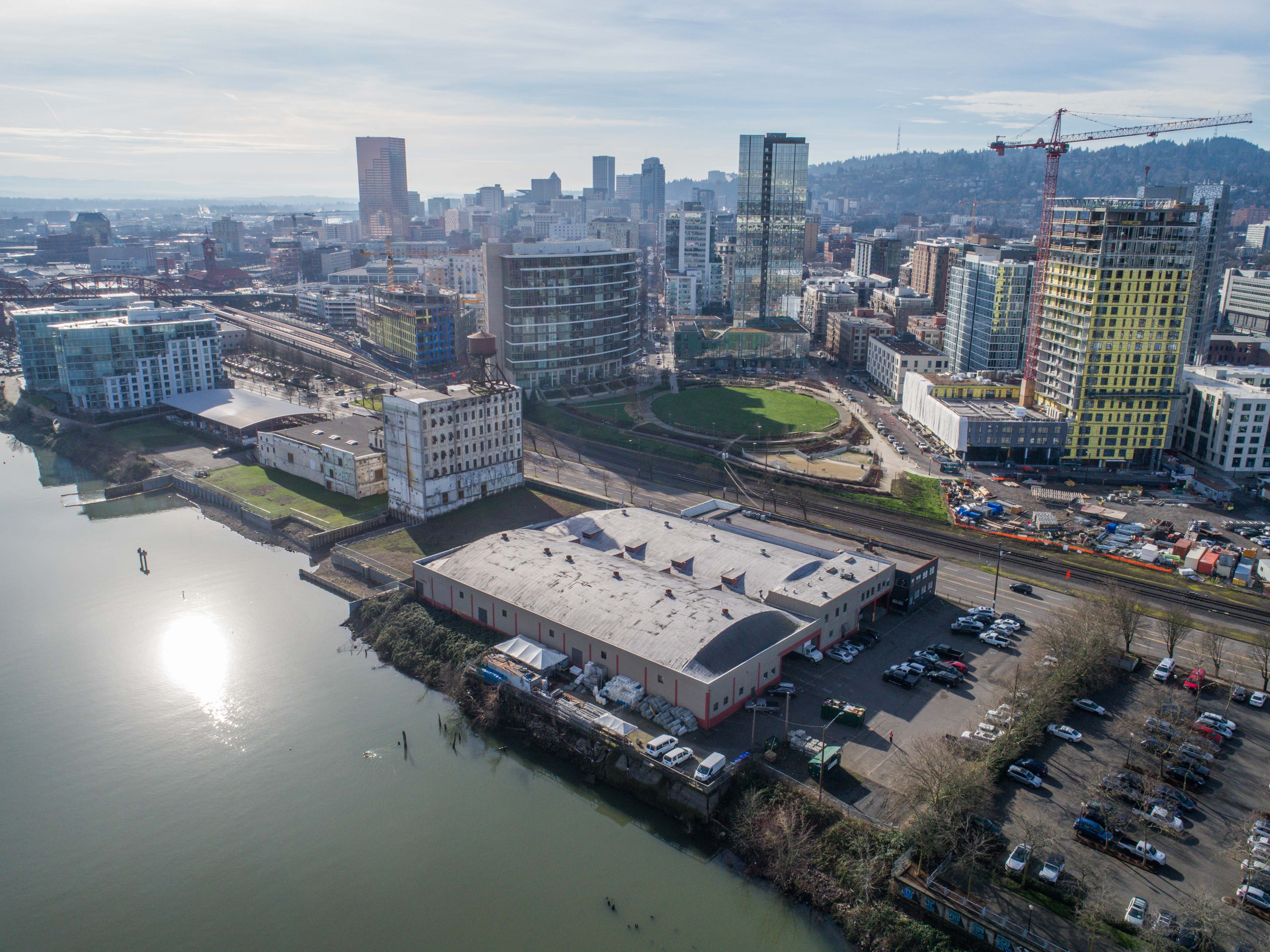
Conducted a quick flight today for a Drone Base client who wanted aerial shots of a property on the west shore of […]

Share this:

  • Click to email a link to a friend (Opens in new window)
  • Click to share on LinkedIn (Opens in new window)
  • Click to share on Facebook (Opens in new window)
  • Click to share on Twitter (Opens in new window)
  • Click to share on Pinterest (Opens in new window)
  • Click to share on Pocket (Opens in new window)
  • Click to share on Reddit (Opens in new window)
February 7, 2018February 9, 2018Aerial Services, Real Estate

720 NE Grand Ave

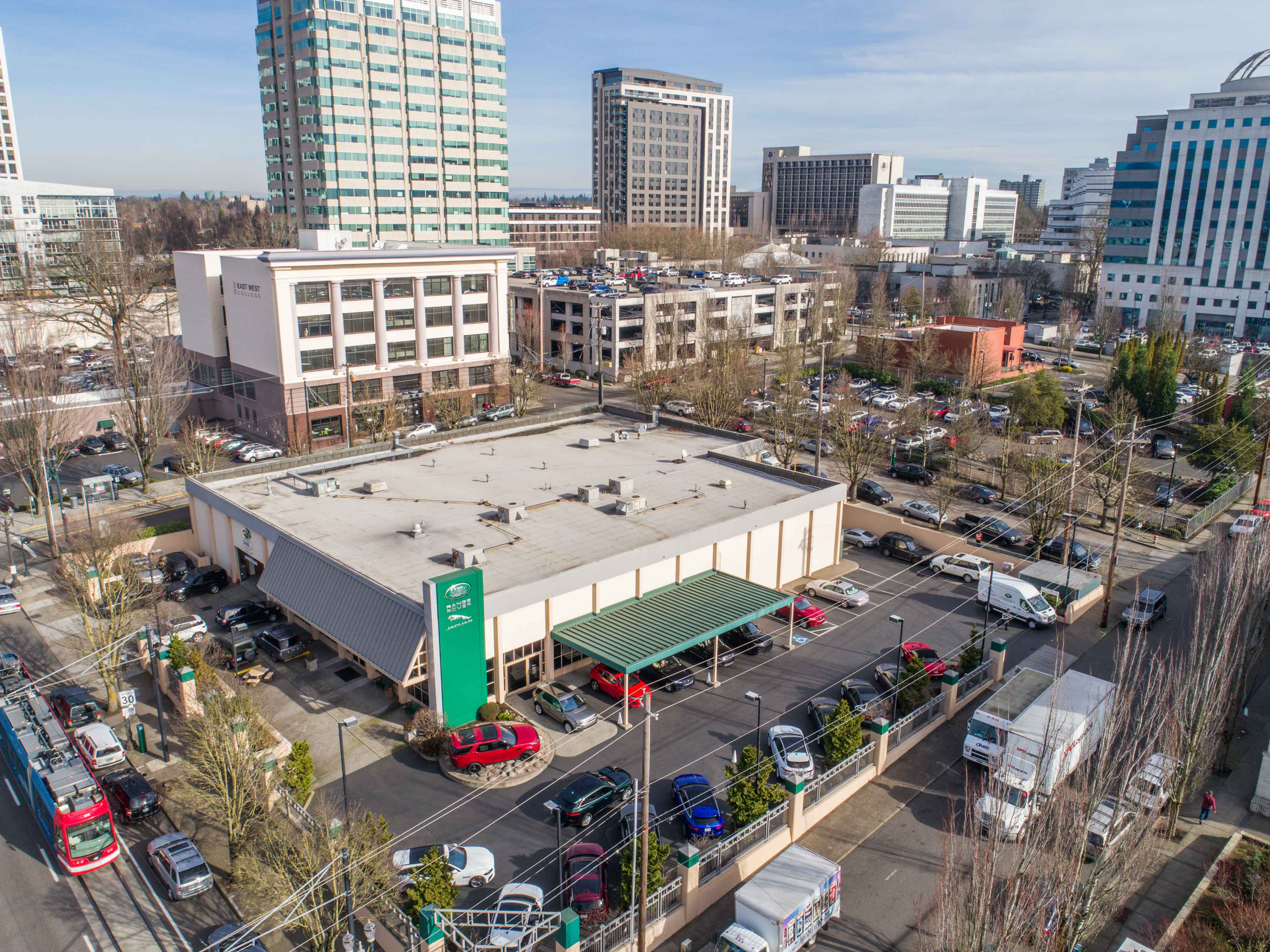
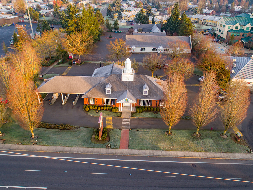
Conducted a quick flight over a Range Rover dealership today for the property owner. Lots of low utility wires and nearby tall […]

Share this:

  • Click to email a link to a friend (Opens in new window)
  • Click to share on LinkedIn (Opens in new window)
  • Click to share on Facebook (Opens in new window)
  • Click to share on Twitter (Opens in new window)
  • Click to share on Pinterest (Opens in new window)
  • Click to share on Pocket (Opens in new window)
  • Click to share on Reddit (Opens in new window)
February 7, 2018February 9, 2018Aerial Services, Marketing

Eola Drive for Century West Engineering

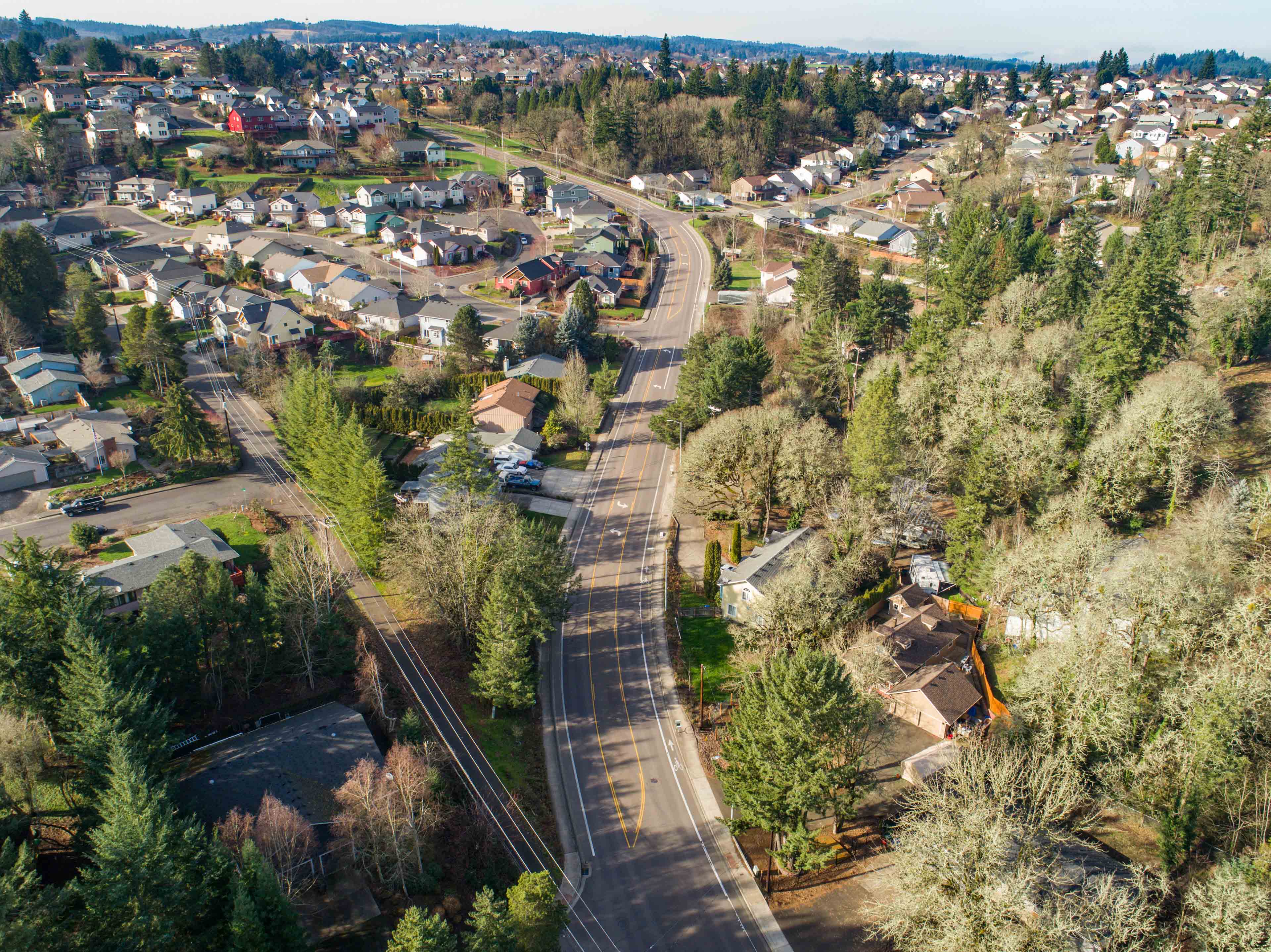
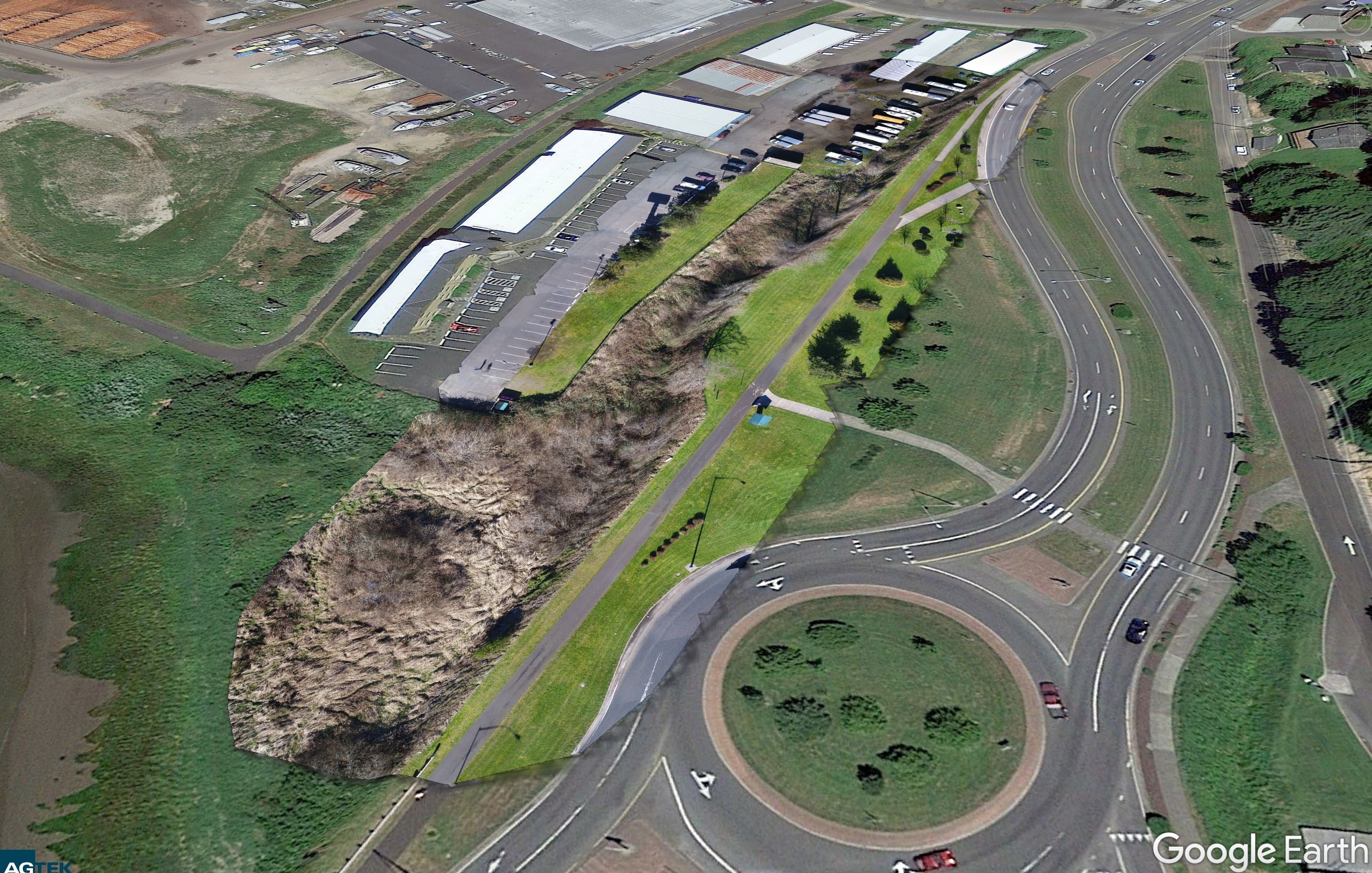
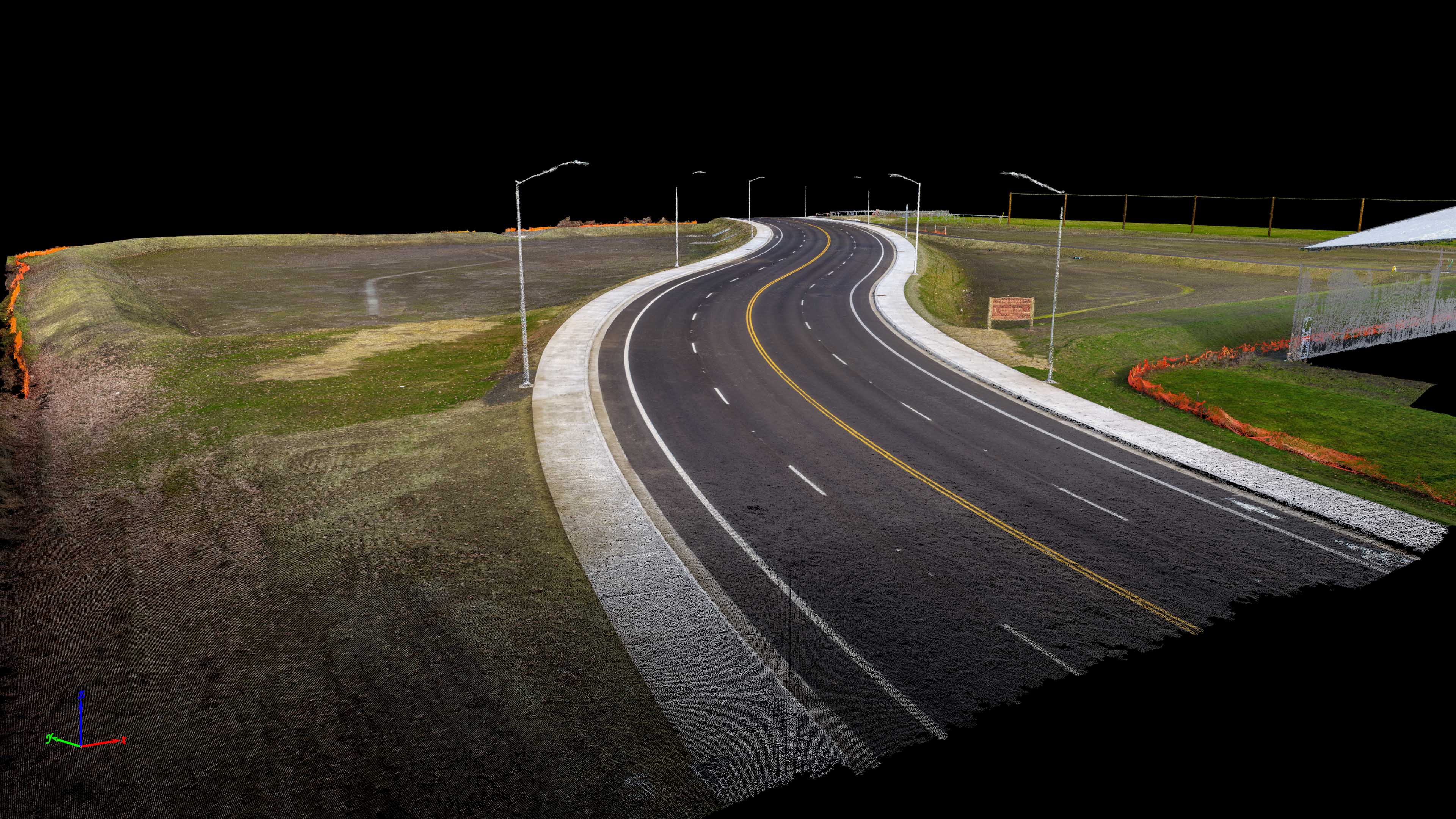
Today I flew a very long roadway for Century West Engineering. I took off, kept the drone at about 150 feet and […]

Share this:

  • Click to email a link to a friend (Opens in new window)
  • Click to share on LinkedIn (Opens in new window)
  • Click to share on Facebook (Opens in new window)
  • Click to share on Twitter (Opens in new window)
  • Click to share on Pinterest (Opens in new window)
  • Click to share on Pocket (Opens in new window)
  • Click to share on Reddit (Opens in new window)
February 7, 2018February 9, 2018Aerial Services, Real Estate

Adair Village Property

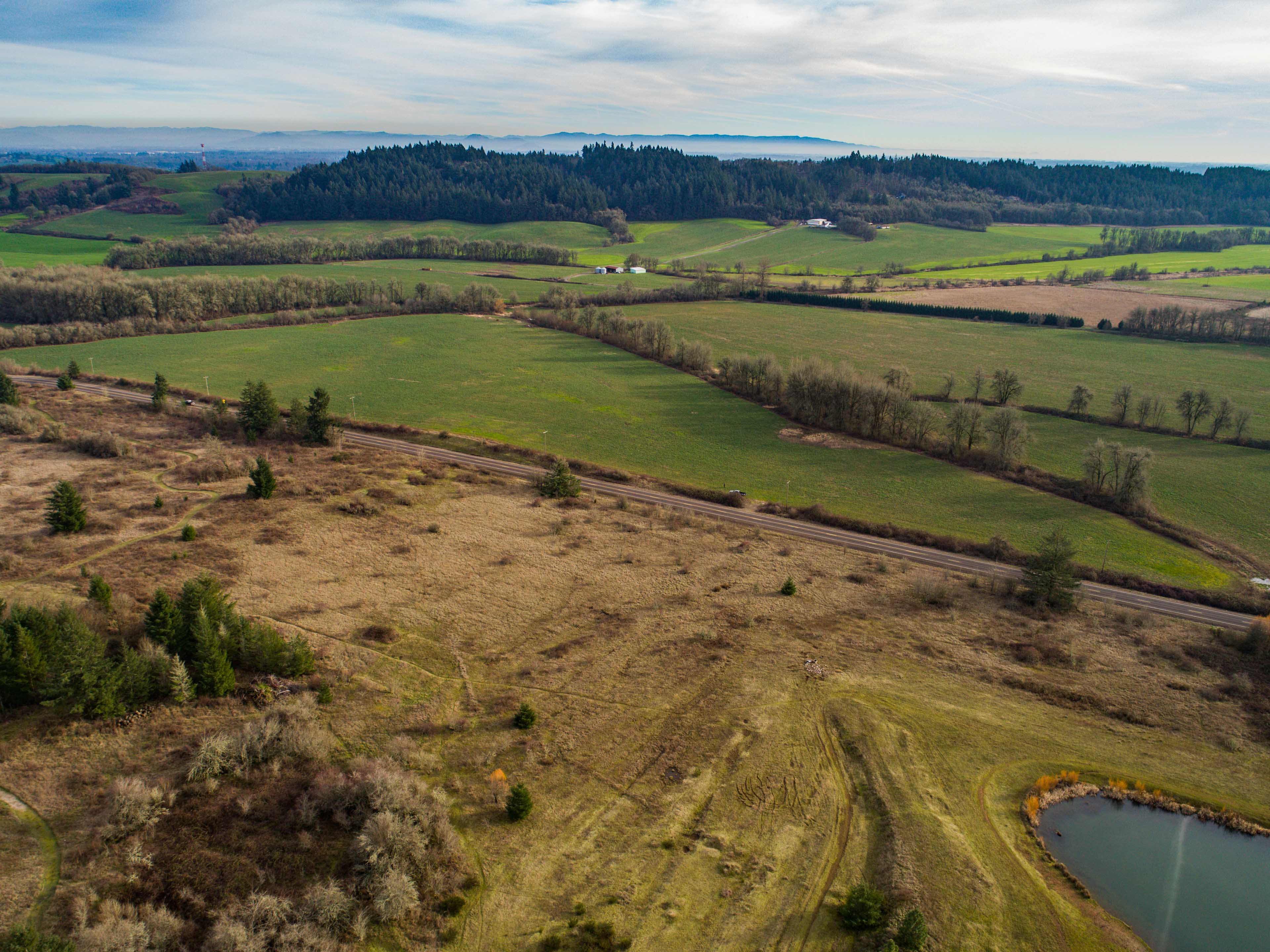
Today I flew a beautiful property for a new client. This property is owned by his family and he asked if he […]

Share this:

  • Click to email a link to a friend (Opens in new window)
  • Click to share on LinkedIn (Opens in new window)
  • Click to share on Facebook (Opens in new window)
  • Click to share on Twitter (Opens in new window)
  • Click to share on Pinterest (Opens in new window)
  • Click to share on Pocket (Opens in new window)
  • Click to share on Reddit (Opens in new window)
January 31, 2018February 3, 2018Aerial Services, Marketing, Real Estate

Portland Post Office Center Flights

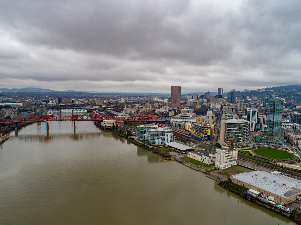
Today I flew a really fun project for Scott Baumberger of Baumberger Design Studios.  The purpose of this flight was to capture […]

Share this:

  • Click to email a link to a friend (Opens in new window)
  • Click to share on LinkedIn (Opens in new window)
  • Click to share on Facebook (Opens in new window)
  • Click to share on Twitter (Opens in new window)
  • Click to share on Pinterest (Opens in new window)
  • Click to share on Pocket (Opens in new window)
  • Click to share on Reddit (Opens in new window)
January 3, 2018February 3, 2018Aerial Services, Marketing

Stewart Parkway Aerial Marketing Video

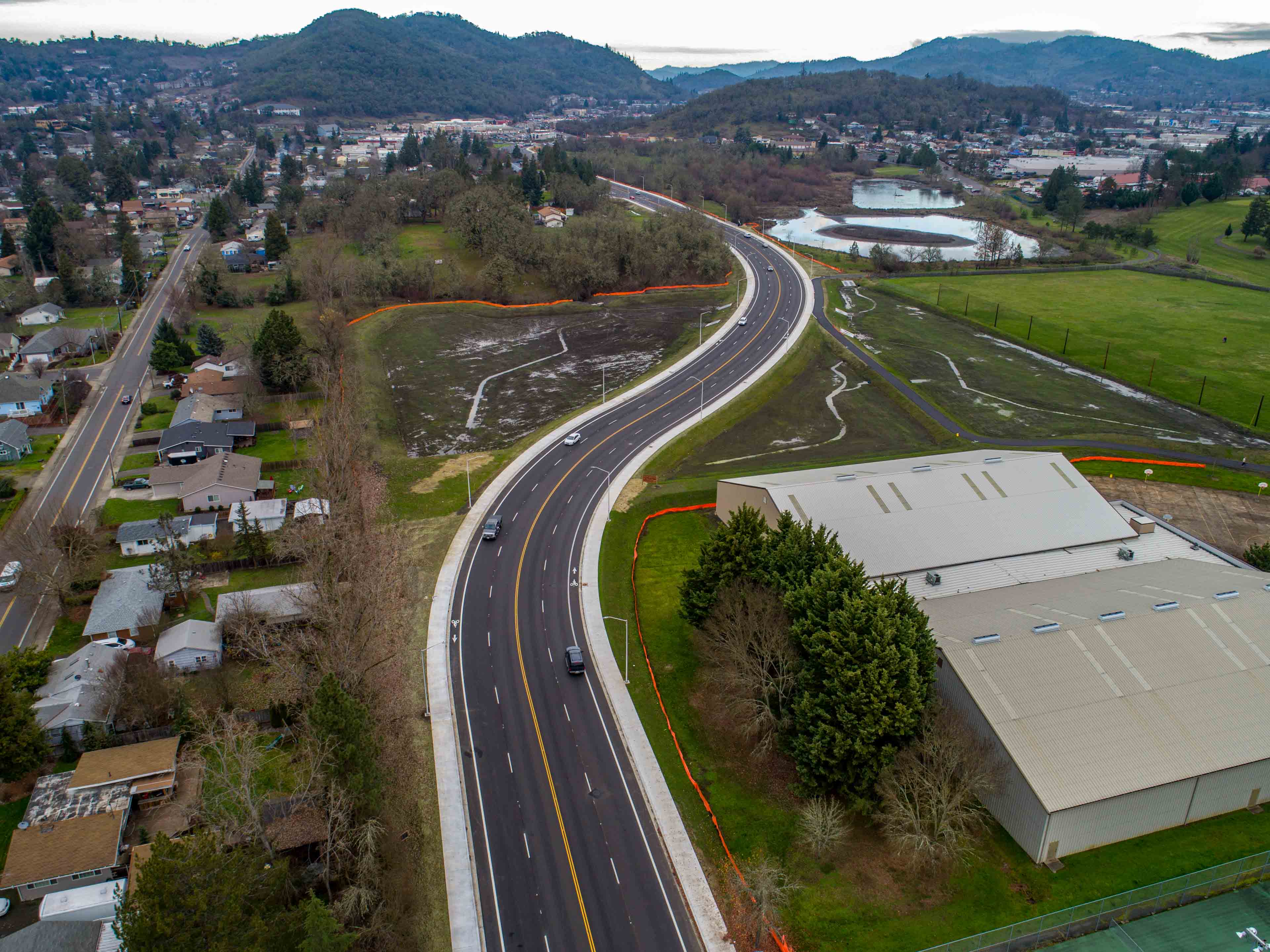
After I was done mapping for Century West Engineering, I grabbed my DSLR, Action Camera and began filming some footage for them […]

Share this:

  • Click to email a link to a friend (Opens in new window)
  • Click to share on LinkedIn (Opens in new window)
  • Click to share on Facebook (Opens in new window)
  • Click to share on Twitter (Opens in new window)
  • Click to share on Pinterest (Opens in new window)
  • Click to share on Pocket (Opens in new window)
  • Click to share on Reddit (Opens in new window)
January 3, 2018February 3, 20183D Modeling, Data Solutions, GIS Solutions, Photogrammetry, Survey

Stewart Parkway Surface Modeling from UAV Imagery

Directly after returning from Christmas I began to plan another detailed acqusition for creation of a survey-grade surface model.  This project was […]

Share this:

  • Click to email a link to a friend (Opens in new window)
  • Click to share on LinkedIn (Opens in new window)
  • Click to share on Facebook (Opens in new window)
  • Click to share on Twitter (Opens in new window)
  • Click to share on Pinterest (Opens in new window)
  • Click to share on Pocket (Opens in new window)
  • Click to share on Reddit (Opens in new window)
December 8, 2017February 3, 2018Aerial Services, Photography, Real Estate

Anixter Building and Umpqua Bank Flights for CRESA

This week I flew some corporate property aerial footage again for CRESA. This included an Umpqua Bank in Vancouver, WA, the Anixter […]

Share this:

  • Click to email a link to a friend (Opens in new window)
  • Click to share on LinkedIn (Opens in new window)
  • Click to share on Facebook (Opens in new window)
  • Click to share on Twitter (Opens in new window)
  • Click to share on Pinterest (Opens in new window)
  • Click to share on Pocket (Opens in new window)
  • Click to share on Reddit (Opens in new window)

Posts pagination

< 1 … 4 5 6 … 8 >

Recent Posts

  • Baja Mexico Film
  • North Bethany Ridge Aerials
  • Tillamook Head Lighthouse
  • Boones Ferry Road
  • Wilsonville Road

Recent Comments

  • Homepage on Data Solutions
  • Anonymous on Tillamook Head Lighthouse
  • Holden Greene on Protected: Large Traditional Aerial Mapping Project in Southwest
  • Anonymous on Protected: Large Traditional Aerial Mapping Project in Southwest
  • Cost Effective Photography Salt Lake City Utah Area Payment Option | Salt Lake City Photography Guy on Cost-Effective Aerial Mapping by Helicopter

Archives

  • January 2020
  • October 2018
  • September 2018
  • August 2018
  • July 2018
  • June 2018
  • May 2018
  • April 2018
  • March 2018
  • February 2018
  • January 2018
  • December 2017
  • November 2017
  • October 2017
  • September 2017
  • August 2017
  • July 2017
  • June 2017
  • May 2017
  • April 2017
  • March 2017
  • January 2017
  • November 2016
  • December 2011

Categories

  • 3D Modeling
  • Action Sports
  • Adventure
  • Aerial Services
  • Data Solutions
  • Digital Archiving
  • GIS Solutions
  • Guide Services
  • Inspections
  • Itineraries & Planning
  • Marketing
  • Nature Photography
  • Personal Photographer
  • Photogrammetry
  • Photography
  • Real Estate
  • Review
  • Special Events
  • Survey

Meta

  • Log in
  • Entries feed
  • Comments feed
  • WordPress.org
© 2026 TLT Photography. Proudly powered by Sydney
 

Loading Comments...