Skip to content
TLT Photography
Toggle menu
  • Photography
    • Landscape & Wildlife
    • Client Work
    • 3D Model Gallery
    • Family Archive
  • Adventures
  • Photo Blog
  • Contact

Month: August 2018

August 30, 2018November 9, 2018Action Sports, Adventure, Aerial Services, Nature Photography, Photography

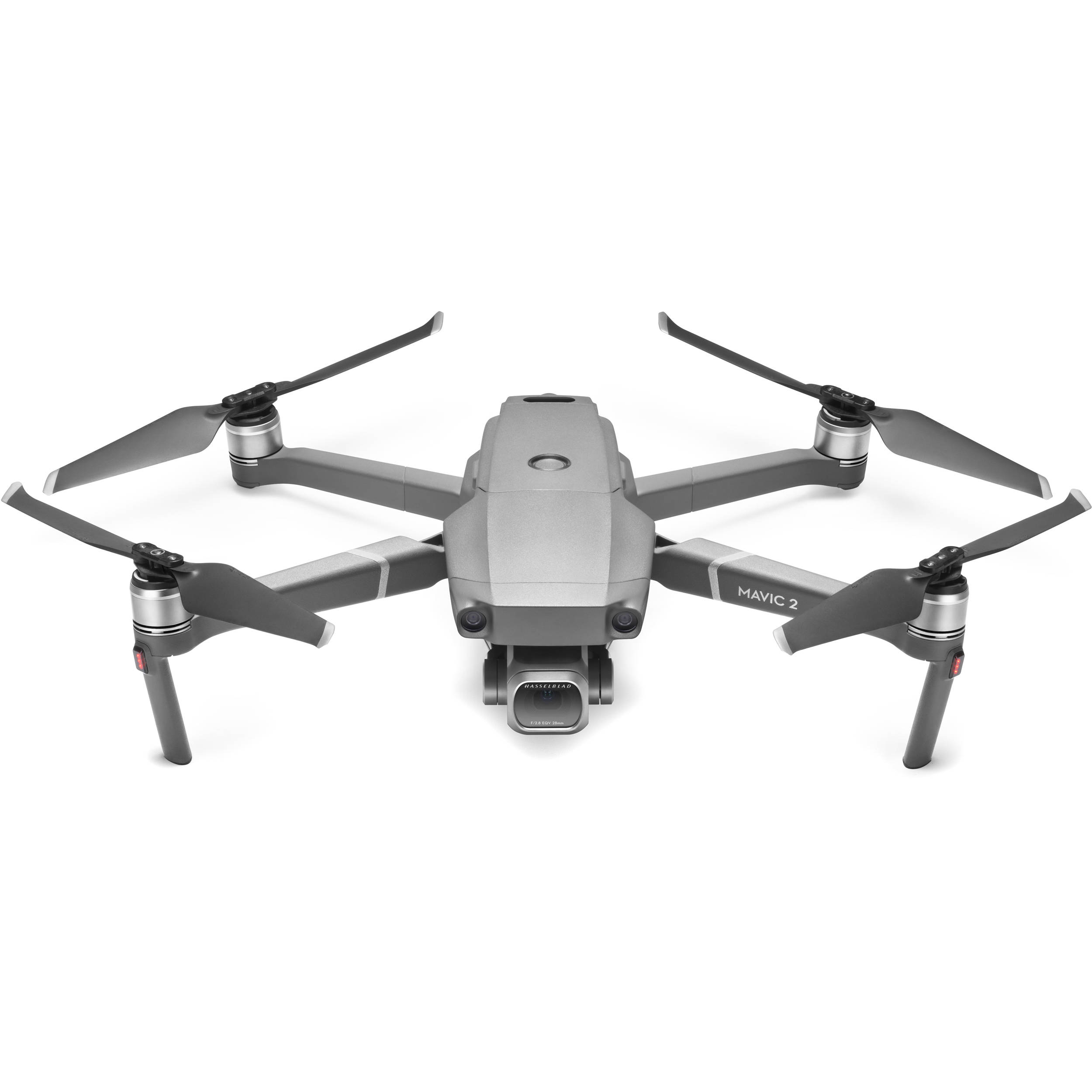
TLT Photography Purchases DJI Mavic 2 Pro

I have enjoyed the use of my Mavic Pro for over two years now. With the ability to fold up to the […]

Share this:

  • Click to email a link to a friend (Opens in new window)
  • Click to share on LinkedIn (Opens in new window)
  • Click to share on Facebook (Opens in new window)
  • Click to share on Twitter (Opens in new window)
  • Click to share on Pinterest (Opens in new window)
  • Click to share on Pocket (Opens in new window)
  • Click to share on Reddit (Opens in new window)
August 27, 2018November 8, 20183D Modeling, Aerial Services, Data Solutions, Photogrammetry, Survey

Troutdale Sewer Plant

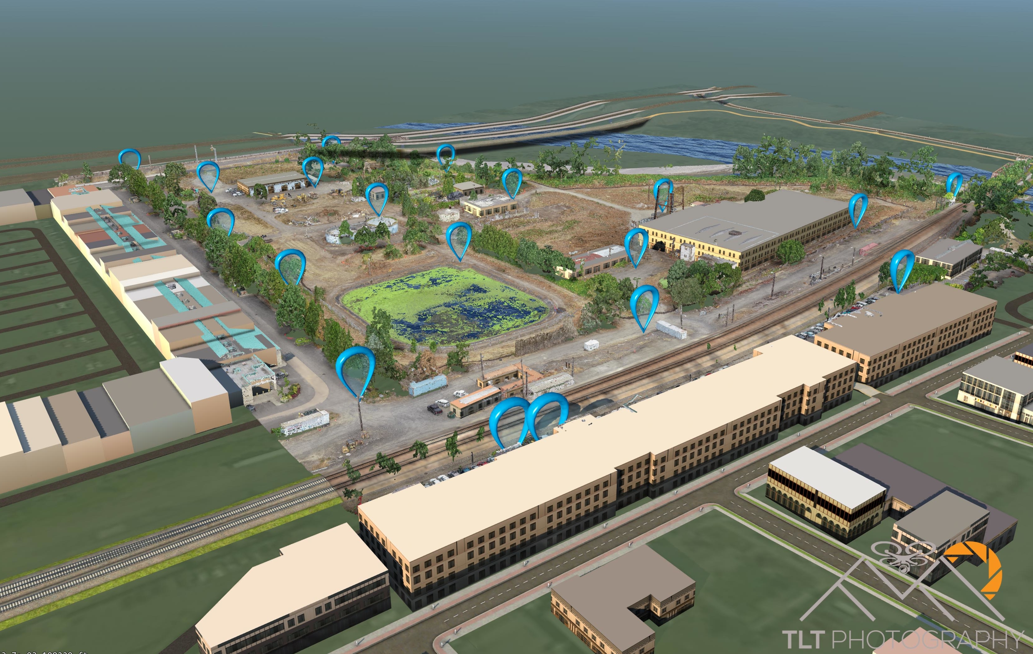
This week I flew the old Troutdale Sewer Plant for Mike Magyar.  I’m not sure what the plans are for the site […]

Share this:

  • Click to email a link to a friend (Opens in new window)
  • Click to share on LinkedIn (Opens in new window)
  • Click to share on Facebook (Opens in new window)
  • Click to share on Twitter (Opens in new window)
  • Click to share on Pinterest (Opens in new window)
  • Click to share on Pocket (Opens in new window)
  • Click to share on Reddit (Opens in new window)
August 27, 2018November 9, 2018Aerial Services, Real Estate

Windermere Lot in Woodland, WA

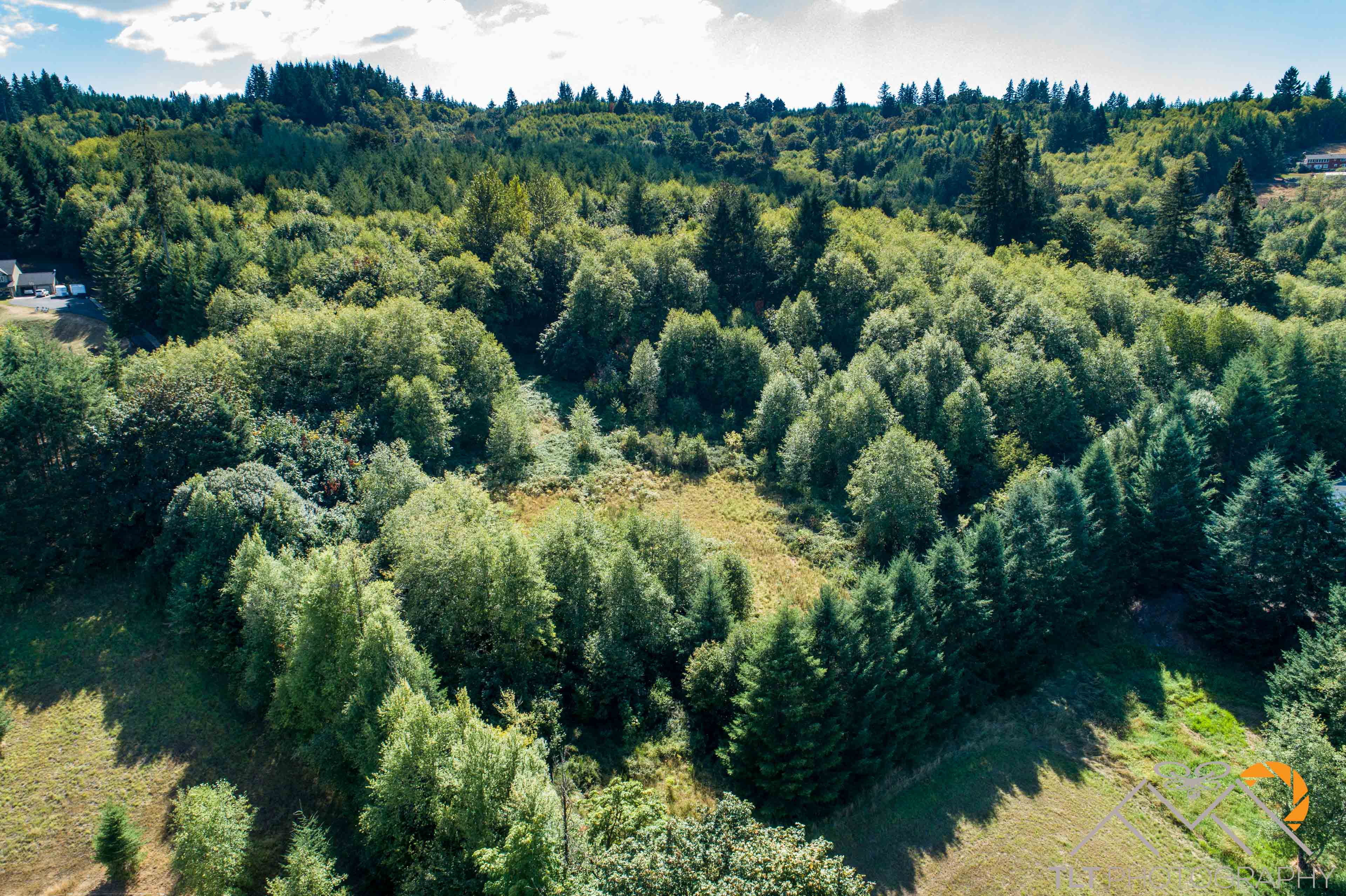
I received a call from Bradley Mulliner of Windermere Real Estate last Friday.  Bradley had a very heavily wooded lot in Woodland, […]

Share this:

  • Click to email a link to a friend (Opens in new window)
  • Click to share on LinkedIn (Opens in new window)
  • Click to share on Facebook (Opens in new window)
  • Click to share on Twitter (Opens in new window)
  • Click to share on Pinterest (Opens in new window)
  • Click to share on Pocket (Opens in new window)
  • Click to share on Reddit (Opens in new window)
August 22, 2018November 8, 20183D Modeling, Data Solutions, Photogrammetry, Survey

Cost-Effective Aerial Mapping by Helicopter

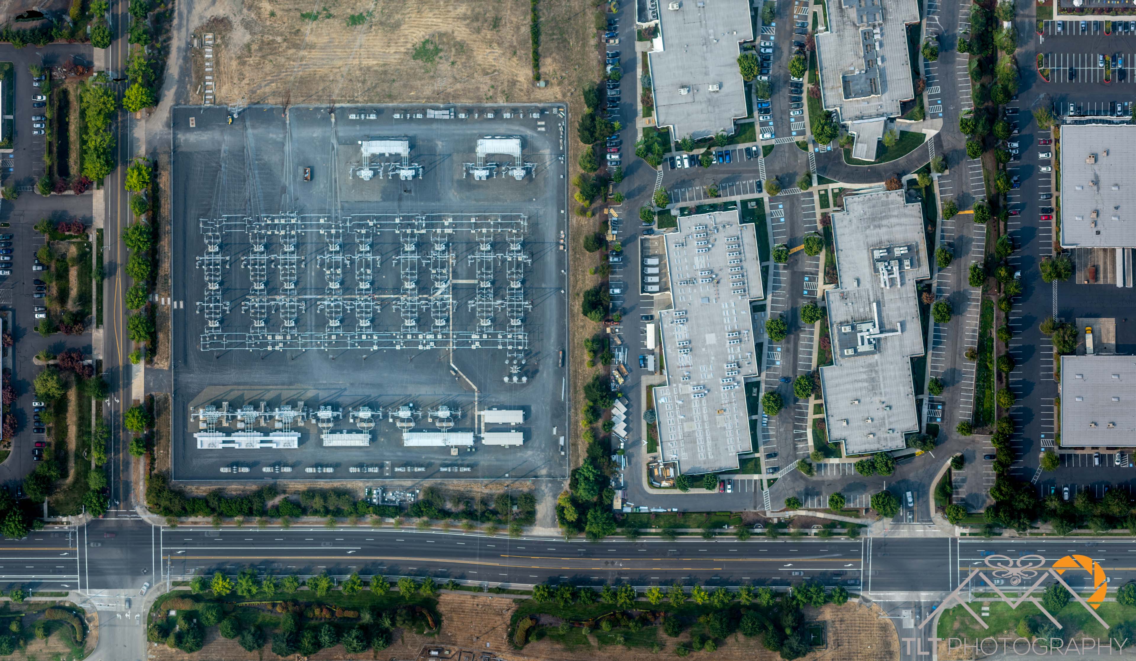
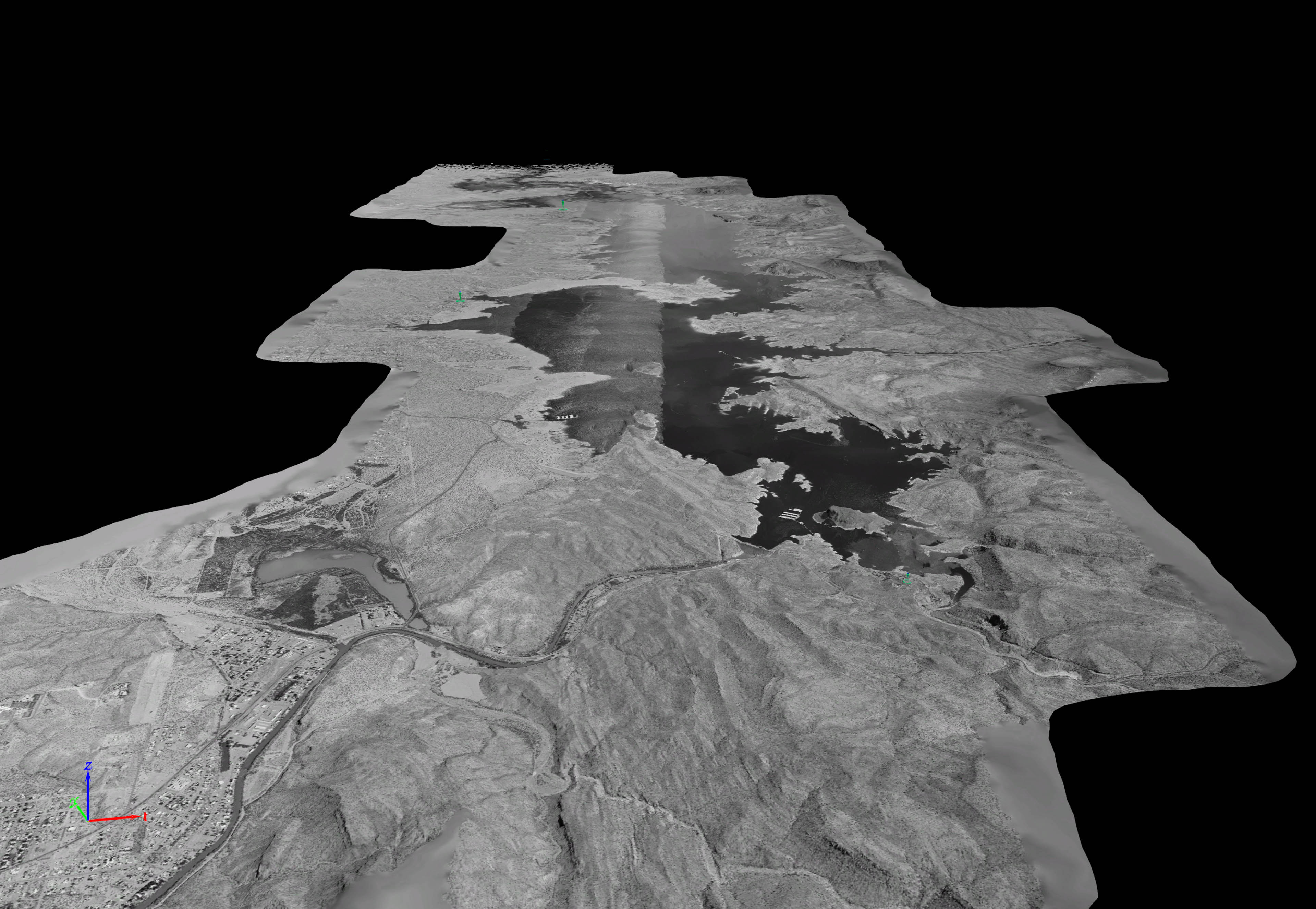
Today I conducted my first manned-mission aerial mapping acquisition!  I have been capturing my own data and processing through to completion for […]

Share this:

  • Click to email a link to a friend (Opens in new window)
  • Click to share on LinkedIn (Opens in new window)
  • Click to share on Facebook (Opens in new window)
  • Click to share on Twitter (Opens in new window)
  • Click to share on Pinterest (Opens in new window)
  • Click to share on Pocket (Opens in new window)
  • Click to share on Reddit (Opens in new window)
August 8, 2018November 7, 20183D Modeling, Aerial Services, Data Solutions, Photogrammetry, Survey

1500ft Tower Modeling

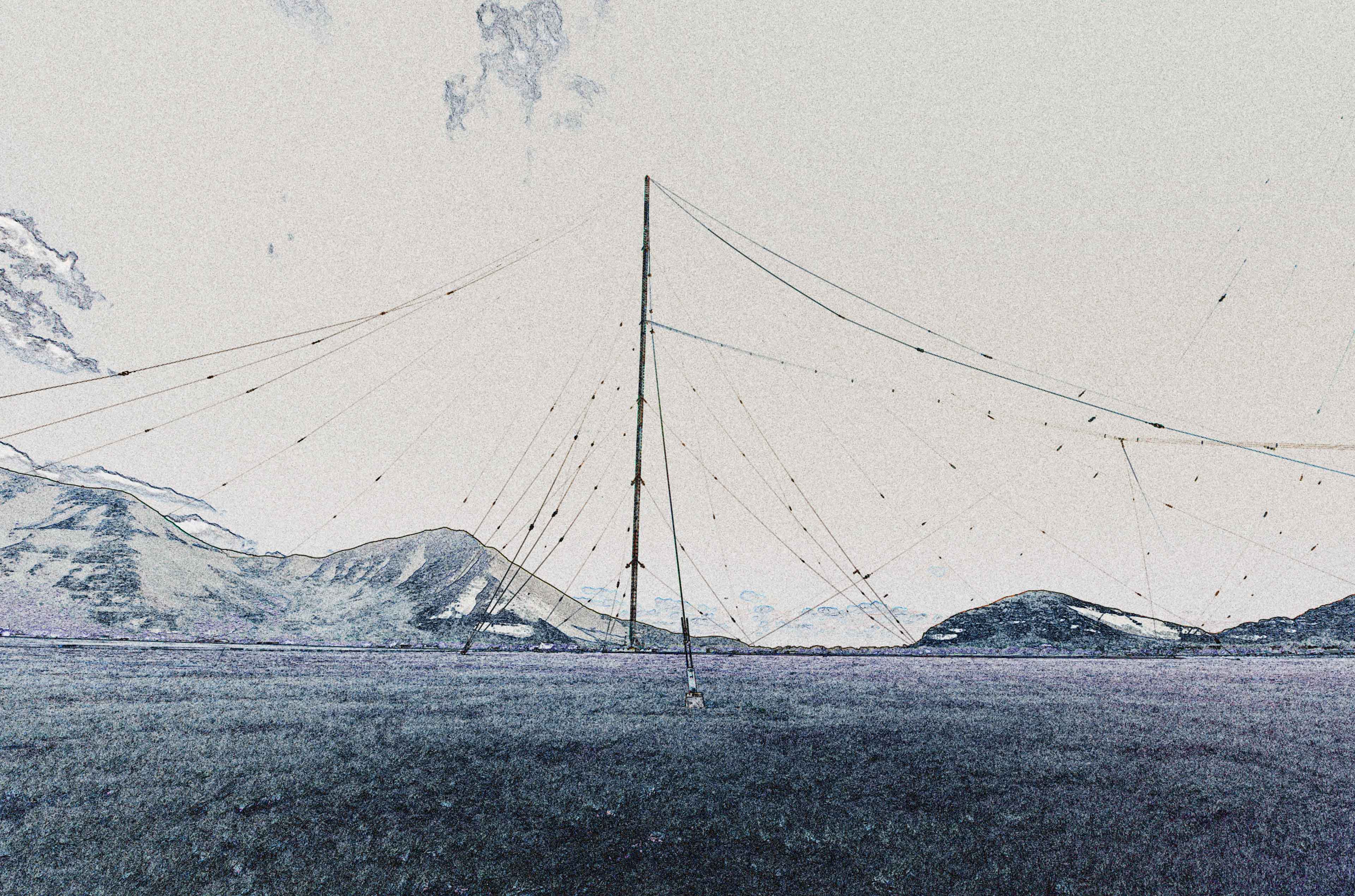
This week I joined one of my partners for a trip to try to model what I call the “holy grail” of […]

Share this:

  • Click to email a link to a friend (Opens in new window)
  • Click to share on LinkedIn (Opens in new window)
  • Click to share on Facebook (Opens in new window)
  • Click to share on Twitter (Opens in new window)
  • Click to share on Pinterest (Opens in new window)
  • Click to share on Pocket (Opens in new window)
  • Click to share on Reddit (Opens in new window)
August 5, 2018January 28, 20193D Modeling, Data Solutions, Photogrammetry

Protected: Large Traditional Aerial Mapping Project in Southwest

There is no excerpt because this is a protected post.

Recent Posts

  • Baja Mexico Film
  • North Bethany Ridge Aerials
  • Tillamook Head Lighthouse
  • Boones Ferry Road
  • Wilsonville Road

Recent Comments

  • Homepage on Data Solutions
  • Anonymous on Tillamook Head Lighthouse
  • Holden Greene on Protected: Large Traditional Aerial Mapping Project in Southwest
  • Anonymous on Protected: Large Traditional Aerial Mapping Project in Southwest
  • Cost Effective Photography Salt Lake City Utah Area Payment Option | Salt Lake City Photography Guy on Cost-Effective Aerial Mapping by Helicopter

Archives

  • January 2020
  • October 2018
  • September 2018
  • August 2018
  • July 2018
  • June 2018
  • May 2018
  • April 2018
  • March 2018
  • February 2018
  • January 2018
  • December 2017
  • November 2017
  • October 2017
  • September 2017
  • August 2017
  • July 2017
  • June 2017
  • May 2017
  • April 2017
  • March 2017
  • January 2017
  • November 2016
  • December 2011

Categories

  • 3D Modeling
  • Action Sports
  • Adventure
  • Aerial Services
  • Data Solutions
  • Digital Archiving
  • GIS Solutions
  • Guide Services
  • Inspections
  • Itineraries & Planning
  • Marketing
  • Nature Photography
  • Personal Photographer
  • Photogrammetry
  • Photography
  • Real Estate
  • Review
  • Special Events
  • Survey

Meta

  • Log in
  • Entries feed
  • Comments feed
  • WordPress.org
© 2025 TLT Photography. Proudly powered by Sydney
 

Loading Comments...