This week S&F Land Services had me fly 164th Street for the City of Vancouver. This was a roadway project requiring a high resolution ortho as well as a surface model. The roadway had a bunch of trees with canopies overhanging the road. This meant that I had to plan my acquisition very carefully to both fly high enough above the trees to both keep the road in focus and not hit them as well as aim the camera in a way that would capture the underlying roadway and the painted utility lines on it. For a 1.5 mile roadway this was a challenge for sure. To aid in my georeferencing of the data a crew of professional land surveyors from S&F laid out nearly 40 air targets in a pattern that I suggested based off of years of photogrammetry experience working with imagery of narrow corridors. If you understand photogrammetry and the principals of triangulation you know that long, skinny aerial mapping projects are some of the toughest. After a handful of roadway projects with S&F and amazing R&D support from them I have been perfecting both my capture and processing techniques for these challenging jobs. I could go on an on about how much I learned through working on this project but hey, that’s my own special recipe so I’ll leave you to guess 🙂
In the end the data set of over 2,000 frames produced a Horizontal and Vertical RMS Accuracy of around +/- 1 inch. The data set was used to digitize top and bottom of curbs as well as the crown of the road to assist S&F in their surface model creation. I spent many hours pulling back vegetation and removing objects in motion (cars, etc) from the final orthomosaic. We were then able to deliver to the city a refined Orthomosaic with reduced tree canopy obstruction and all cars removed. In essence the final deliverable appeared as if the entire road had been shut down for our survey.
I’m looking forward to continued work with S&F Land Services and further refinement of my roadway processing methodology. 
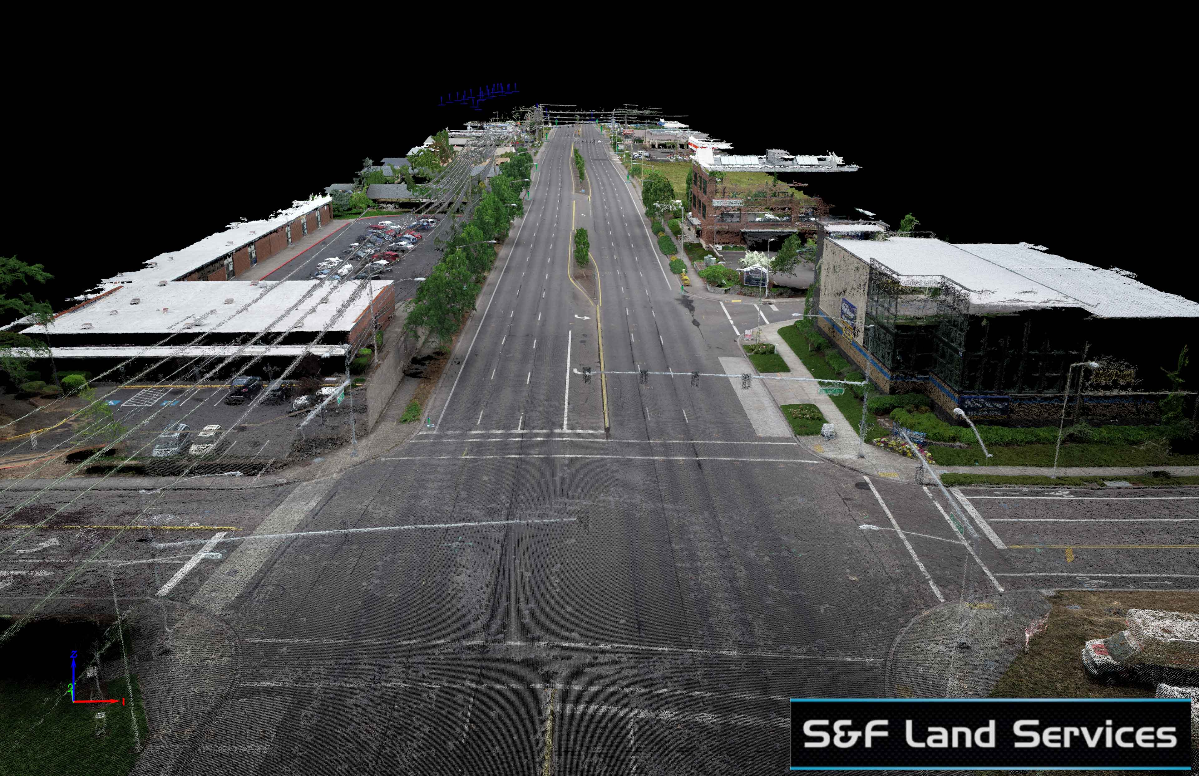
Looking up the roadway from road level in the data set.
Looking up the road at 1/3rd the length of the project. Those blue icons in the distance are the air targets from another section I had yet to process at this point.
Locating the curb underneath tree canopy thanks to innovative capture techniques.
Using the point cloud to determine the crown of the road.

Further Roadway Modeling

Sorry about the flickering in the first part of the video above. This was a huge point cloud to render and sometimes, even with the fastest of computers, we data scientists have to work with some of the slowest software… little dig at AutoDesk there…. 😉
Below is one section of the 3D model. The full model was 3x longer than this but I had to break it up to post the point cloud online.