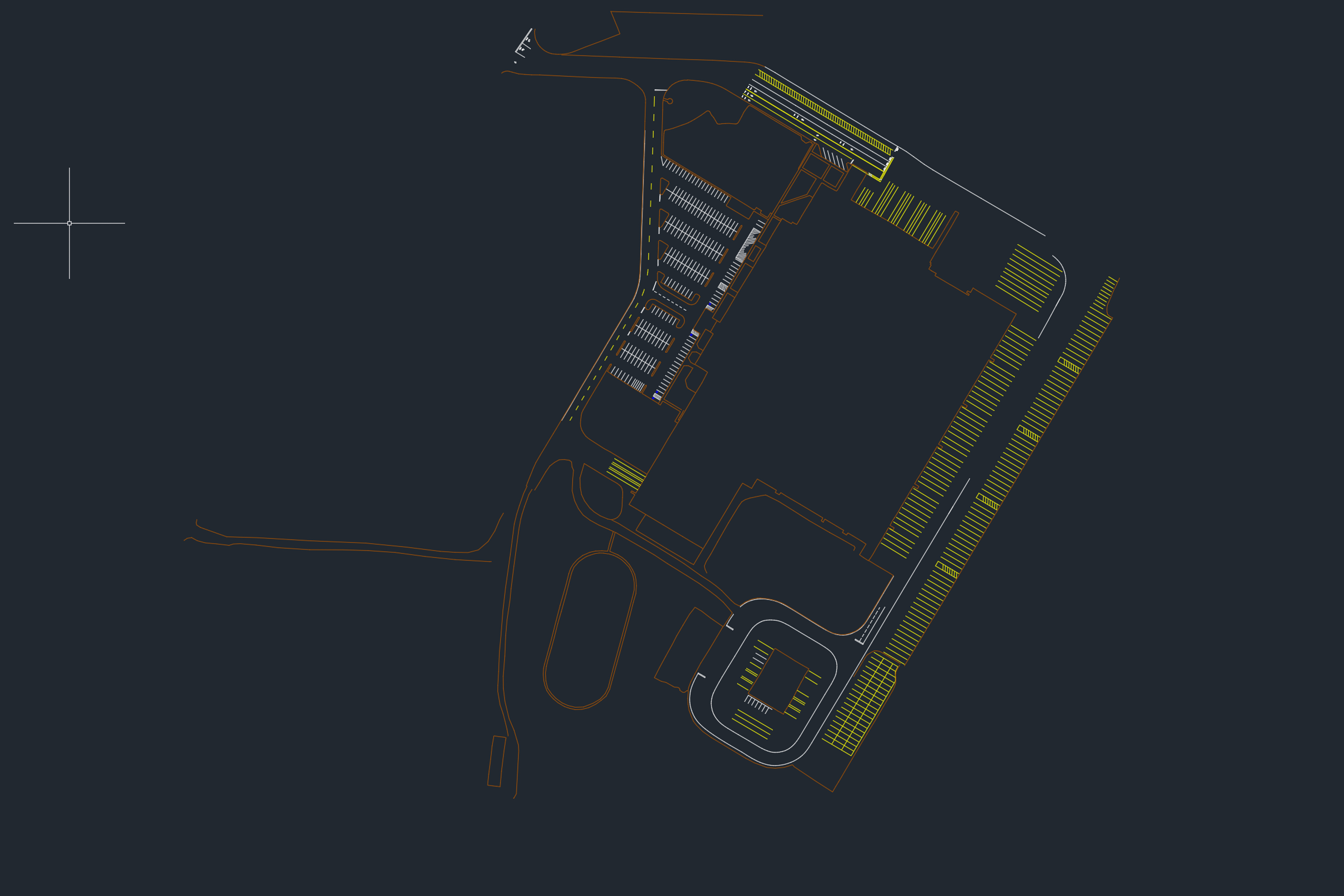
This weekend I flew a large 50 acre project for S&F Land Services. It was a large Food Services warehouse in Woodbury, OR. To keep the number of frames reasonable I had to fly this at 200 feet vs the 80ft I flew 139th at and the 125 feet of Grade Street in Kelso. Once again S&F was expecting drafting work to be done for this project including the building footprint of the large warehouse on site. I was a little nervous flying so high to meet the accuracy specs needed for survey-grade drafting but after everything processed out we nailed it with an XYZ RMS accuracy of about 1cm! It is truly an art deciding how many and the distribution of aerial targets needed to meet stringent geospatial accuracy standards! Thankfully I’ve been at this game for a while and have gotten pretty good at it 🙂

After the learning lessons of Grade Street drafting and planimetrics went pretty smoothly for this job. It was crucial to have the 3D point cloud for building footprint digitization, especially around where the front bushes met the building facade. Trying to this directly from the birds-eye NADIR orthomosaic would not have been possible as I would not be able to see through the vegetation. The same can be said for the side building and parts of the large building where there are overhanging structures blocking the true building footprint when looking straight down from above.


There was even a moment in this project where some heights had forgotten to be measured on an obscure building at the bottom of the AOI. A quick email from S&F and I was able to bring up the point cloud in minutes and provide precise point elevations around the building for the surveyors to use in their design. Yet another useful application of having such a dense and accurate 3D Model of the site.

3D Interactive Model and Data Fly-Through Below