This week I flew two acquisitions of Reed College in Portland, Oregon as a demonstration for ZGF Architects. My goal was to show them the 3D modeling that can be done for a site from various flight altitudes and angles of capture. My first flights were of a large part of their campus and I flew at 175ft AGL. This produced a 0.65in resolution orthomosaic. I only flew NADIR as well so I was not able to capture some of the building facades and vertical structures clearly. The landscape also was on a pretty steep hill so my resolution changed slightly along the length as I flew at a constant height above my take off point.


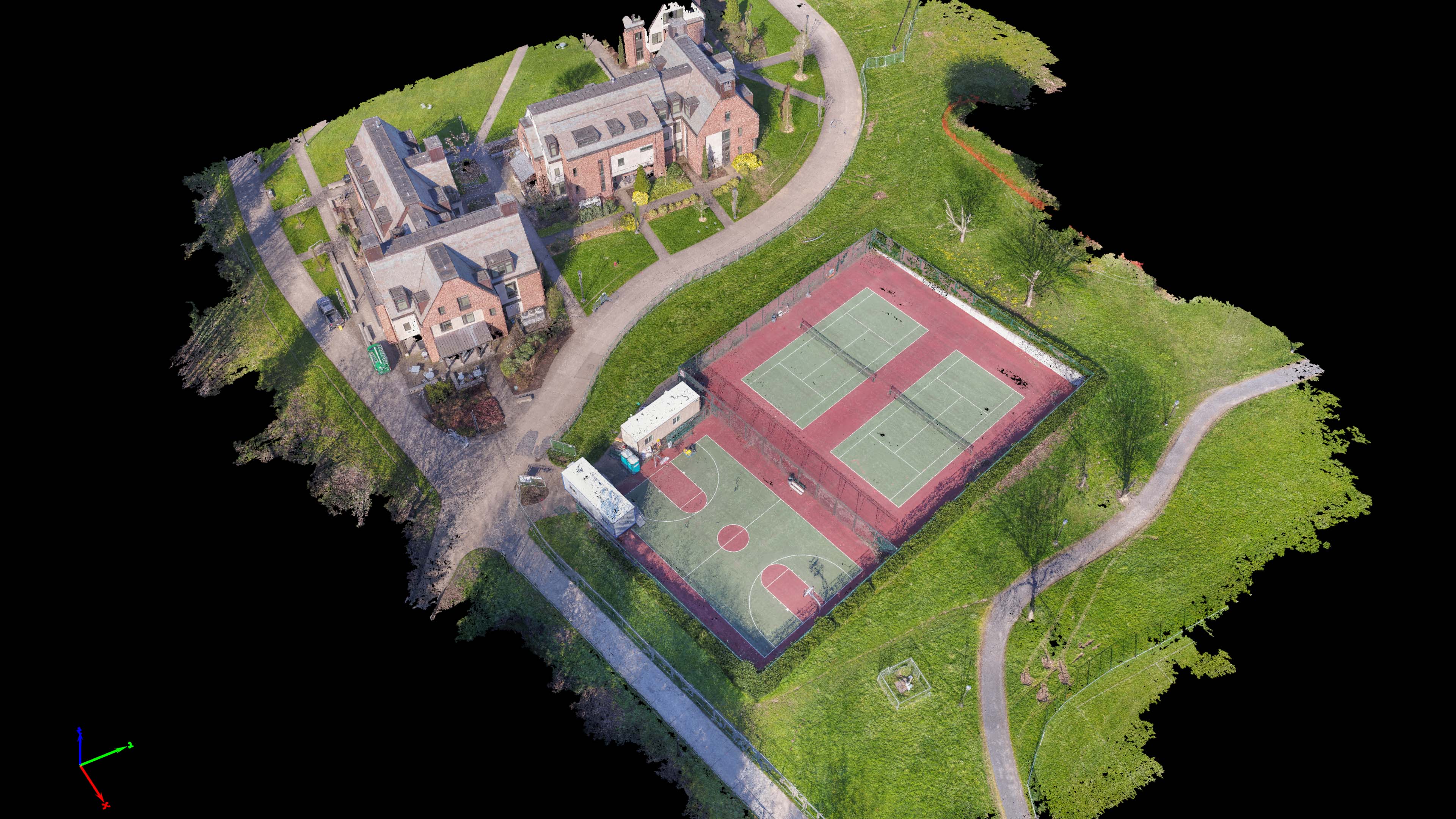
After I flew the overview I then flew a more focused acquisition around the tennis courts and neighboring buildings. For these flights I flew at about 80 feet which gave a 0.32in/pixel dataset. I flew this at every oblique angle possible capturing over a thousand frames. I ran this through Pix4D at max density settings to create an insanely detailed 164 million colorized point cloud which clearly shows every building face as well as details that couldn’t be seen from the previous flights at a higher altitude. Thanks to Hoffman Construction who was on site working for ZGF for providing me surveyed control points that I could see in my aerial imagery. Using those points I was able to achieve cm-level horizontal and vertical accuracy for this data set.


As you can see from the CAD design files overlaid upon my final orthomosaic my site capture was very accurate and in the future could be used to draft upon saving hours of traditional field survey. With UAV Aerial mapping I would only need a surveyor to survey 10-15 points per site and then all drafting, measurements, and area/volume measurements could be made with survey-grade confidence from the 3D models and orthomosaics I produce from the data set. This was a proof of concept job for ZGF and I hope that they will be able to see the potential using this technology on their future projects.

3D Interactive Models and Data Fly Through Videos Below