New 3D modeling Services

Posted Posted in 3D Modeling, Aerial Services, Data Solutions, Photogrammetry

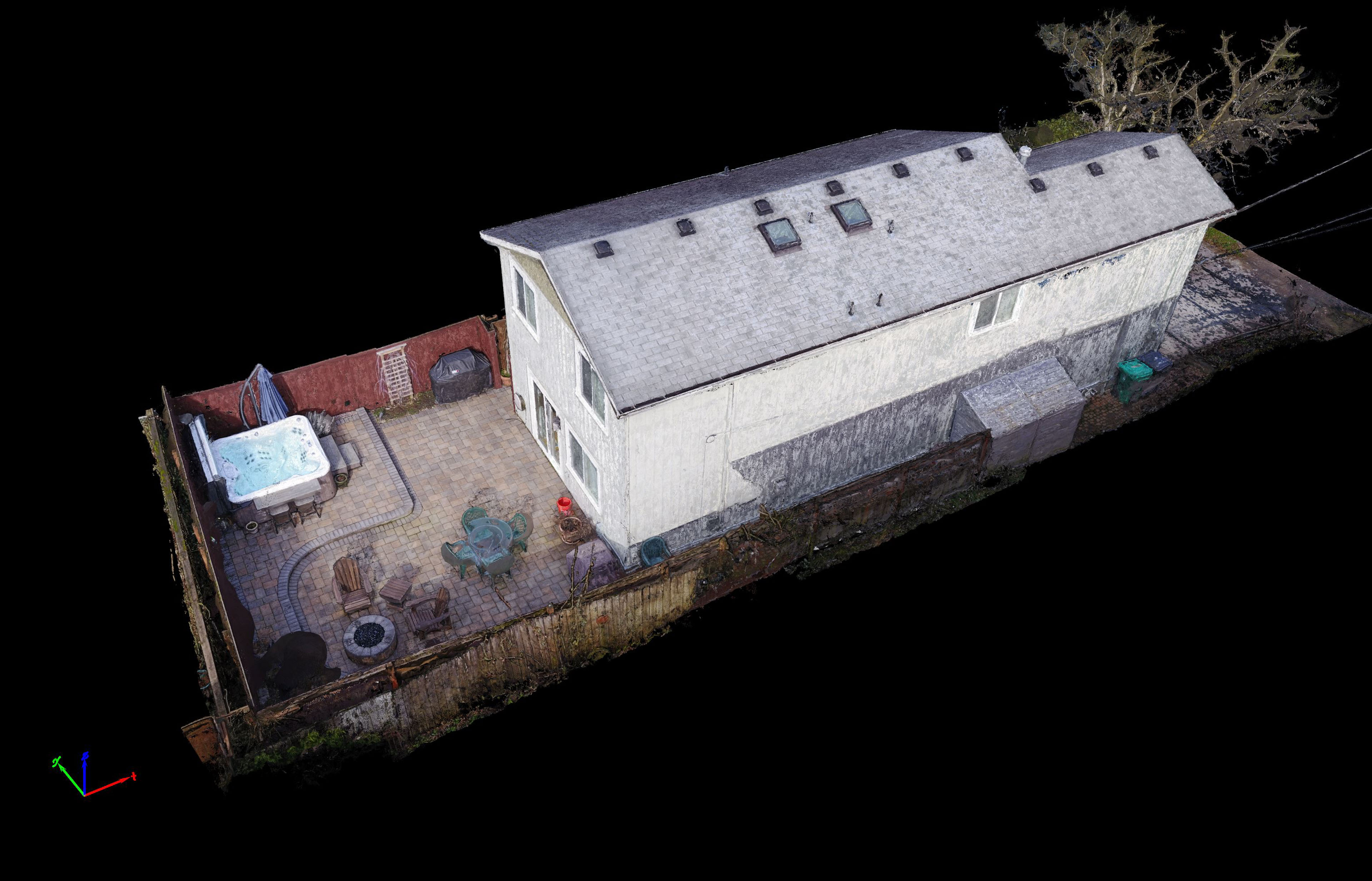
TLT Photography is pleased to announce new 3D modeling services. Using advanced photogrammetric software and knowledge gained over a decade of experience as a professional photographer and geospatial data scientist Jon Ellinger is able to produce ultra-high resolution 3D models of virtually any subject matter.  This can include expansive terrain modeling over hundreds of acres […]

Chenoweth Cliffs 3D Terrain Model

3D Terrain Visualization From UAV (Drones)

Posted Posted in 3D Modeling, Aerial Services, Data Solutions, Inspections, Photogrammetry

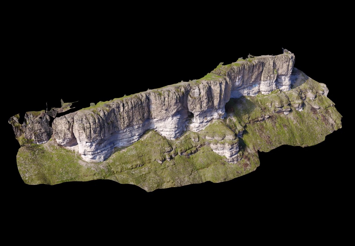
Ultra high-resolution 3D terrain models produced by modern photogrammetric software from aerial imagery captured by UAV is nothing short of stunning. No longer do you need a million dollar lidar sensor mounted to an aircraft to achieve the point density necessary to make detailed sub-cm models of geological features. Geological applications of such models include […]

Munra-Viewpoint Mavic-Pro

Munra Viewpoint Mavic Pro Orbit Test

Posted Posted in Action Sports, Adventure, Aerial Services, Guide Services, Itineraries & Planning, Nature Photography, Personal Photographer, Photography

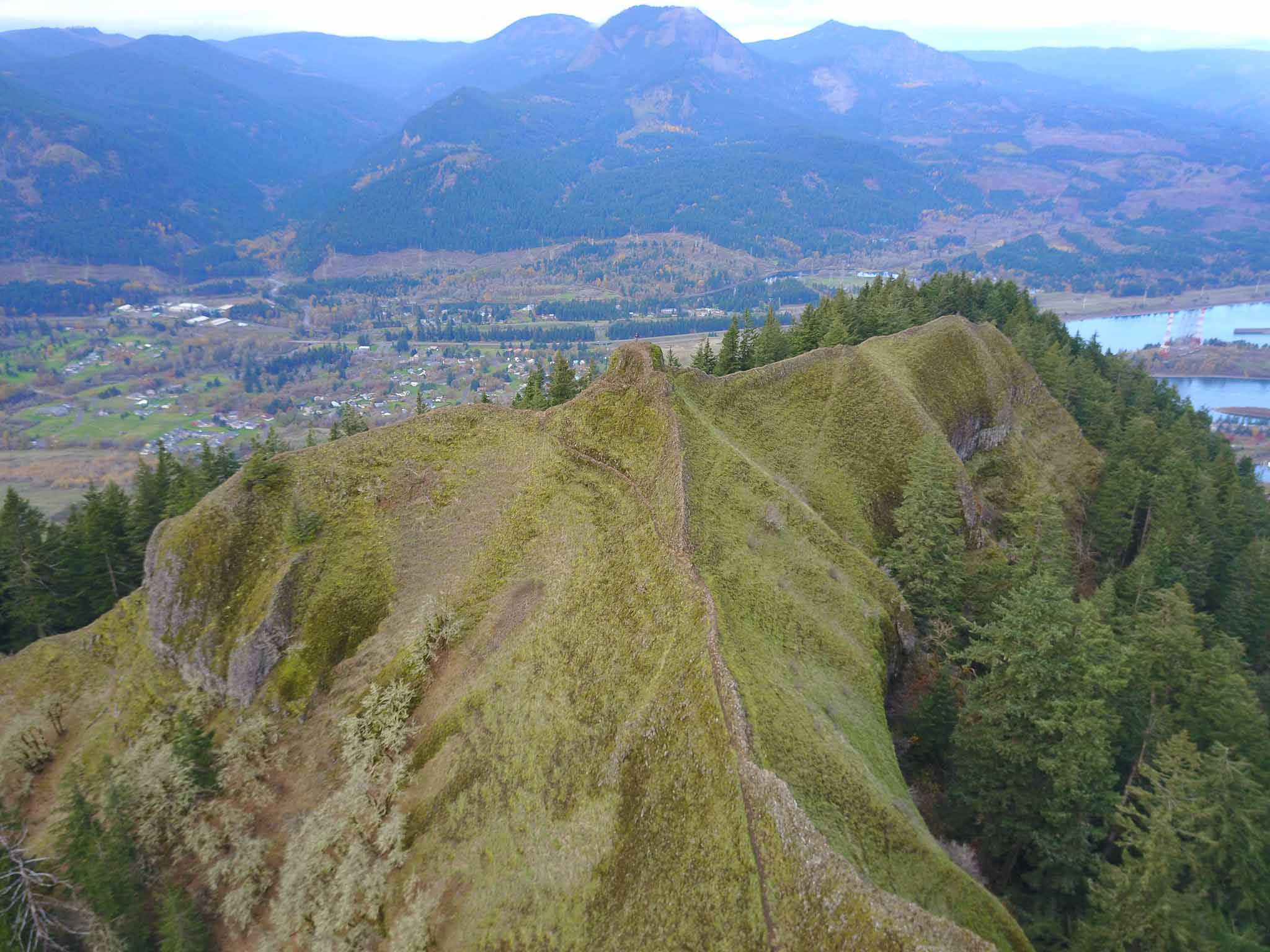
Took the Mavic Pro up a trail less traveled in the Columbia Gorge to check out it’s orbiting autonomous flight mode. This is not a maintained trail and there was a bit of a fourth class scramble up a narrow chute to get on the knife-edge ridge so Leo couldn’t make it to the top. […]