Category: 3D Modeling

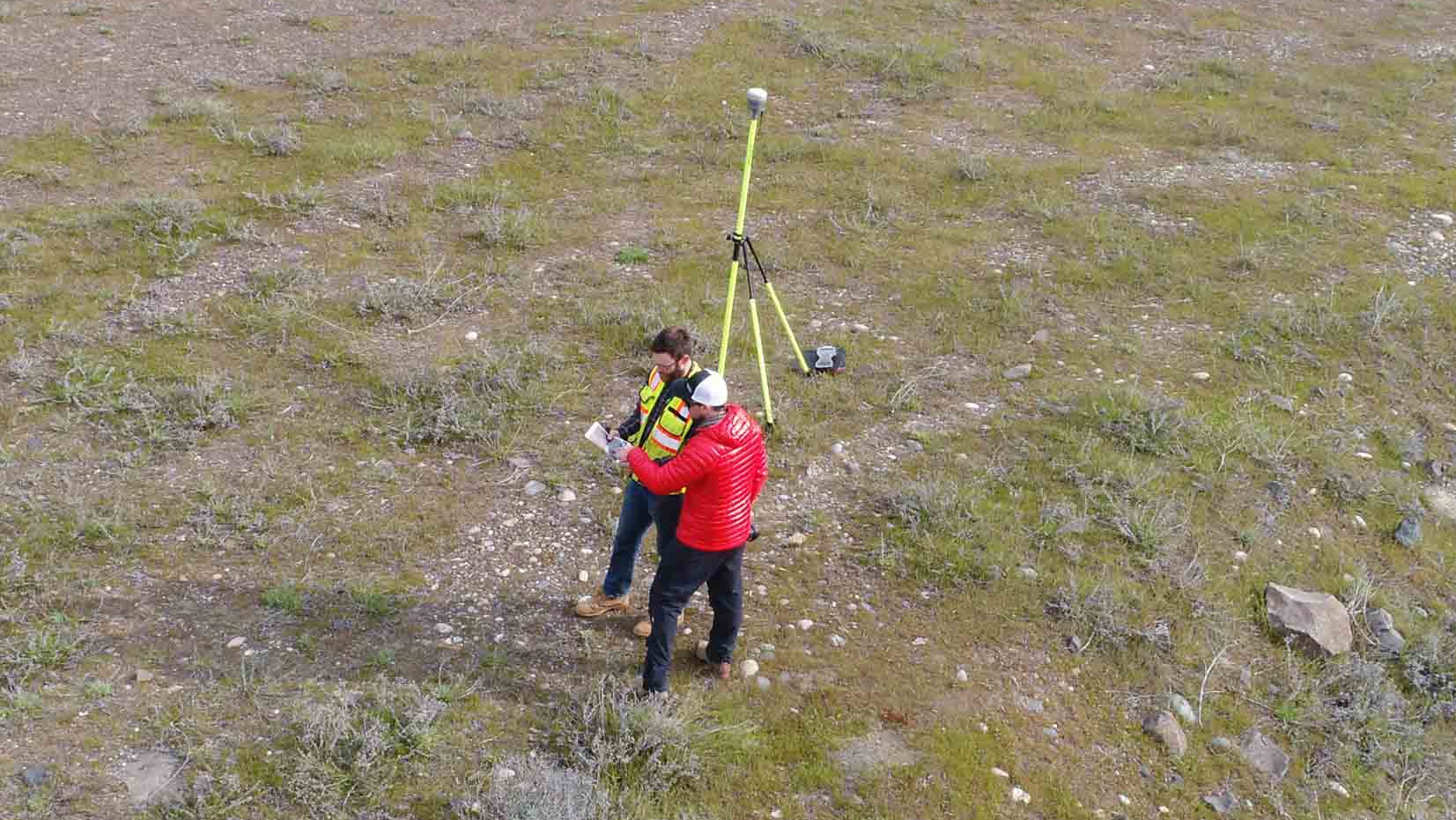
Statewide Land Surveying Partnership
I recently finished a project in partnership with Statewide Land Surveying out of Gresham, Oregon. It was for the Army Corps of […]
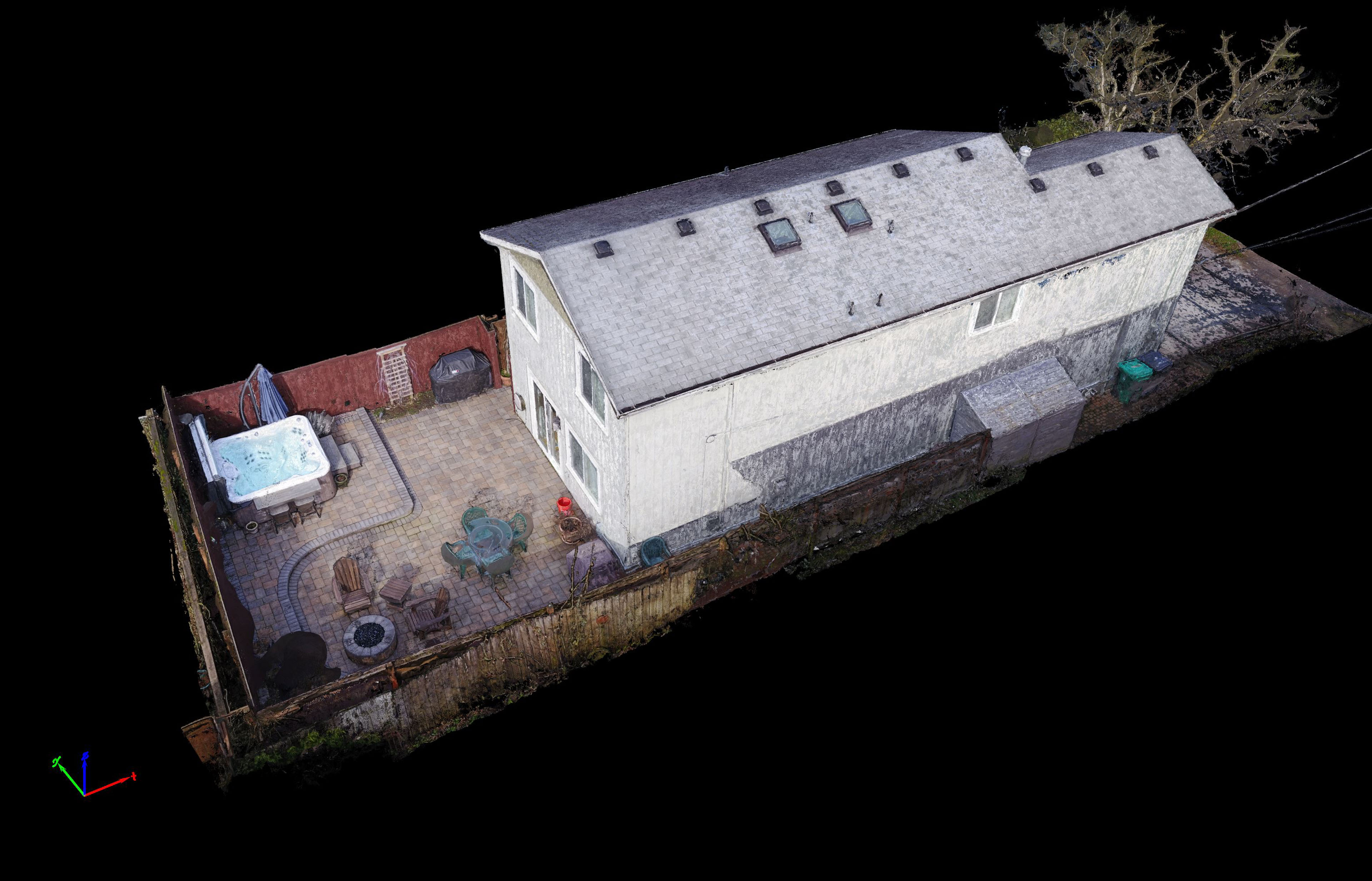
New 3D modeling Services
TLT Photography is pleased to announce new 3D modeling services. Using advanced photogrammetric software and knowledge gained over a decade of experience […]
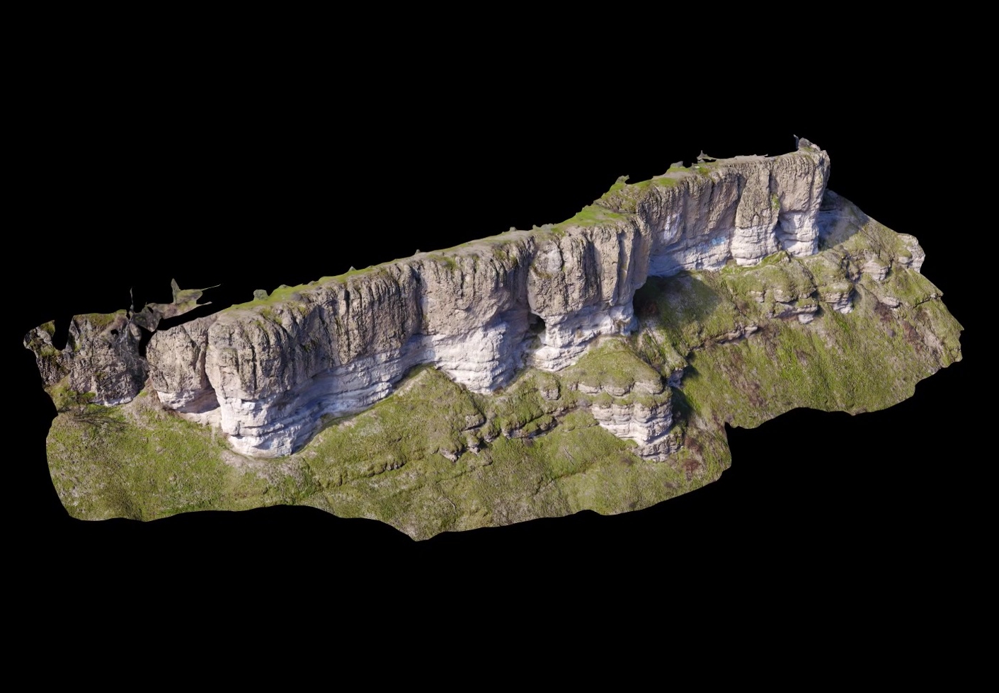
3D Terrain Visualization From UAV (Drones)
Ultra high-resolution 3D terrain models produced by modern photogrammetric software from aerial imagery captured by UAV is nothing short of stunning. No […]
Site Branding!
Today the site logo was completed. I haven’t got the exact finished version yet but it will look nearly identical to this. […]