Skip to content
TLT Photography
Toggle menu
  • Photography
    • Landscape & Wildlife
    • Client Work
    • 3D Model Gallery
    • Family Archive
  • Adventures
  • Photo Blog
  • Contact

Category: Aerial Services

November 7, 2017February 3, 20183D Modeling, Aerial Services, Data Solutions, GIS Solutions, Photogrammetry, Survey

Railway Yard Aerial Mapping

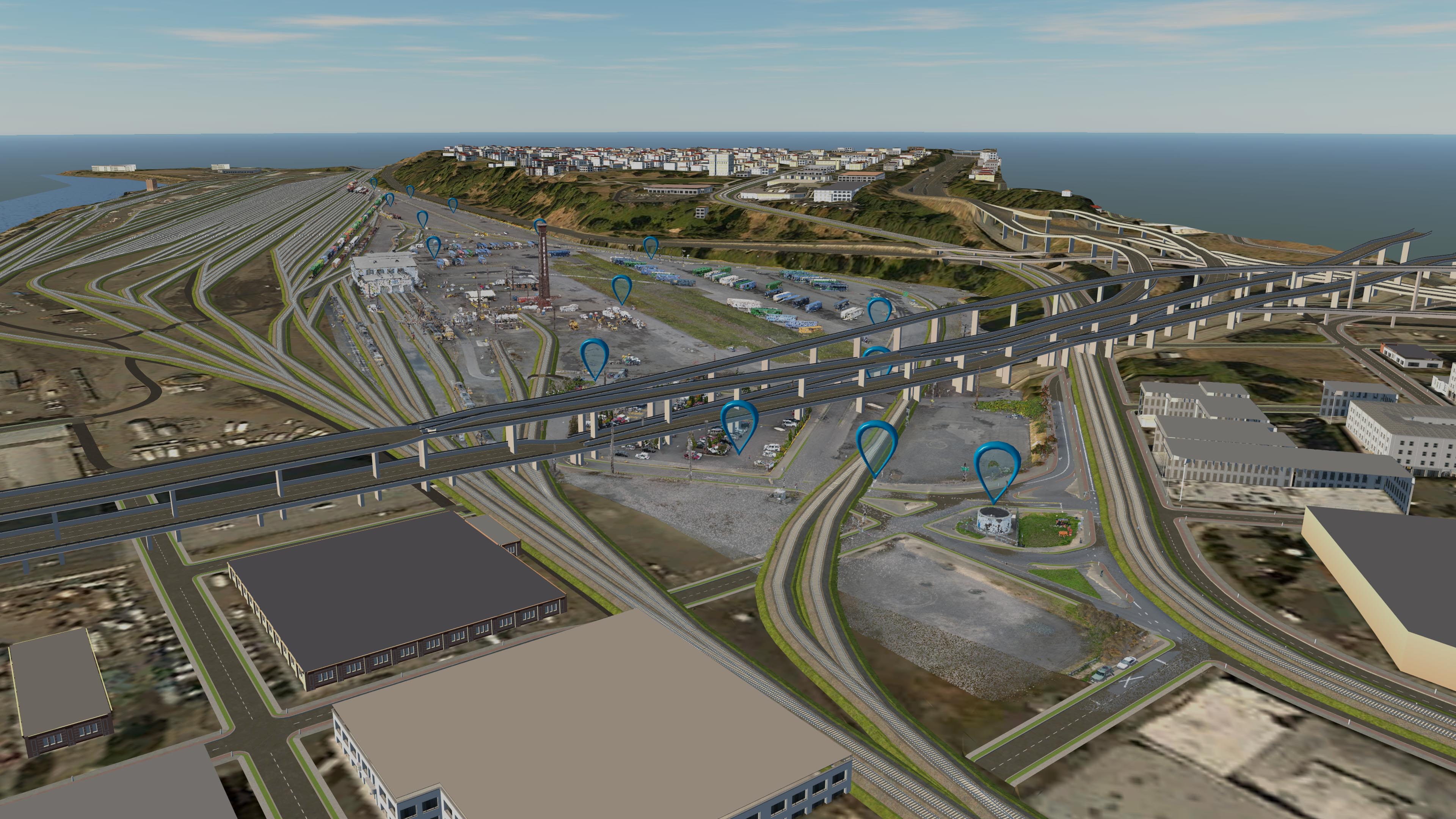
This week I flew my most challenging project yet, a Union Pacific Railway Yard for a local engineering firm.  There were multiple […]

Share this:

  • Click to email a link to a friend (Opens in new window)
  • Click to share on LinkedIn (Opens in new window)
  • Click to share on Facebook (Opens in new window)
  • Click to share on Twitter (Opens in new window)
  • Click to share on Pinterest (Opens in new window)
  • Click to share on Pocket (Opens in new window)
  • Click to share on Reddit (Opens in new window)
October 31, 2017February 3, 20183D Modeling, Data Solutions, GIS Solutions, Photogrammetry, Survey

Digitizing Offshore Pilings on the Willamette from a UAV Photo-derived 3D Point Cloud

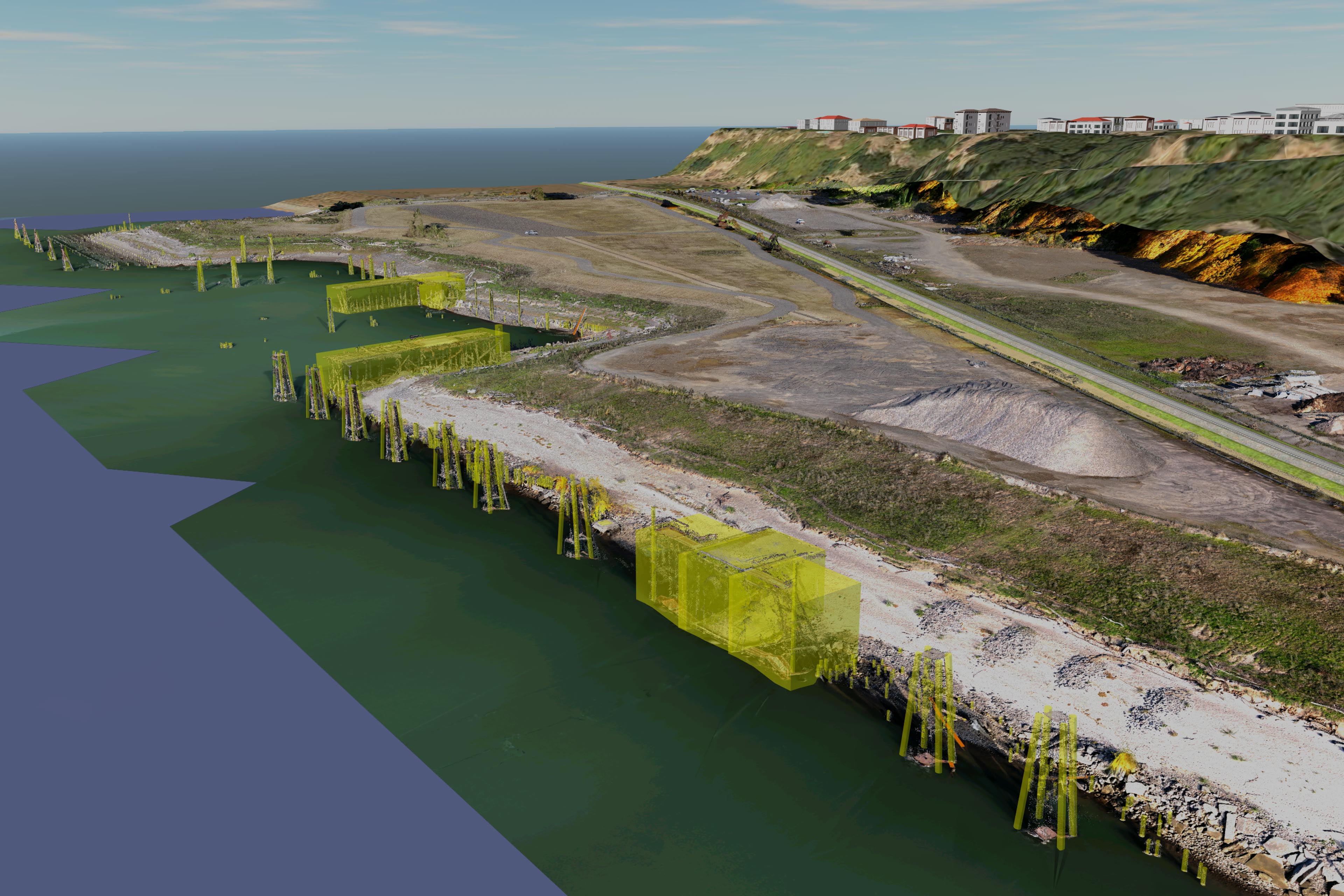
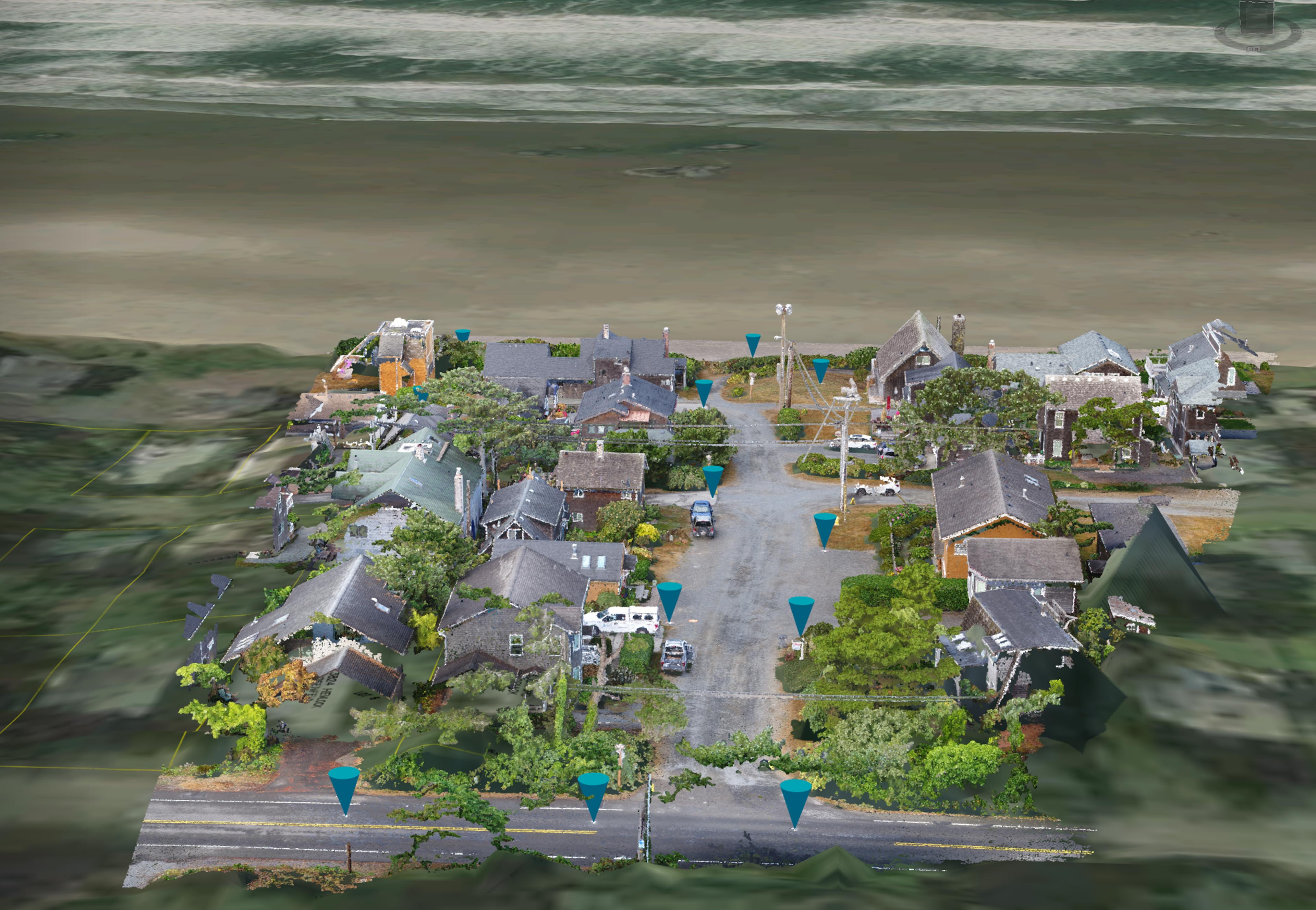
I recently completed a unique project for Statewide Land Surveying.  This project was on the shore of the Willamette River just below […]

Share this:

  • Click to email a link to a friend (Opens in new window)
  • Click to share on LinkedIn (Opens in new window)
  • Click to share on Facebook (Opens in new window)
  • Click to share on Twitter (Opens in new window)
  • Click to share on Pinterest (Opens in new window)
  • Click to share on Pocket (Opens in new window)
  • Click to share on Reddit (Opens in new window)
October 26, 2017February 10, 20183D Modeling, Data Solutions, Photogrammetry, Survey

Astoria commercial waterfront ALTA

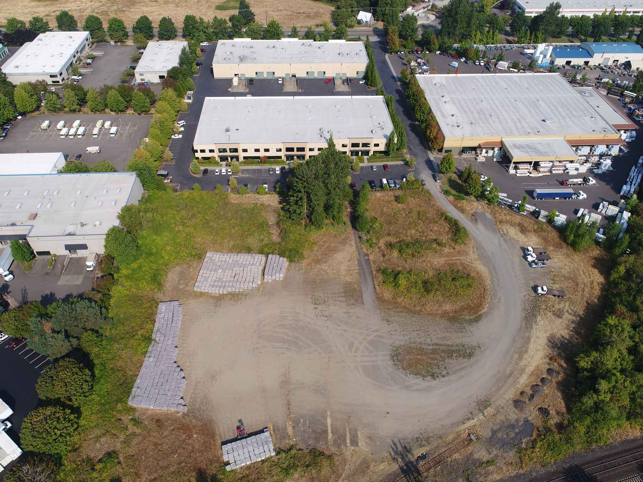
This week I flew aerial imagery to create a quarter inch resolution orthomosaic and 3D model of a site for Mike Magyar […]

Share this:

  • Click to email a link to a friend (Opens in new window)
  • Click to share on LinkedIn (Opens in new window)
  • Click to share on Facebook (Opens in new window)
  • Click to share on Twitter (Opens in new window)
  • Click to share on Pinterest (Opens in new window)
  • Click to share on Pocket (Opens in new window)
  • Click to share on Reddit (Opens in new window)
October 9, 2017October 19, 2017Action Sports, Adventure, Nature Photography, Personal Photographer

An Autumn Ride

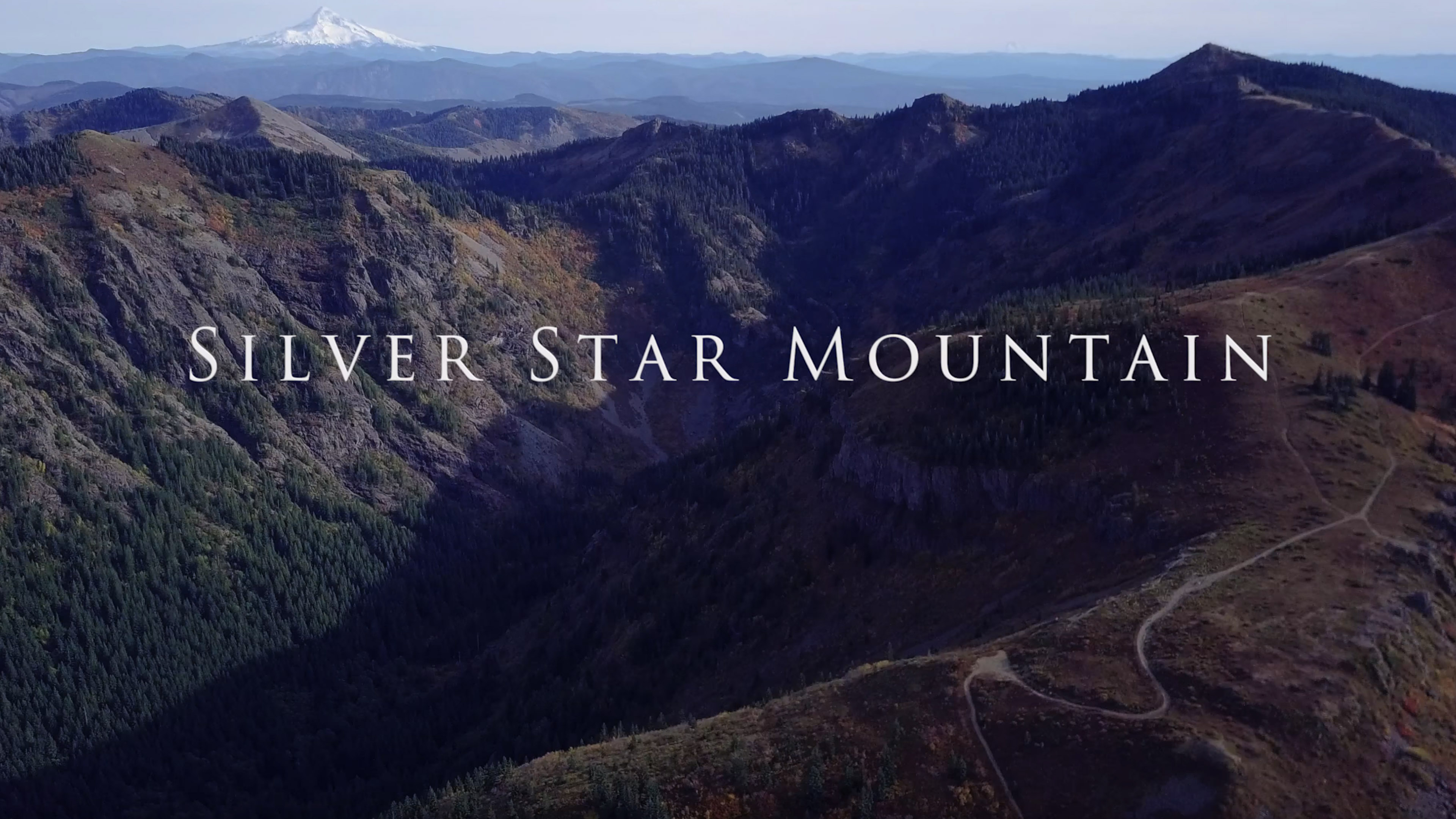
There aren’t that many nice days left around Portland so today I took the Mavic Pro, the Sony Action Cam and my […]

Share this:

  • Click to email a link to a friend (Opens in new window)
  • Click to share on LinkedIn (Opens in new window)
  • Click to share on Facebook (Opens in new window)
  • Click to share on Twitter (Opens in new window)
  • Click to share on Pinterest (Opens in new window)
  • Click to share on Pocket (Opens in new window)
  • Click to share on Reddit (Opens in new window)
October 5, 2017February 3, 2018Aerial Services, Marketing, Real Estate

Jones Lang LaSalle Properties Aerial Video & Stills

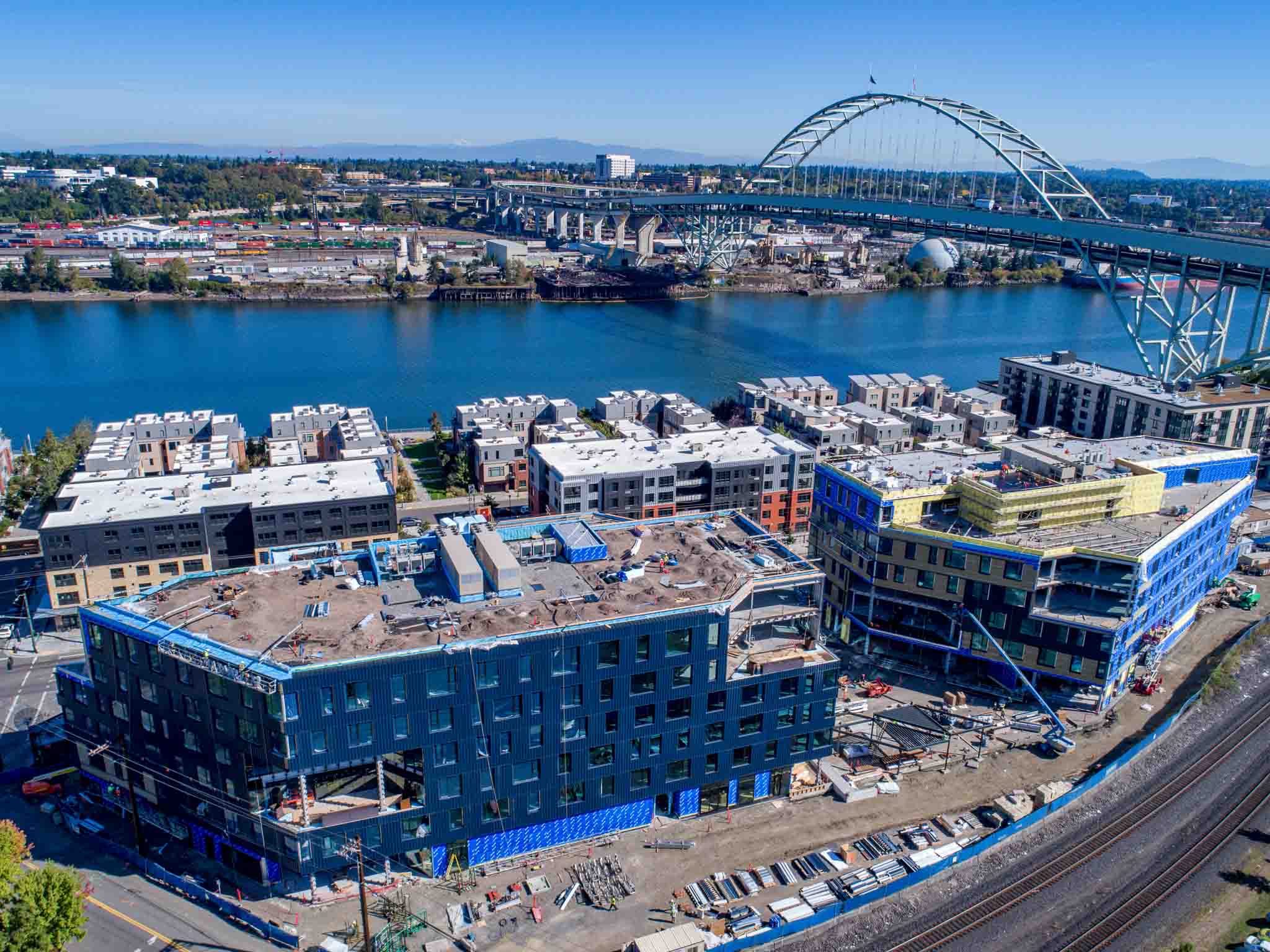
Today I was chosen by Jones Lang LaSalle Properties on behalf of Project PDX to fly aerial imagery and video for their site […]

Share this:

  • Click to email a link to a friend (Opens in new window)
  • Click to share on LinkedIn (Opens in new window)
  • Click to share on Facebook (Opens in new window)
  • Click to share on Twitter (Opens in new window)
  • Click to share on Pinterest (Opens in new window)
  • Click to share on Pocket (Opens in new window)
  • Click to share on Reddit (Opens in new window)
September 27, 2017October 11, 20173D Modeling, Aerial Services, Real Estate

Leland Properties

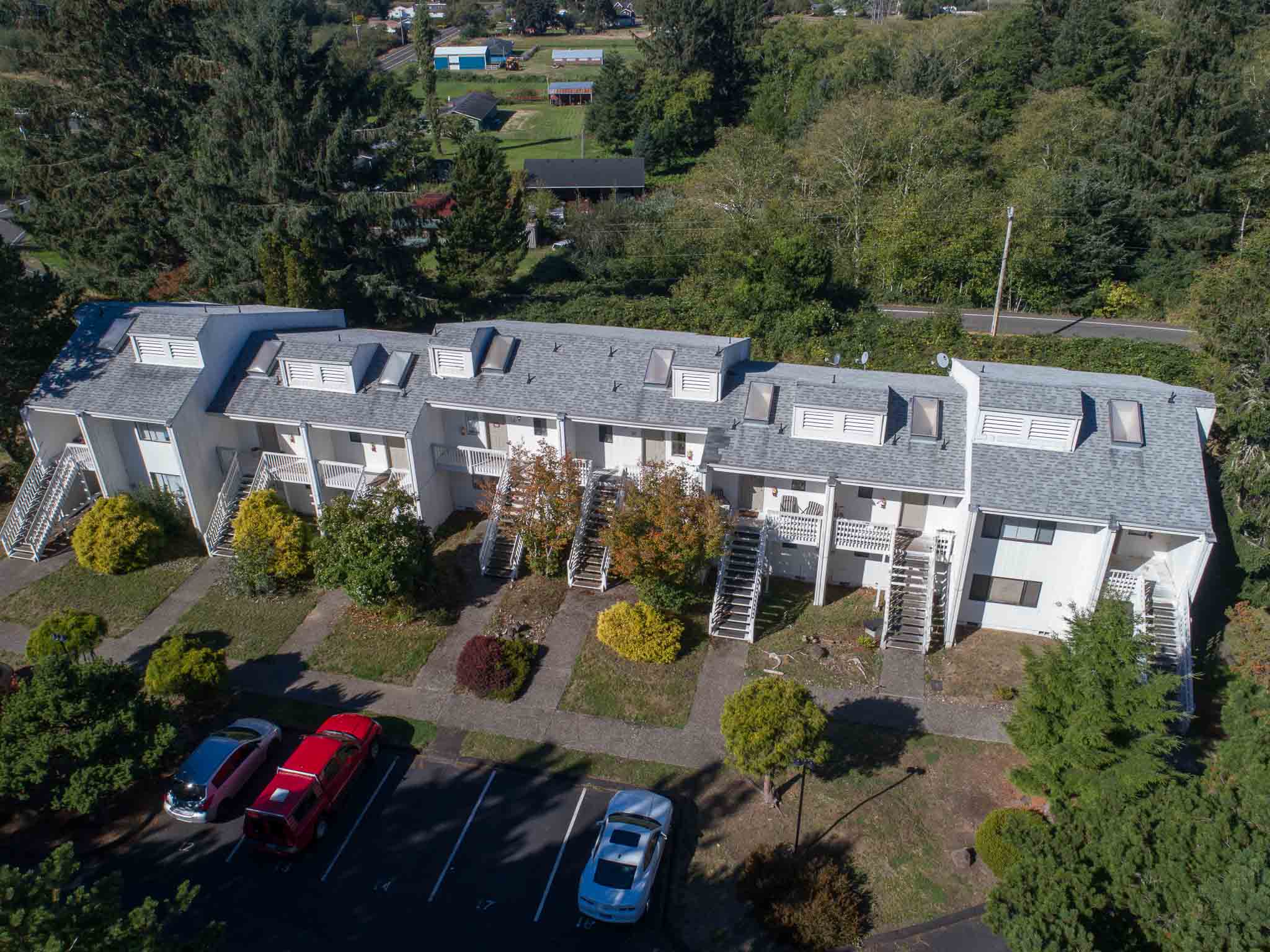
Today I spent the day touring various properties around Seaside, Oregon for Leland Properties.  At each property I performed walkthroughs of the […]

Share this:

  • Click to email a link to a friend (Opens in new window)
  • Click to share on LinkedIn (Opens in new window)
  • Click to share on Facebook (Opens in new window)
  • Click to share on Twitter (Opens in new window)
  • Click to share on Pinterest (Opens in new window)
  • Click to share on Pocket (Opens in new window)
  • Click to share on Reddit (Opens in new window)
September 25, 20173D Modeling, Aerial Services, Data Solutions, GIS Solutions, Photogrammetry, Review

Survey-Grade Right of Way Surface Modeling with UAS

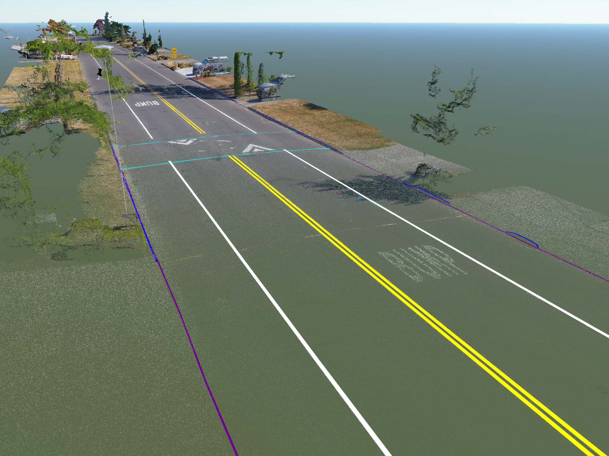
Throughout this summer I have been working with several survey partners to develop a new methodology for cost-effective and accurate right of […]

Share this:

  • Click to email a link to a friend (Opens in new window)
  • Click to share on LinkedIn (Opens in new window)
  • Click to share on Facebook (Opens in new window)
  • Click to share on Twitter (Opens in new window)
  • Click to share on Pinterest (Opens in new window)
  • Click to share on Pocket (Opens in new window)
  • Click to share on Reddit (Opens in new window)
September 12, 2017February 16, 20183D Modeling, Aerial Services, Data Solutions, Photogrammetry

Viewshed Analysis

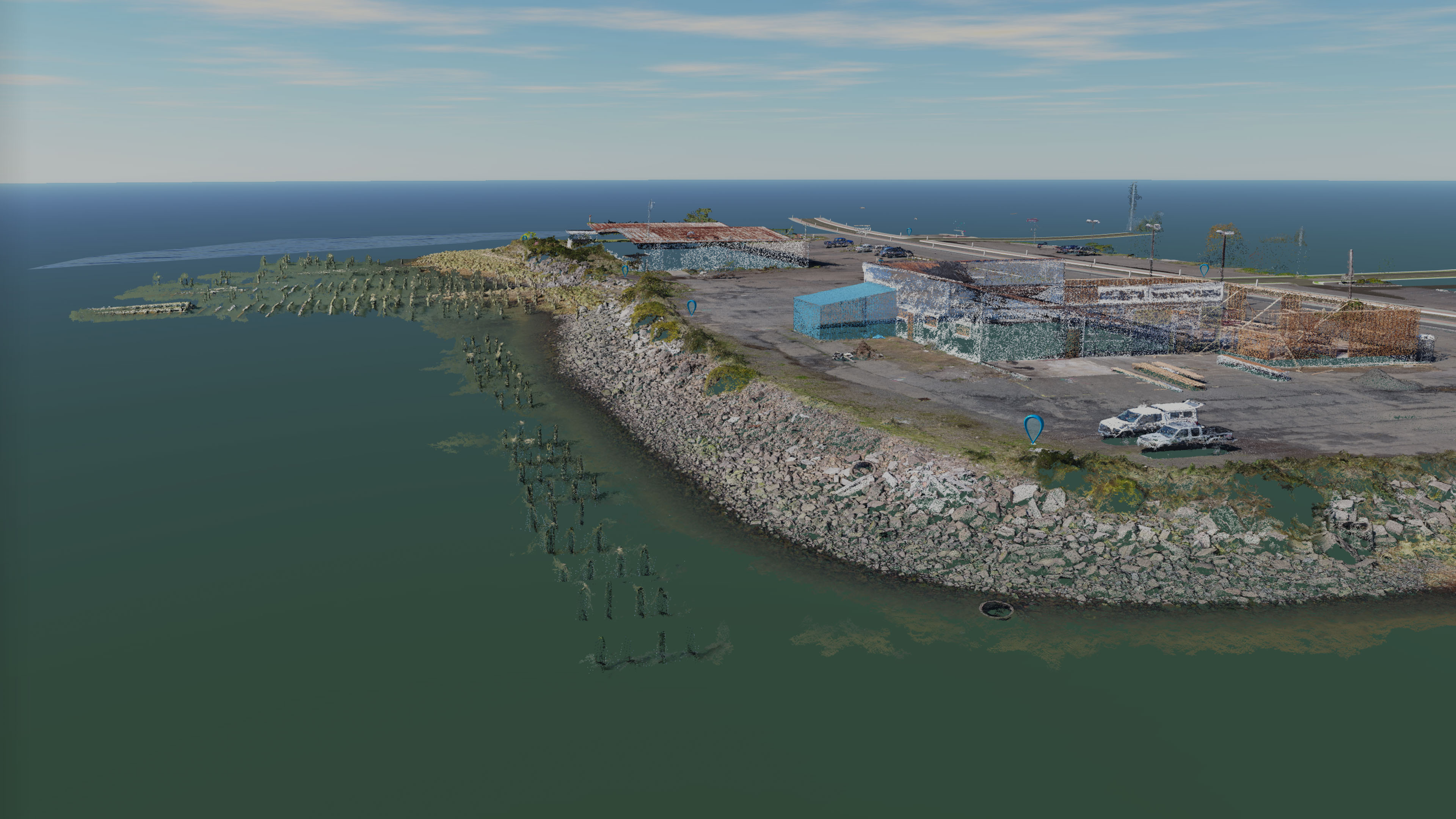
I recently worked on a very unique client with my survey partner Mike Magyar of Magyar Surveying in Astoria. Our client owns […]

Share this:

  • Click to email a link to a friend (Opens in new window)
  • Click to share on LinkedIn (Opens in new window)
  • Click to share on Facebook (Opens in new window)
  • Click to share on Twitter (Opens in new window)
  • Click to share on Pinterest (Opens in new window)
  • Click to share on Pocket (Opens in new window)
  • Click to share on Reddit (Opens in new window)
August 28, 2017September 25, 20173D Modeling, Aerial Services, Data Solutions, Real Estate

10700 Tualatin-Sherwood Road

This summer I signed up for a service called “Thumbtack” which is a website that connects clients with professionals. I was luck […]

Share this:

  • Click to email a link to a friend (Opens in new window)
  • Click to share on LinkedIn (Opens in new window)
  • Click to share on Facebook (Opens in new window)
  • Click to share on Twitter (Opens in new window)
  • Click to share on Pinterest (Opens in new window)
  • Click to share on Pocket (Opens in new window)
  • Click to share on Reddit (Opens in new window)
August 28, 2017September 25, 20173D Modeling, Aerial Services, Data Solutions, Photogrammetry

Pix4D Hall of Fame Model

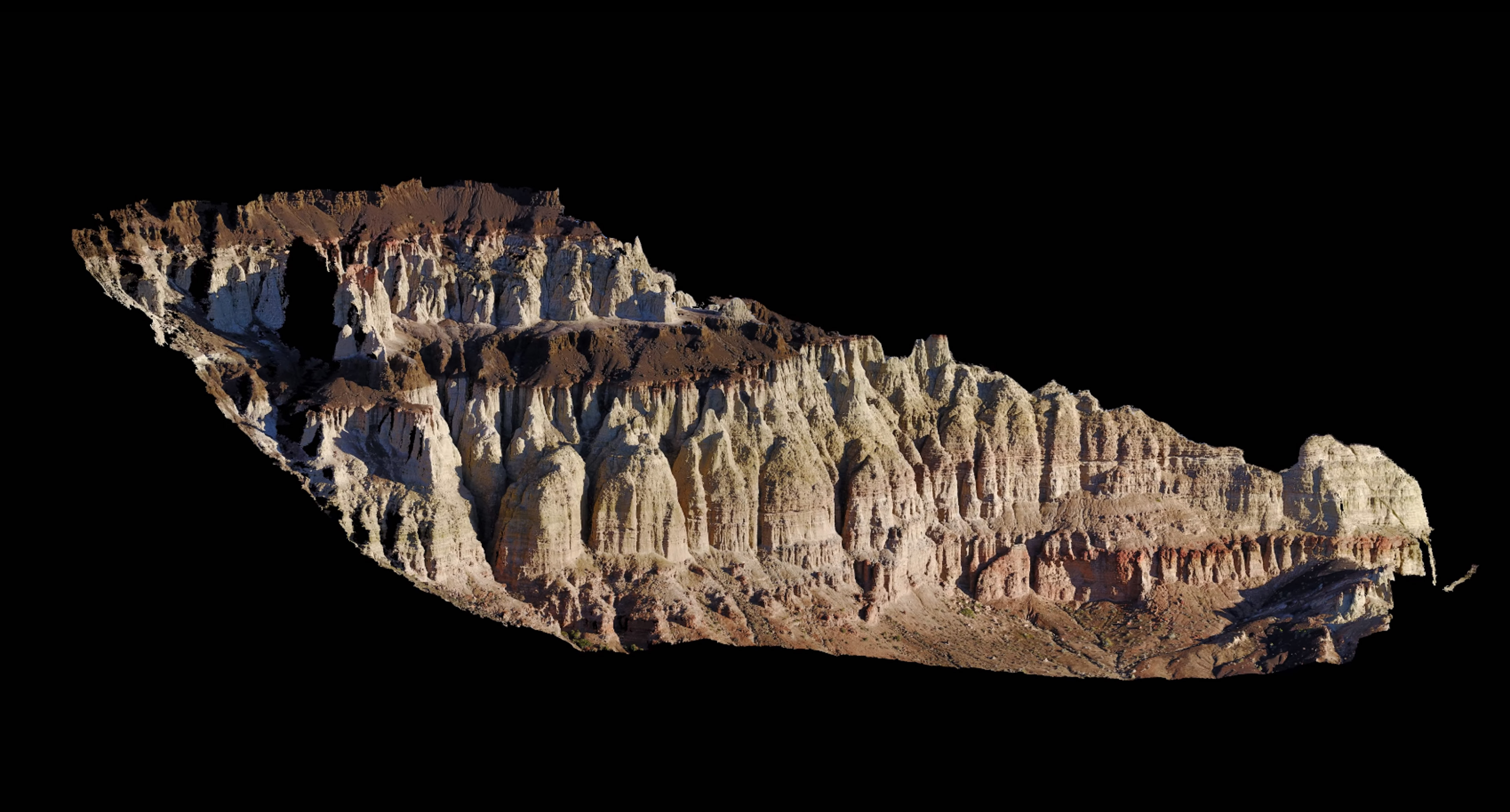
Today I was featured in Pix4D’s “Hall of Fame” for a model I created on a recent adventure in Eastern Oregon This […]

Share this:

  • Click to email a link to a friend (Opens in new window)
  • Click to share on LinkedIn (Opens in new window)
  • Click to share on Facebook (Opens in new window)
  • Click to share on Twitter (Opens in new window)
  • Click to share on Pinterest (Opens in new window)
  • Click to share on Pocket (Opens in new window)
  • Click to share on Reddit (Opens in new window)

Posts pagination

< 1 … 5 6 7 8 >

Recent Posts

  • Baja Mexico Film
  • North Bethany Ridge Aerials
  • Tillamook Head Lighthouse
  • Boones Ferry Road
  • Wilsonville Road

Recent Comments

  • Homepage on Data Solutions
  • Anonymous on Tillamook Head Lighthouse
  • Holden Greene on Protected: Large Traditional Aerial Mapping Project in Southwest
  • Anonymous on Protected: Large Traditional Aerial Mapping Project in Southwest
  • Cost Effective Photography Salt Lake City Utah Area Payment Option | Salt Lake City Photography Guy on Cost-Effective Aerial Mapping by Helicopter

Archives

  • January 2020
  • October 2018
  • September 2018
  • August 2018
  • July 2018
  • June 2018
  • May 2018
  • April 2018
  • March 2018
  • February 2018
  • January 2018
  • December 2017
  • November 2017
  • October 2017
  • September 2017
  • August 2017
  • July 2017
  • June 2017
  • May 2017
  • April 2017
  • March 2017
  • January 2017
  • November 2016
  • December 2011

Categories

  • 3D Modeling
  • Action Sports
  • Adventure
  • Aerial Services
  • Data Solutions
  • Digital Archiving
  • GIS Solutions
  • Guide Services
  • Inspections
  • Itineraries & Planning
  • Marketing
  • Nature Photography
  • Personal Photographer
  • Photogrammetry
  • Photography
  • Real Estate
  • Review
  • Special Events
  • Survey

Meta

  • Log in
  • Entries feed
  • Comments feed
  • WordPress.org
© 2026 TLT Photography. Proudly powered by Sydney
 

Loading Comments...