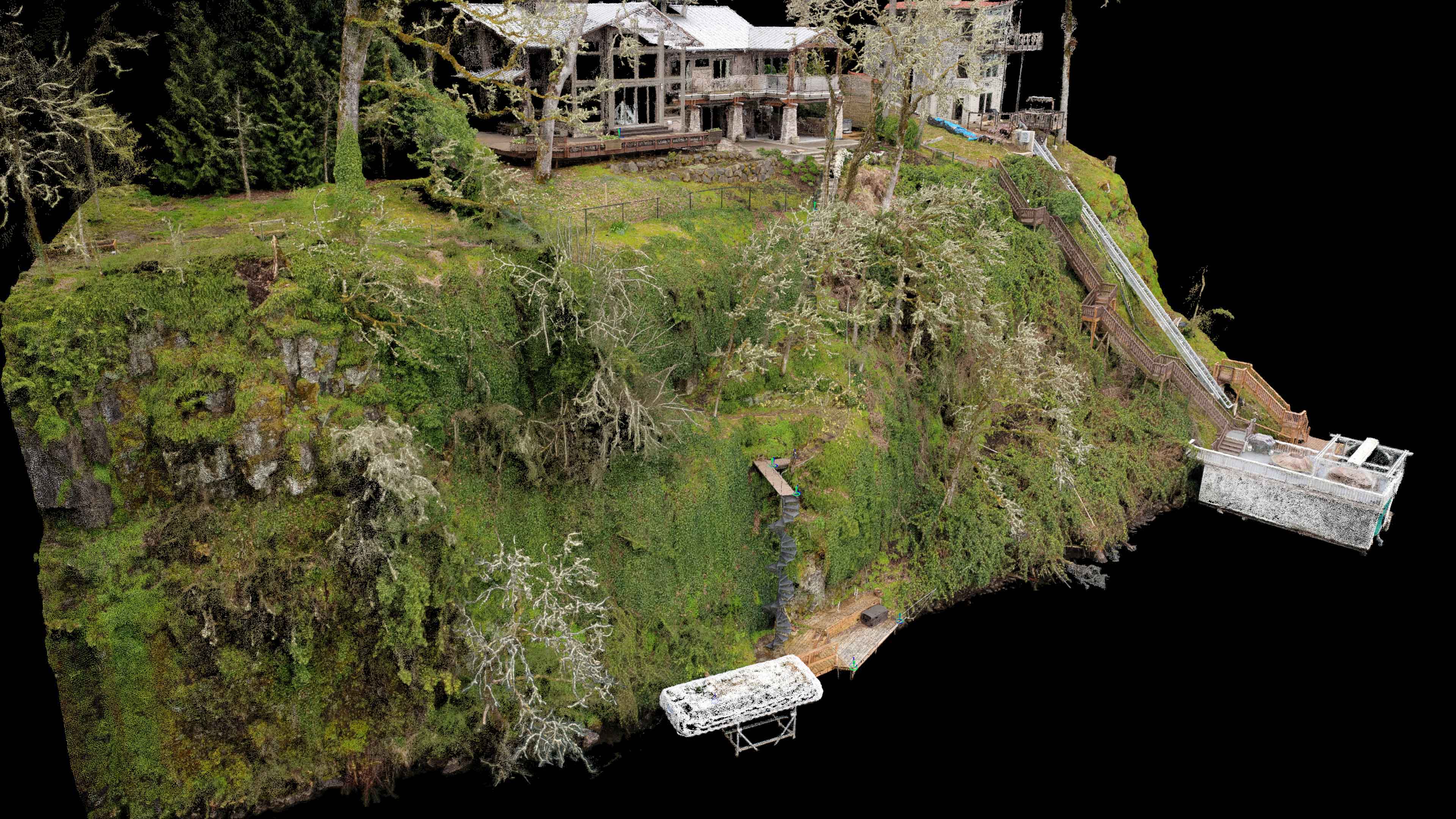
This week I had one of my most challenging projects yet! A few weeks back Jason Bauer of MCM Construction found my website and gave me a call to inquire about flying a unique property on the shore of Lake Oswego just south of Portland. This was my first “landscape design” type project as the goal was to produce a 3D model for design work to be done upon rather than the traditional NADIR Ortho imagery (although that was helpful too). When I got to the site I immediately knew it was going to be a challenge for flights but thankfully it was early enough in the spring that the tall trees hadn’t “leafed-out” yet obstructing the surface underneath them. I flew two missions for this site. One was a quick overview at about 175 feet to avoid the tall trees in the area to give a nice overview orthomosaic for MCM and the second was a thorough capturing of the cliff face at every angle possible. 
Like the cliff face I had modeled for SWLS along the Columbia I had to fly this entire cliff face manually which meant carefully flying around the trees above the water of Lake Oswego. Like in skiing “no fall zones” this was a “no limb zone” for an aerial UAV pilot like myself. The other problem was that I was lacking traditional aerial survey targets for the site and, like the construction sites I fly for BD Aerial, this site had its own local coordinate system. After working closely with Jason from MCM I was able to locate some key points within the dense point cloud that matched up with points that had local coordinates from the site CAD design. Using these points on the dock, along the spiral staircase and up a the house I was able to georeference the 3D point cloud to perfectly match the CAD designs. Yes, this is a little backwards from how I typically work but as you can see from the photos below it resulted in an extremely accurate dataset capable of producing very accurate measurements for design work. In the future we will use traditional clear air targets to ensure best geospatial accuracy but for the first time working together on this project I am very proud of what we were able to achieve.


After some manual work removing the tree canopy I was able to provide Jason several versions of the point cloud and 3D mesh options for him to throw into Sketchup for his design work. This whole process was a lot of trial and error on what formats and file sizes would work best but I must say that it was an absolute pleasure working with Jason at MCM. He’s brilliant and picked up on everything that I was throwing at him very quickly. I was even able to teach him a bit about Cloud Compare so he could fully realize the potential of the point cloud data I was sending him.


Interactive 3D Model and Site Fly-Through Video Animations Below