My good friend and partner Chris Sherby of S&F Land Services asked a few weeks back if I could fly a 1.5 mile section of roadway in Kelso to create planimetrics from. Both S&F and TLT Photography had done a ton of R&D work on 139th Street last summer and fall perfecting both acquisition techniques as well as processing procedures to ensure survey-grade accuracy of the models produced. We had used that knowledge to successfully complete the 39th street project for the City of Vancouver and they were very pleased with the results. Now it was time to up the ante on a longer stretch of road in Kelso and of course I was up to the challenge.

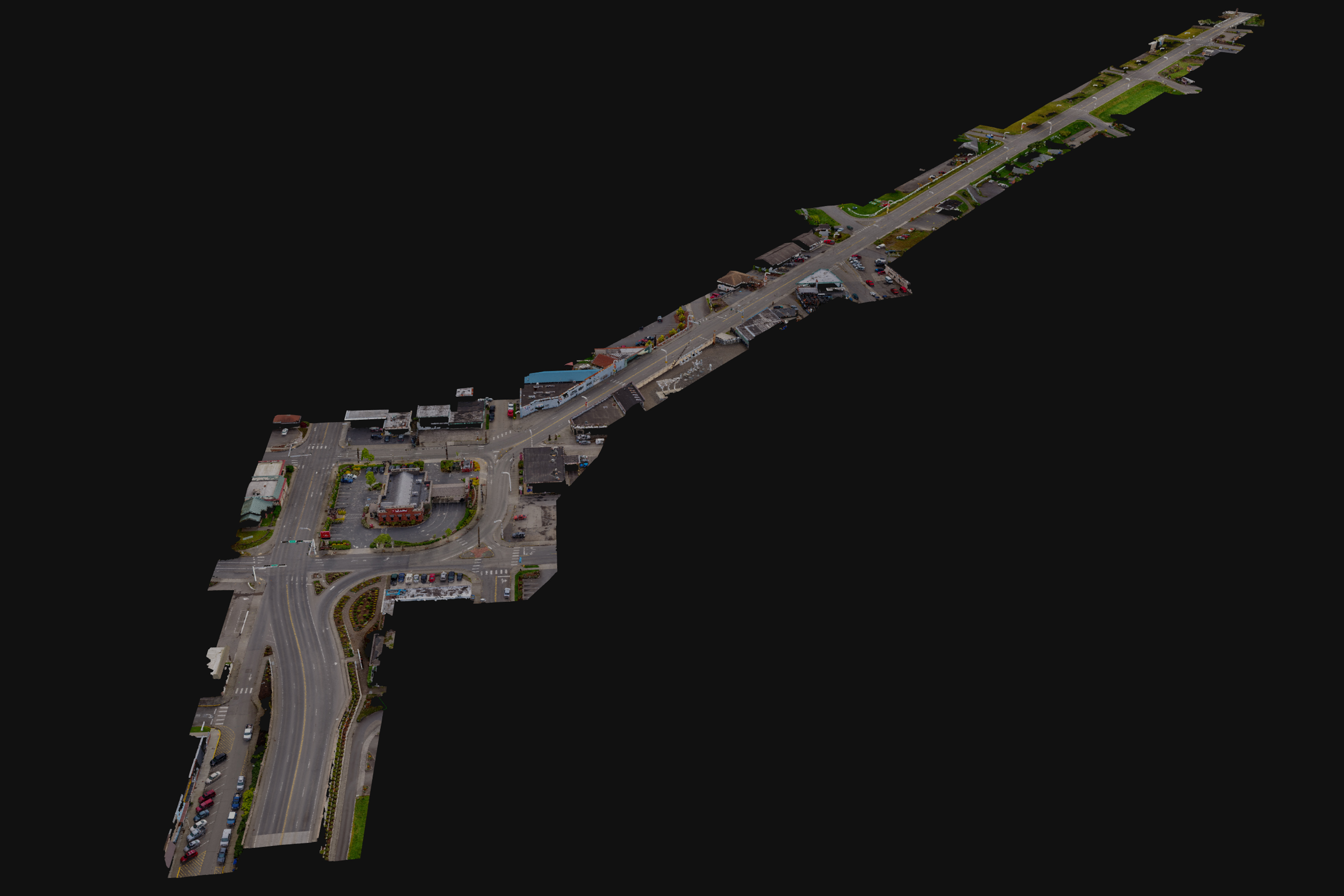
This job required capturing nearly 1700 frames over the approximately 1.5 mile stretch of roadway. Subject matter ranged from a straight roadway with fields and light housing on the sides and a bridge on the east end to a more urban environment with multiple intersections and a larger bridge on the west end with a ton of overhead wires and street lights along the way as well. This was certainly a challenge and I learned a lot of lessons while flying it on how best to position myself during the multiple mission capture. After checking a couple tree heights I decided to fly the entire length at about 125ft which would provide me with enough clarity to draft the painted underground utilities from the 0.37in/pixel final orthomosaic.


I had done some linework for 139th and 39th street before for S&F but on this go around Chris expected a bit more professional drafting work for me including drafting of the painted underground utillities along the street. Diving into Civil3D was a challenge for me but using a combination of 3D linework I completed in Infraworks along with traditional drafting from within Civil3D I was able to create a very detailed and thorough CAD design for the entire roadway. The point cloud model I created was one of the largest I have completed to date with over 344 million points. This provided more than enough detail and clarity to digitize curb and edge of pavement lines from and the high resolution orthomosaic clearly showed all the painted lines. Having learned many lessons about both total number, type, and placement of air targets we used 20 targets to achieve about 2cm horizontal and vertical accuracy for the project.


In the end I was able to create a very detailed 2013 .DWG file for S&F Land Services by using their company layer symbology template. With some help from Ben, their CAD expert, I also learned a lot about Civil3D tools and was able to speed up the drafting on my end significantly. I still have a lot to learn with Civil3D but I really enjoy this work.
This type of work has enormous potential for the surveying world. I was able to capture this site in 2 hours by UAV and when combined with appropriate Aerial Target surveys which take a few hours as well this methodology reduces the field time to complete a project of this size from days of a multi-person crew down to half a day of data capture and a few days of drafting work at a computer. This saves S&F both time and resources and I’m proud to be a part of it for them. This methodology also provides clients value-added deliverables they would not get with traditional survey such as:
- Sub-cm resolution color orthomosaic with moving objects (cars/people/animals) removed. It is as if the street were completely closed down for the survey.
- Interactive 3D model of dataset (see below) – give it a moment to load
- A surface model and point cloud made of millions of XYZ points… each with survey-grade accuracy. Endless possibilities for extracting useful information.
- Birds-eye view of the top of buildings, etc which could not be seen from the ground. Great for inspections, etc.
- Data extraction and classification such as tree vegetation types and pavement assessments.
- And this list could go on and on…
Interactive 3D Models and Data Fly-Through Below