
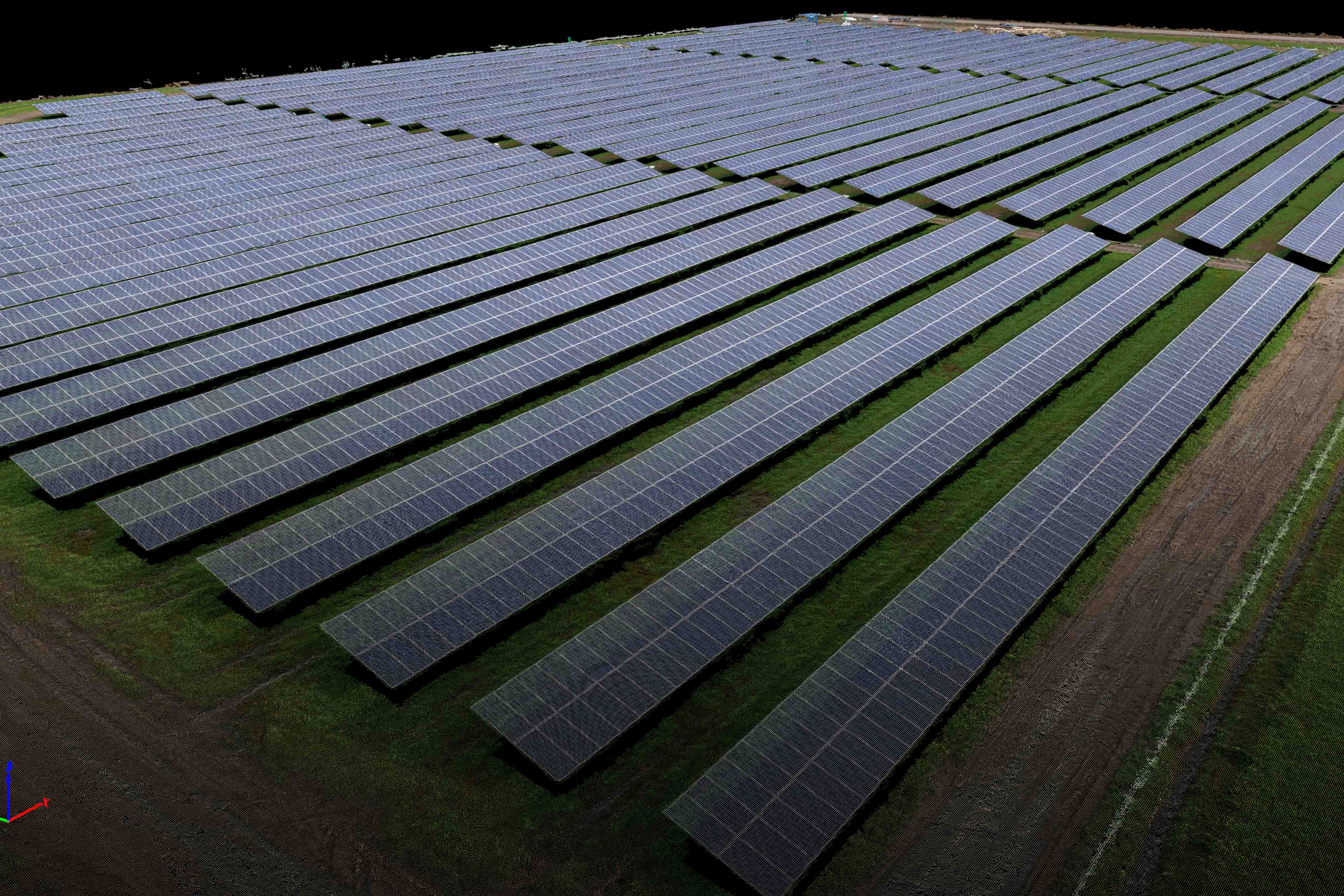
This week I had the great opportunity of flying two solar farms for S&F Land Services. One was along I-5 and the other was located in Silverton. Both were 20-25 acres in size and I flew at 350 feet as the client said they just wanted an overview orthomosaic and were ok with 1.5″ resolution pixels for the deliverable. Being me, I of course beat this and delivered 1.0″ resolution pixels and even flew at half the altitude to produce 3D point cloud models based off 0.6in resolution imagery. Because it is harder to clean up the point cloud noise around the sharp edges in the higher resolution imagery I posted a comparison of quality (below) for S&F to show the client and let them decide if they would like to pay for the extra work of a higher spatial resolution orthomosaic. No skin off my back if they don’t and I was able to create some very cool 3D models from the higher resolution frames. While I was on site I also flew some video of the solar farms that I mashed together with some 3D model animations. The video can be seen below. Throughtout the acquisition I had to wait until clouds came over before I flew so that I could minimize deep shadowing in the imagery. The best part of the day for me was when a big blue heron flew down and landed on a row of panels while I was acquiring the Interstate farm site. It didn’t stay long and no, I did not somehow make a 3D point cloud model of it, but it was still a cool experience. Enjoy the data “eye candy” from this very interesting work and make sure to check out the video and try interacting with the 3D models embedded in this post as well!


