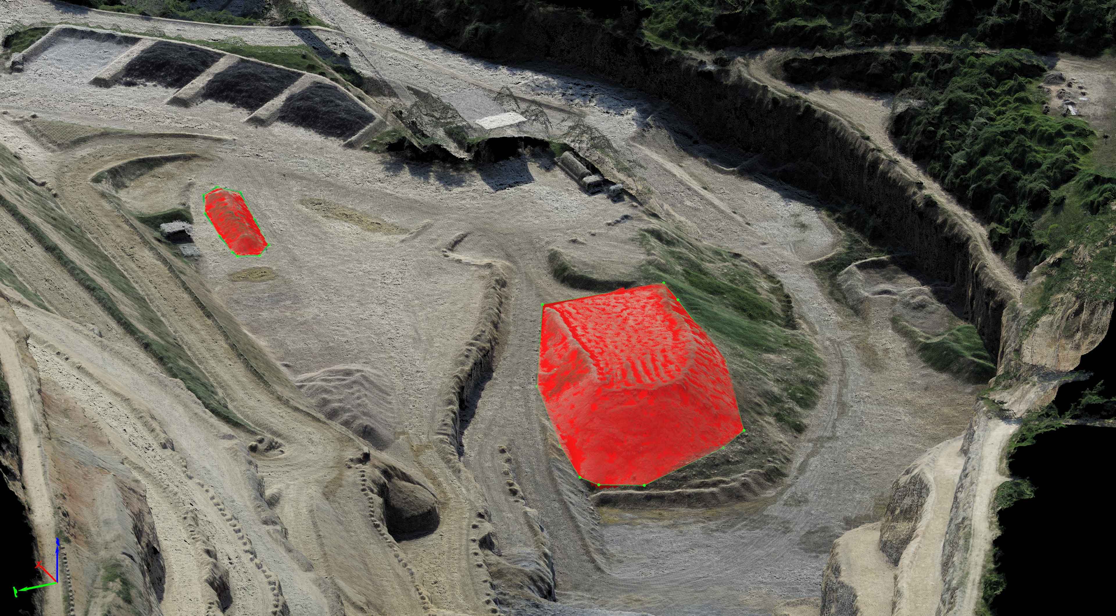
This week I had the opportunity to do my first volumetric analysis job for one of my partners. The client had a small 7 acre lot that they wanted to know material volumes for on site. My partner captured nearly 800 photos and I processed this into a 25 million point densified cloud. This was then thinned for surface model creation by the client within Civil3D and I also produced various contours from the data set for the client. The data was georeferenced with XYZ data from a total station and delivered in a local coordinate system. One thing I am still working through is the best way to deliver volumetric analysis for the client. Drone Deploy has a wonderful client portal for data access but it can’t handle local coordinate systems. Pix4D can handle local coordinate systems but clients do not have the ability to perform volumetric analysis from within it’s cloud portal. Other sites like 3DR Site Scan and Propeller offer these tools but are far too costly as a service for myself and my partners to use efficiently…. For now we will continue to work with our clients to provide them the highest quality data sets and help ensure they are able to use the data sets in their traditional software platforms. This is the personal touch that TLT Photography promises its clients!
Cut & Fill Volumetrics