
This week I flew aerial imagery to create a quarter inch resolution orthomosaic and 3D model of a site for Mike Magyar Land Surveying in Astoria. Mike needed to perform a detailed ALTA (American Land Title Association) survey for his client. The ultra high resolution orthomoaic created by georeferencing the data with aerial targets surveyed by Mike allowed him to accurately locate all paint striping and above ground utilities for the site. Using the orthomosaic as well as referencing the photo-derived 3D point colorize point cloud Mike was able to save time in the field while maintaining survey-grade geospatial accuracy in his final deliverable Civil3D drawings for his clients.

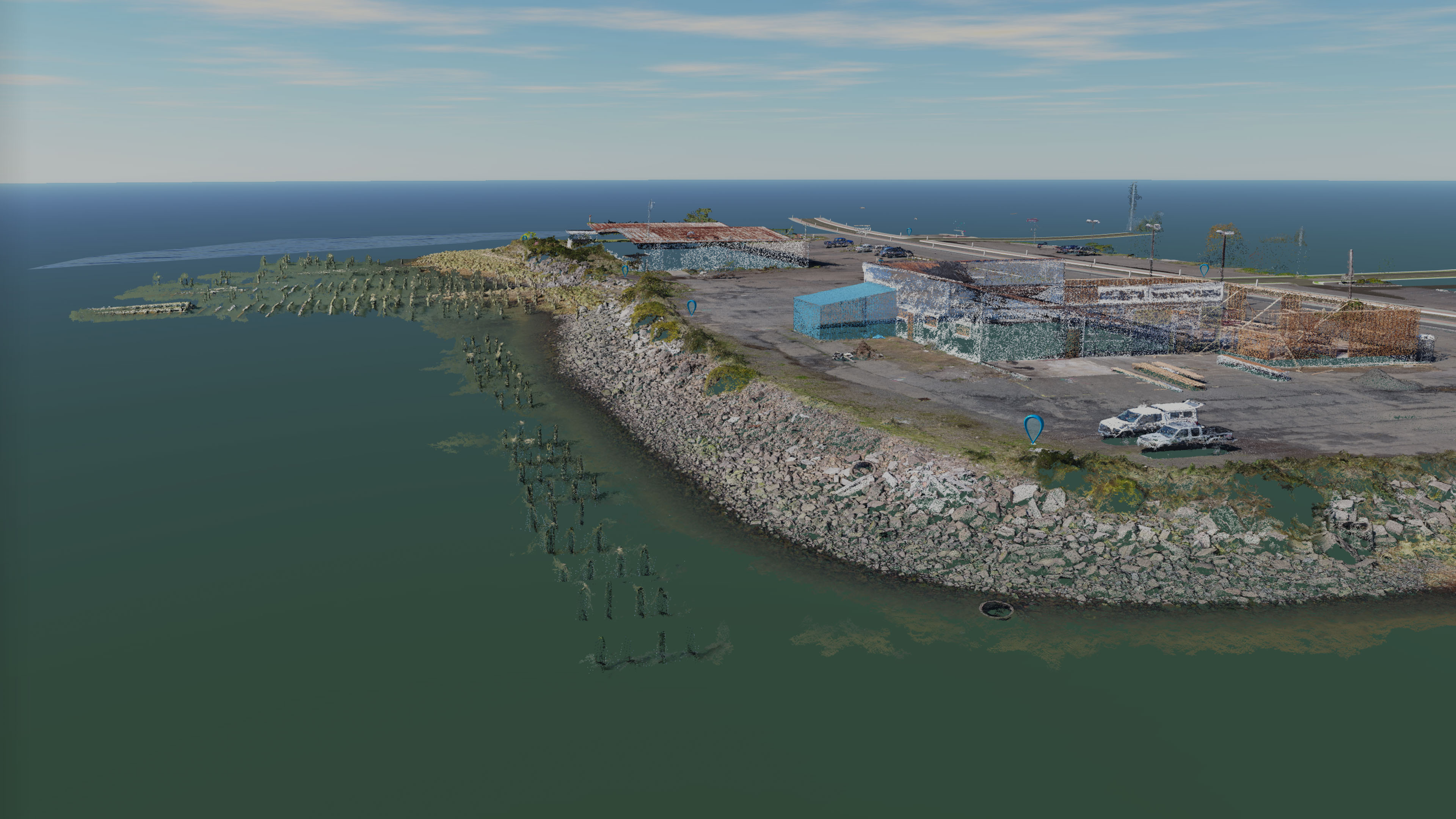
Not only did the model pick up up all the subject matter on land beautifully, it also captured offshore wood pilings and old docks on the site, providing additional valuable geospatial information and saving Mike the time of taking shots with his total station of each of the wooden structures. It is this level of detail that aerial photogrammetry can provide to surveyors that can save them time and money in their professional while also providing a new cutting edge deliverable for their clients.

The above photo is is the orthomosaic for the job site with a contours derived from a surface model created from the 3D point cloud after removing the shore vegetation and man-made structures. The red is the average high tide water line and the yellow is a 12 foot legal contour defining the boundary of the property with the bay. Having an ultra-high resolution background for drawings such as this provide a more professional product compared to using low accuracy, Google Earth background imagery for design files.