
Throughout this summer I have been working with several survey partners to develop a new methodology for cost-effective and accurate right of way surface modeling, primarily for roadway and land development projects. In direct comparison to traditional survey methods the ground model data processed from UAS imagery has proven to be incredibly accurate in both the horizontal and vertical axes. Developing this methodology has been a series of trials and errors over various sites throughout the summer but I am very close to nailing the correct combination of acquisition parameters and processing techniques to make this a new product category for TLT Photography. Thanks to all the support from my trusted partners at S&F Land Services and Magyar Surveying for providing me the opporunity to develop and continuously enhance this product offering. See the attached video for glimpse of what I’ve been working on.

Key Advantages to Surveying by UAS
– Time Savings – Can acquire full data set for surface modeling in under an hour for a 1 mile stretch of road.
– Cost Savings – Send me an inquiry and I’ll blow your socks off.
– Turnaroud Time – Days, not weeks
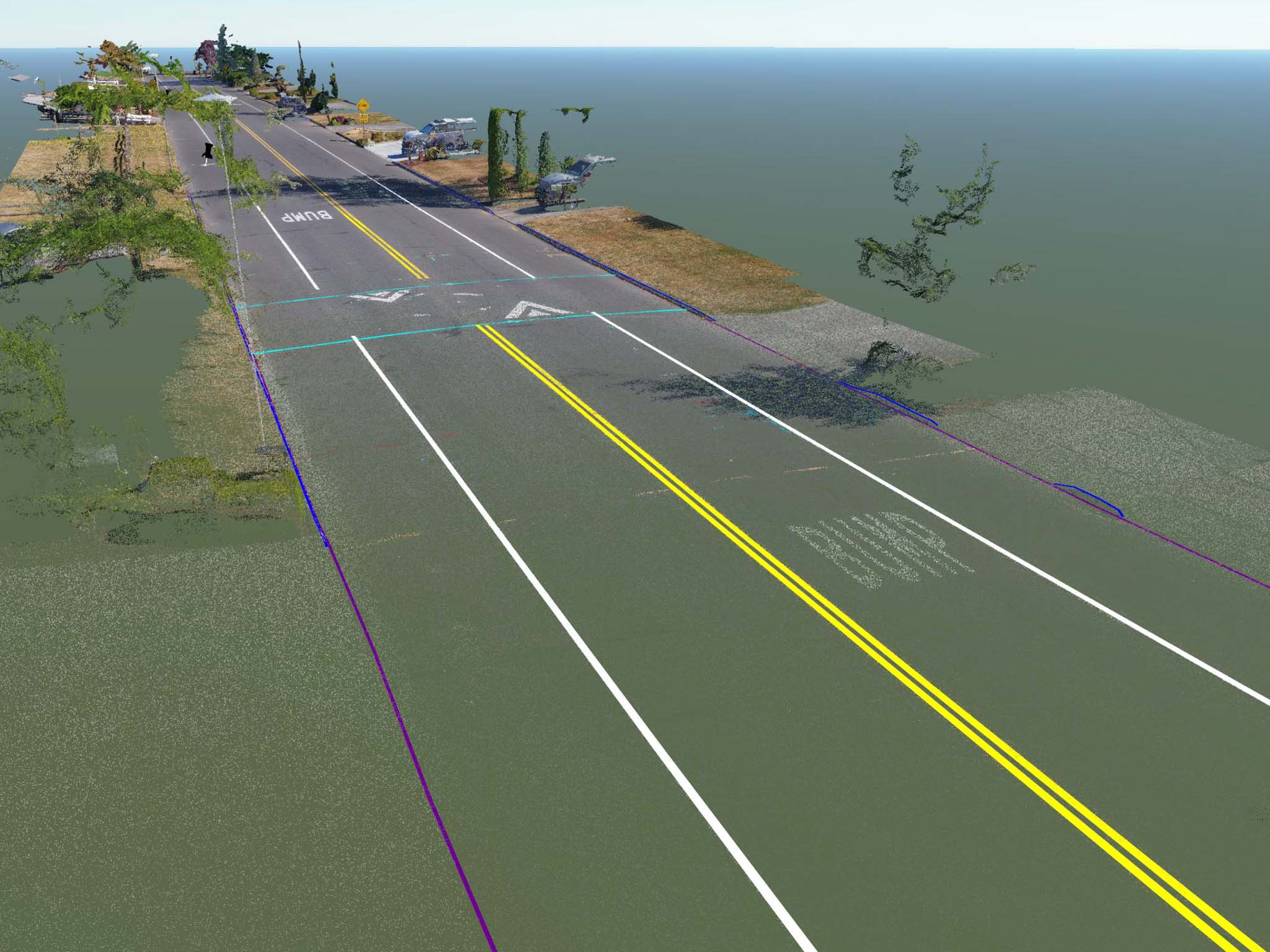
– Precise Breakline Creation – Using cross-sections of the photo-derived point cloud.
– Roadway Center Line – Ultra-precise location of roadway centerline based on detailed surface modeling.
– Surveyors partners can take on more job sites knowing their time at each is reduced to surveying a few air targets for UAS modeling
– More details – Instead of a TIN network created from several dozen surveyed points clients now have a surface model created from over 5,000 points per square meter.
– Photo-realistic 3D model of subject matter
– Ultra High Resolution Orthomosaic Photo of scene with all moving objects (cars, people, etc) removed for clarity.
Key Advantages over Aerial Lidar
– Full colorized point clouds of nearly equal density
– Equipment and processing costs are a tiny fraction of the cost of a survey-grade LiDAR Unit and platform to carry it.

Please email me if you’d like to learn more about what I’m developing and how I can help your survey business stay on the cutting edge of technology.